Hughes Ridge Trail

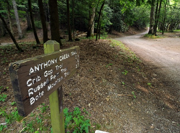
For those of you looking for a way to get to the Appalachian trail, but would like to get a bit further into the Smokies backcountry beforehand, the Hughes Ridge Trail is an excellent way to begin your trek to the AT. In all, it’s a 5 mile trail, though you will forced to hike 5 miles before you reach it. If you’re a wildflower enthusiast, it’s totally worth the trip during those ripe spring months.

To get there, you’ll take Newfound Gap Road from Gatlinburg to the Smokemont Campground. Just past the ranger station you’ll find the trailhead for the Bradley Creek Trail which you’ll take for 1.1 miles until it intersects with the Chasteen Creek Trail. Stay on it for 4.1 miles until you reach the Hughes Ridge Trail.

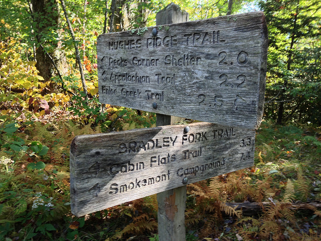
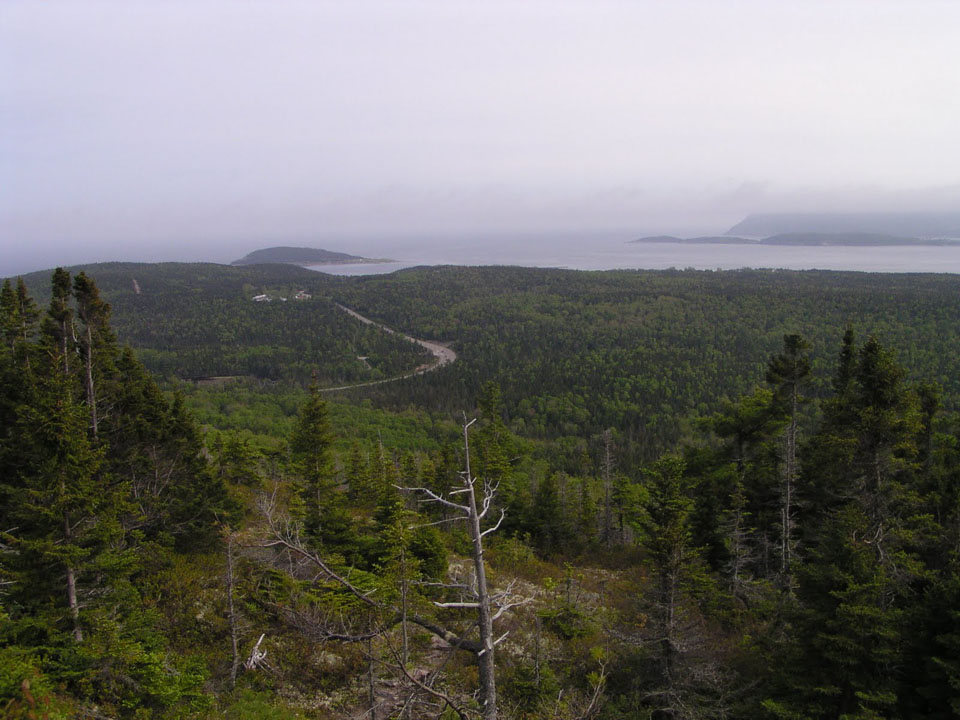
Along the Hughes Ridge Trail, hikers will make their way from the very top of the Chasteen Creek Trail to Pecks Corner at the Appalachian Trail. This area was home to numerous pioneer families as well as a number of Cherokee Indian families before the land was went into the hands of the government and became a part of the Great Smoky Mountains National Park.

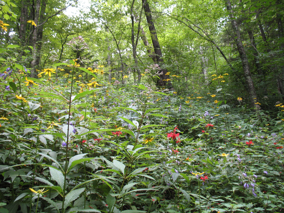
Starting out on the trail, you should quickly become aware that this is prime wildflower country, especially in the spring. Flame azalea and mountain laurel are just two species people come looking for, camera in hand, or backpack.

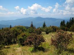
Hikers pass the junction with the Enloe Creek Trail before descending the Hughes Ridge Trail, then rising again through a ridge covered with red spruce and other species typically found in the higher elevations of the Smoky Mountains like Catawba rhododendron.

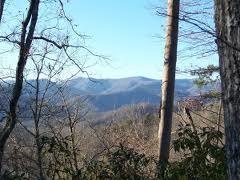
Once you reach the 2.5 mile mark, the junction with the Bradley Fork Trail, the continues along what is described as a wide jeep track. It’s a rocky go as you begin the hike uphill. It eventually reaches a beautiful ridge top.

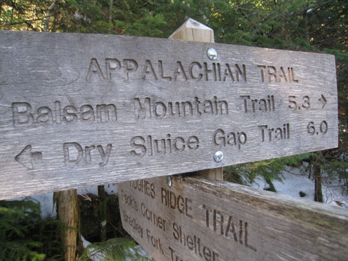
At mile 4.3 a utility shack can be seen along the trail before continuing through the spruce forest and climbing to the Appalachian Trail at Pecks Corner.

Cove Mountain Trail

cmt2So what’s a good trail in the Gatlinburg area? That’s a question that gets asked countless times each year from people visiting the area. Well, if you’re looking for a good, hearty hike, let up suggest the Cove Mountain Trail – an 8.5 miler starting at the Great Smoky Mountains National Park headquarters and ascending Mount Harrison to the summit of Cove Mountain.

There are a number of spectacular views along this trail as well as a few waterfalls so be sure to pack a camera not matter what season you’re hiking in.

To say that this trail features a myriad of landscapes and sights would be selling it very short. From forests to homes and wildlife to ski resort, you’ll see it all. It’s almost man versus nature.

At 0.1 miles you come to the first cascade – Cataract Falls. It’s a small, 12-foot falls that offers some cool relief during the summer months. This is also a great place to take notice of the beautiful wildflowers that take root in the Smoky Mountain soil during the spring.

cmt1Continuing along the trail, Double Gourd Branch tumbles and rolls across the trail and onward through the mountains . Keeping walking, you’ve got at least another 8 miles of climbing ahead of you. The trail will come to parallel Dry Pond Branch before you reach an actual backyard at 1.5 miles and the park boundary.

A majestic view, like that at mile 3.1 of Mount LeConte, is just one of the highlights of this climb. The boundary comes into view again around mile 3.4 as hikers notice the chair lift to Ober Gatlinburg. You’ll see it again as you traverse Mount Harrison before finally leaving the sights of Gatlinburg all together.

Hickory Falls Branch is followed by the trail around a few turns before starting the steepest climb of this journey. The Cove Mountain Wildlife Management Area comes into focus so be wary. A lot of hunting goes on in this area of the Smokies when such things as deer and wild hog are in season. Late fall is prime season so bright colors wouldn’t be the worst thing you could pack.

It’s an easy hike from here to the top and the fire tower. If you choose, you can take a side trail to Laurel Falls or just double back to park headquarters and the Sugarlands Visitors Center.

Forney Ridge Trail

One of the more traversed areas in the Smoky Mountains is Andrews Bald, and rightly so, it’s a majestic spot and one that is accessible by routes like the Forney Ridge Trail.

frt1
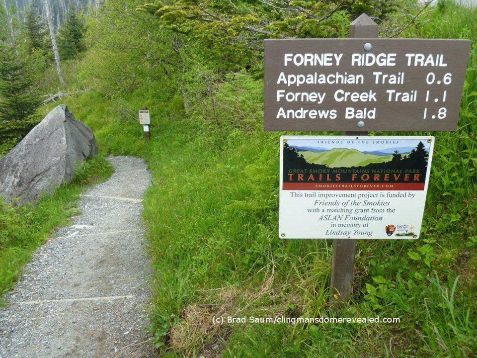
For the most part, the Forney Ridge Trail is a downhill hike for 5.6 miles and travels from the Clingmans Dome parking area all the way to the Springhouse Branch Trail. And while it is a downhill hike, it’s a steep and rocky one. So, prepare yourself accordingly with the right footwear.

To reach the trailhead, travel down Clingmans Dome Road until you reach the parking area. Between the water fountain and the path to the lookout tower, you’ll find the access trail.

It’s an uneven trail starting out and you’ll pass some large rocks before taking a left and passing the Clingmans Dome Bypass Trail. There are still fir trees that align the ridge if you’ll take notice before heading down into a patch of blackberries and raspberries.

Rocks and roots get in the way a bit too much going on down the trail so keep steady if you can. Watch out for a sharp right at mile 1.1 on the trail, but continue straight ahead. You’ll rise slightly through the forest before dropping again into Andrews Bald.

Andrews Bald is named after an early settler who herded cattle up to the bald and eventually built himself a home up there. If you’re clocking yourself, you reach Andrews Bald at mile 1.8 on the Forney Ridge Trail. There are a few offshoots on Andrews Bald that takes you to some great lookout points of Fontana Lake and the Noland Creek Valley. If it’s a clear day, take advantage of these two side trails, the views are some of the best in the entire park.

June is a rather popular month on the Bald as rhododendrons are in full color, thus the foot traffic can be pretty heavy, especially on weekends.

Continuing on the trail, you’ll hike a switchback going down on a rocky path. On the descent past Andrews Bald blackberries and various wildflowers find shelter among the number of rock outcroppings.

Following another ridge hike, you’ll drop down the trail again into more wildflower species, rhododendron, and beech trees. Large boulders can be seen along this ridge and about 2.5 miles past the bald, the trail loses its rocky texture and turns primarily to dirt. You’ve reached the intersection with the Springhouse Branch Trail. Hope this is a trail you’ll remember and visit again as you search for the best views in the Smokies.

Deeplow Gap Trail

deeplowgap1Hikers will cross their share of streams and then some, as well as hike past Little Creek Falls, along the 6.1 mile Deeplow Gap Trail.

To reach this Smoky Mountain trail from the end of Deep Creek Road, hike 3.6 miles on Deep Creek and Indian Creek Trails. At the start, you’ll hike to the right past a bench along Indian Creek. You”ll pass George Branch by bridge at approximately 0.1 miles on the trail before coming to an old homestead at 0.2 miles in.

You soon ascend the trail with George Branch following along on the left and come to backcountry campsite No. 51 soon after. Hikers continuing on will crisscross a smaller branch as you hike Deeplow Gap.

deeplowgap2At mile 2.2, the trails meets the intersection with Thomas Divide at Deeplow Gap. Descending the divide’s eastern slope, you’ll cross by way of a foot log over Little Creek and come to the top of Little Creek Falls at 2.9 miles. You’ll descend to the base of the falls where it cascades over 95 feet to its majestic ending below. Another foot log crosses the bottom of Little Creek where you’re bound to get sprayed just a bit depending on the wind.

You’ll cross Little Creek again and some more foot logs before reaching a clearing that marks an old home site. Little Creek flows to the right till its intersection with Cooper Creek. Meanwhile, hikers come to the trail’s junction with the Cooper Creek Trail at mile 3.7, hikers will continue northward on the Deeplow Gap Trail. Another foot log is approached at 4.1 miles in and soon thereafter you’ll notice the remains of two chimneys – the site of a one-time farmhouse.

Another foot log must be crossed at 4.9 miles over Cooper Creek before ascending the ridge crest at 6.1 miles and the junction with Mingus Creek Trail. Happy hiking!

Crooked Arm Ridge Trail

Another Cades Cove trail, or “close to” Cades Cove, is the Crooked Arm Ridge trail which runs 2.2 miles from the Rich Mountain Loop trailhead to the Indian Grave Gap trail.

Starting on the Cades Cove Loop Road, walk 0.5 miles to its intersection with the Rich Mountain Loop Trail before reaching the first stream along the Crooked Arm Ridge trail at 0.2 miles. This stream eventually becomes Crooked Arm Falls, which is really only noticeable during wet weather. You’ll hop across the stream as you make your way along the trail.

Switchbacks come upon the hiker as he ascends the trail further, but don’t keep your head down or you’ll miss the many majestic views Crooked Arm provides. At 1.2 miles in, the view of Cades Cove is one many who just stick to the touristy parts of the national park miss. It’s a beautiful image of one of the park’s jewels.

As trail moves on, hikers continue over Crooked Arm Ridge and then to Pinkroot Ridge and into an oak and pine forest. You’ll want to keep your eyes from here on as a number of spectacular views come up. The first, at mile 1.9, shows you Sparks Lane as it crosses Cades Cove. You’re not far from the conclusion of the Crooked Arm Ridge trail now. At the end of it, you may turn left if you want to continue on the Rich Mountain Loop day hike.

Balsam Mountain Trail

The Balsam Mountain Trail is a 10.1 mile trail that continually rises over the first half of the trail before leveling out and reaching its finale at its meeting point with the Appalachian trail. It’s a day’s worth of good hiking and you can expect to come across wondrous mountain views and various wildflower species during the spring and summer months.

Interested parties can access the trail via its trailhead by way of the Blue Ridge Parkway. Traveling the Heintooga Ridge Road for 9 miles, you’ll enter onto Balsam Mountain Road and travel another 8.4 miles to Pin Oak Gap, where the trail begins.

Accordingly, the Balsam Mountain Trail begins in a northern hardwood forest before moving into a spruce fir forest. You’ll reach Beech Gap at mile 2.3 and notice the dip in the mountain and various patches of grass along the trail. Beech Gap Trail meanders off to the left at this point leading 2.5 miles to a place name Round Bottom. Moving further down the trail, hikers will come to Laurel Gap Shelter – a bear proof structure made of stone. At least 14 people can sleep comfortably here and there is a fire pit and a picnic table.

Past the shelter, you’ll climb another 0.2 miles before reaching the meeting of the Mount Sterling Ridge Trail. From there, you’ll notice a number of various offshoots to other trails before reaching Luftee Knob at 6.9 miles. After this, it’s a level grade for hikers and a panorama of fir forest. You’ll also notice views of Mount Hardison along the trail before a soft ascent to the Appalachian Trail junction.

Cooper Creek Trail

The Cooper Creek Trail is another really short Smoky Mountain hike that runs 0.5 miles and is really only noteworthy for a few streams that run across the trail.

To reach the trailhead, drive down Cooper Creek Road till you reach the end. You’ll be 3 miles from North Carolina Highway 19.

coopercreek

This is another one of those connector trails found throughout the park. This one in particular connects Cooper Creek Road with the Deeplow Gap Trail. Finding a parking spot can be tricky as there are no public lots around here, it’s all private property so plan accordingly.

Walking up the road you’ll pass a gate and the park boundary. Follow the roadbed that runs beside Cooper Creek – this puts you beside the park boundary and private property. Some various wildflowers highlight this walk as well as various tree species like oak and other hardwoods.

A house appears across the creek at 0.2 miles on the trail before coming upon more rhododendron. The trail comes to its ending once hikers cross Little Creek by way of a footlog.

Goldmine Loop Trail

An trail with the name “Goldmine” is sure to attract its share of visitors and it’s no different for the Great Smoky Mountains National Park’s Goldmine Loop Trail. It also helps that it’s a rather short trail that can be hiked over the course of a few hours.

gmlt1
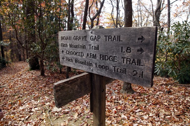
Located on the North Carolina side of the Smokies, the Goldmine Loop Trail is a 2-mile trail that begins at its junction with the Lakeshore Trail and ends at its intersection with the Tunnel Bypass Trail. Highlights include its meeting point with backcountry campsite No. 67, access to Fontana Lake, and a few old homesteads located along the trail.

To get there, hikers must take the Lakeshore Trail for a mile, which is located at the end of Lakeview Drive.

It’s probably safe to say that if you’re looking for gold along this trail, good luck finding it. It was more than likely named for an overzealous prospector. The trail itself begins on a ridge then begins a steep descent. You’ll pass by an old home site before passing by an old chimney on your right. A stream also lies at the site as well as an old washtub and other remnants of a once thriving farm.

The trail continues and follows the Goldmine Branch that creeps and crawls over the mountain before reaching Fontana Lake. Another homestead is reached at 0.75 miles on the trail. The rock-lined cellar of the home still remains. It’s said that wild hogs may have made their way around the site at some point due to its disjointed remains.

You’ll have to leave the trail at 0.9 miles to reach backcountry campsite No. 67 for about 300 yards. It’s considered a gently-used campsite and another old homestead can be found there as well.

The trail then follows Goldmine Branch down 0.2 miles to Fontana Lake. You’ll come to the trail’s end at 2 miles in at the Tunnel Bypass Trail. From here, you can hike to the parking area 0.4 miles on Lakeview Drive.

Anthony Creek Trail

If you’re looking for a good, hearty hike in the Cades Cove area, check out the Anthony Creek Trail next time you’re in the area.

Anthony Creek Trail starts at the beginning of the Cades Cove in the picnic area and goes a little over three and a half miles up Bote Mountain, gaining some 3000 or so feet. It’s a pretty difficult hike, so hikers should try to pack as much water as they think they’ll need taking weather, et al into consideration.

Aside from the hike’s challenges, Smoky Mountain visitors using the Anthony Creek trail enjoy some of the most picturesque scenery in the national park. You also get wonderful views from Spence Field and Rocky Top, both important locations in the history of Cades Cove. To get to Spence Field and Rocky Top, travel the Anthony Creek Trail to the Bote Mountain Trail and the Appalachian Trail.

Anthony Creek Trail also features the headwaters of Anthony Creek. The popular Cades Cove trail also goes by the horse camp, a delight to horsemen and travels past numerous backcountry camp sites. Due in part to the location of the trailhead, the Anthony Creek Trail is one of the most traveled in Cades Cove.

Grassy Branch Trail

grassybranchGet ready for an uphill hike if you decide to set out on the Grassy Branch Trail one day. It’s a short, yet challenging trek in the Smokies from its intersection with the Kephart Prong Trail to the junction with the Dry Sluice Gap Trail.

To get there, From Newfound Gap drive 8 miles south, which is approximately 22 miles from Gatlinburg. There you’ll find the Kephart Prong parking area beside the river. You’ll hike over the Oconoluftee River by way of a foot bridge and hike for 2 miles on the Kephart Prong Trail. At that point, you’ll be at the Kephart Prong Shelter and ready to start out on the Grassy Branch Trail.

Now the steep climb starts. Passing the trail sign and a stone chimney, the trail winds around almost to the point that you feel you’re hiking around a cliff. Be wary of any loose rocks and a wet trail when it rains.

You’ll eventually come to an old stone wall and the trail will widen and become a bit more level than it was. Crossing another creek, you’ll skirt around a ridge then repeat. Soon thereafter you make the final creek crossing on the Grassy Branch Trail.

A switchback occurs at a rock pile continuing on the trail and you’re hiking through a forest of maple and oak. You’ll be able to see a number of other Smoky Mountain peaks if you keep your eyes peeled and look through the trees at this point. You notice them even more during the fall and winter months.

Another switchback occurs as you cross another ridge and you’ll soon notice the sound of a creek as you walk along. Thick, grassy forest will be noticeable as well, and the reason the trail got the name, Grassy Branch. An eroded area of the trail means that you’re nearing the end of the Grassy Branch and you’ll soon see the Dry Sluice Gap Trail sign. The Appalachian Trail is another 1.3 miles to the left if you choose to venture that way. Enjoy the rest of your hike in the Smokies!