Gregory Ridge Trail

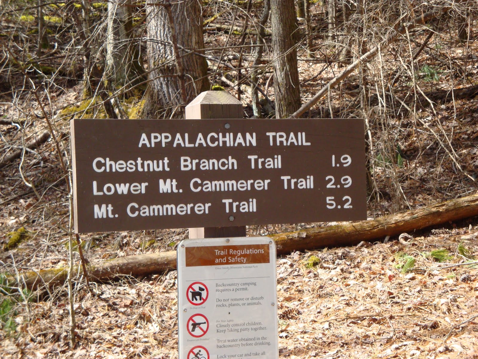
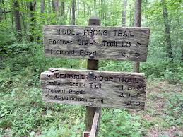
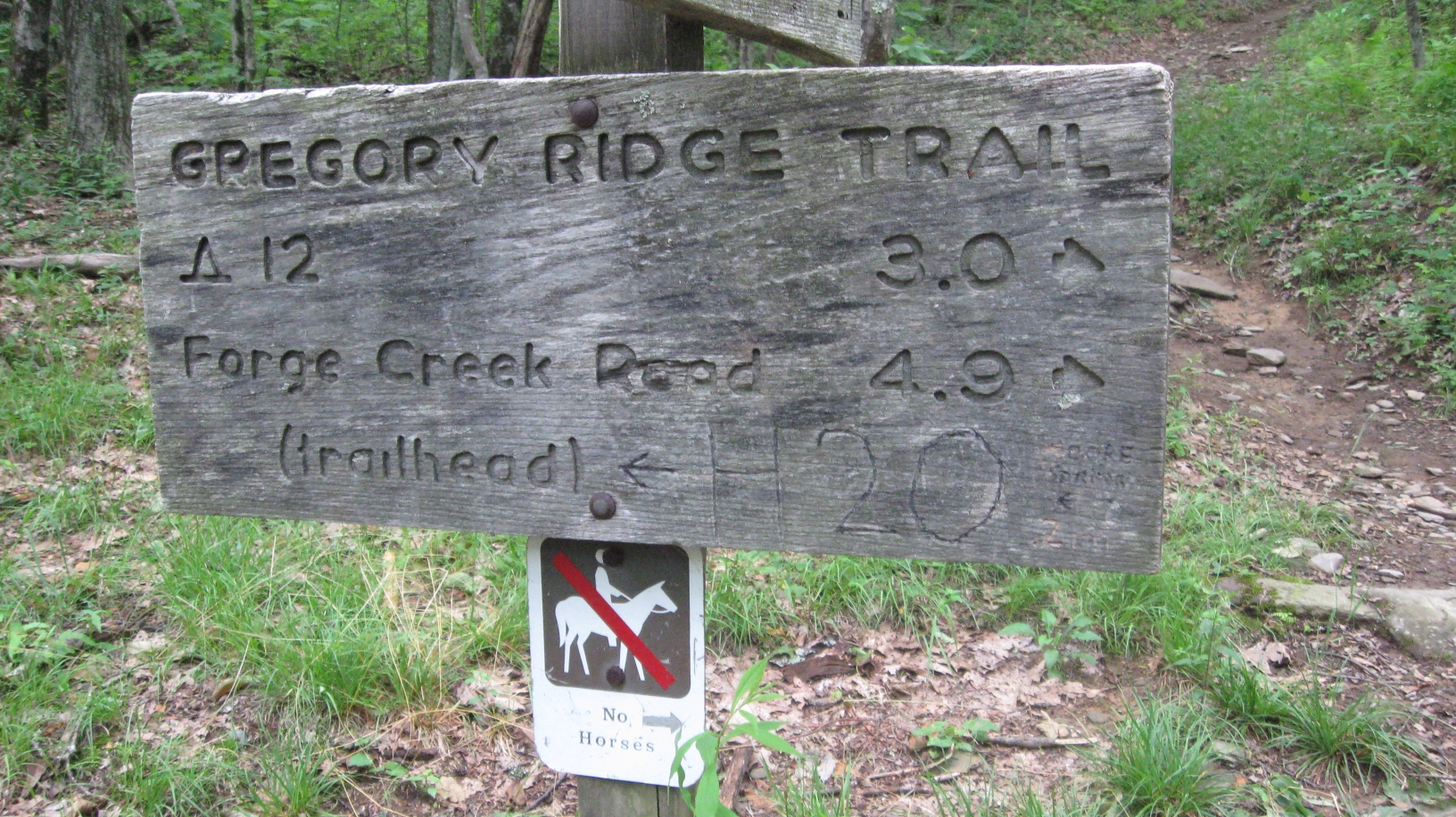
Trying to get to Gregory Bald in the Great Smoky Mountains National Park? One way to do just that is take the 5 mile Gregory Ridge Trail from Forge Creek Road to its intersection with the Gregory Bald Trail at Rich Gap.

To get there, travel to the Cades Cove Visitor Center and take Forge Creek Road till you reach the end. Here you will find one of several trails up to Gregory’s Bald. The hike features Gregory’s Bald, virgin forest with huge tulip trees, flame azaleas and the highly used backcountry campsite No. 13. Gregory’s Bald is one of the high mountain meadows where Cades Cove farmers took their cattle to escape summer heat and flies. Gregory Ridge trail will take seven or eight hours to complete, so be prepared for an arduous hike should you choose it. It may be the most arduous hike in Cades Cove.

Gregory Ridge Trail is a good choice if you want your hike’s destination to have a good view of Cades Cove. So many Smokies visitors hike up the Gregory’s Ridge trail for that reason, that it is one of the most popular trails in the Great Smoky Mountain National Park. The trail winds through some of the best of GSMNP, delightful old growth forest and azalea covered Gregory’s Bald. In azalea season the experience of Gregory’s bald is unmatched, for it is ablaze with breathtaking masses of orange and wine colored blooms, but in the days of old, Cades Cove farmers used to graze their cattle on Gregory’s bald, cattle being one of their best cash crops.

To get to the Gregory Ridge trailhead, turn right out of the Cable Mill area parking lot and proceed to Parson Branch road. The parking area marked Gregory Ridge Trail is about five miles down at Sam’s Gap. Gregory Ridge trail is one of Cades Cove’s most strenuous climbs being four and a half miles up the mountain, but it is well worth the effort.

Chasteen Creek Trail

If a challenging Smoky Mountain trail is what you’re looking for, look no further than the steep slopes of Chasteen Creek on the North Carolina side of the Smokies.

This 4-miler takes hikers through two backcountry campsites along the way, as well as a waterfall as it winds its way along a narrow, sometimes muddy trail. You’ll start out at a familiar site if you’ve hiked this area before – the Smokemont Campground along U.S. 441. From there, you’ll traverse the Bradley Fork Trail for 1.1 miles before joining the Chasteen Creek Trail.

Admire the creek valley as you begin your hike, but keep your eyes on the trail as the first mile is known for its muddier conditions. Thank the horses for that. It won’t last long though. As you climb, the mud gets left behind.

A trail to a hitching post for horses is reached at 0.7 miles into the hike. It’s down this side trail that a better view of the creek is obtained, as well as a  Smoky Mountain cascade.

The trail and the creek run back and forth with each other for the next 1.5 miles. There are a slew of great picture opportunities along the way for all you photography enthusiasts.

Backcountry campsite No. 48 is reached at mile 2.4 on the trail between two creeks. It’s also one of the more picturesque campsites offered.

Back on the trail, it’s just you and the ascent up Hughes Ridge – a narrow, rocky climb with numerous switchbacks. Once you’ve reached the junction with the Hughes Ridge Trail, it’s 5 miles to the Appalachian Trail and Peck’s Corner.


Appalachian Trail

The Appalachian Trail, or AT, makes up roughly 71 miles of the Great Smoky Mountains National Park. Vantage points along the trail include the highest peak – Clingmans Dome (6625 feet), as well as the historic stone fire tower atop Mt. Cammerer.

On average, it takes about 7 days to hike the Appalachian Trail portion of the Great Smoky Mountains National Park, give or take a day or so using Newfound Gap or Clingmans Dome as a mid-way point. Now you’re talking 3 or 4 days using Newfound Gap or Clingmans. And you’ll have to get someone to pick you up should you use either since each is one way. Imagine, “Hey, can you come pick me up? I’ve been in the woods 3 days without a shower.” Not the most welcoming of requests.

Hikers will notice the Appalachian Trail by the various “blazes” painted on trees, posts, and rocks in the park. Above tree-line, posts and rock piles called “cairns” are used to identify the route.

On October 7, 1923, the first section of the Appalachian Trail, from Bear Mountain-Harriman State Park to Delaware Water Gap, was opened. It wasn’t until August 1937 when the Civilian Conservation Corps connected the ridge between Spaulding and Sugarloaf Mountains in Maine that the trail was marked as complete.

The 1968 National Trails System Act designated the Appalachian Trail as a linear national park and authorized funds to surround the entire route with public lands, either federal or state, and to protect it from incompatible uses. At roughly 2175 miles in total length, the Appalachian Trail is the nation’s longest marked footpath. In all, it winds, dips, passes over, and through 6 national parks and touches 14 states.

Camel Gap Trail

For 4.7 miles, the Camel Gap Trail takes the Smoky Mountain hiker on a gradual ascent up to its meeting with the Appalachian Trail. It’s a great little nature trail in the Smokies that begins at the Big Creek junction just past Walnut Bottom.

Once known as the Yellow Creek Trail, hikers beginning on the Camel Gap Trail come to the intersection with the Gunter Fork Trail at 0.6 miles before narrowing. The trail goes on following Big Creek before its final ascent to Camel Gap and the Appalachian Trail. It’s gradual climb is thanks in part to the numerous logging operations that took part here before it was designated for national park use.

As previously mentioned, the Camel Gap Trail is known throughout the region for its dramatic vistas and forest scenes, especially during the colorful fall months. Rocky Branch is soon crossed by the hiker and the trail afterwards runs parallel with the creek. If you pay close enough attention to some of the stream’s pools, you might catch a glimpse of the oh-so-sought-after Smoky Mountain trout.

You’ll reach a switchback at 2.8 miles on the trail as Yellow Creek merges with Big Creek and the trail begins to become steeper at this point. You might even be able to catch a peek of Balsam Mountain from the trail if you’re able to peer through the forest.

Once you’ve reached the Appalachian Trail, you decide to hike back or go on to the Snake Den Ridge Trail, Low Gap, or the Cosby Knob Shelter.

Finley Cane Trail

finley2So you’ve tripped down to Townsend, Tn for a day to take a dip in the “Y” and do a little hiking afterward…. If you’re looking for a rather close trail that won’t leave you too tired after floating on the river all afternoon, try the Finley Cane Trail. It’s a 2.8 miler from its junction with Laurel Creek Road to its end at the intersection of the Bote Mountain Trail.

To reach the trailhead, it’s a 5.5 mile drive, or walk whichever, west of the Townsend “Y” toward Cades Cove. The trailhead can easily be passed up so keep your eyes peeled if you decide to drive. Parking is found along the road for this Smoky Mountain trail.

You’ll parallel the road to start out on the trail before descending on the path and crossing Sugar Cove Creek by way of stepping stones.

finley1
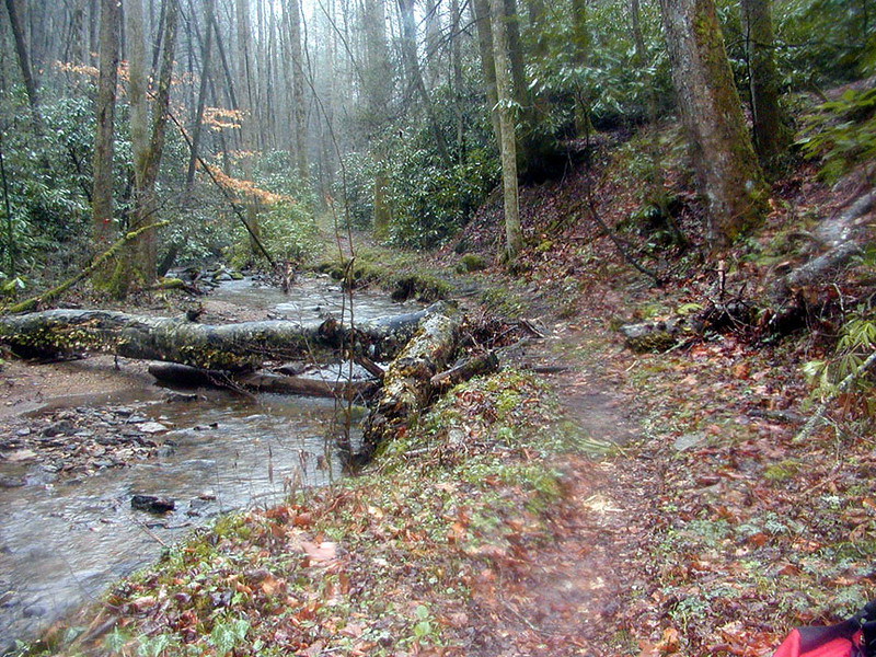
Continuing on, the trail can be rather muddy at times before you cross another small spring branch and then begin the ascent up Bote Mountain. Rhododendron are especially prevalent here as well as other points on the trail as you’ll surely notice.

Laurel Cove Creek and Hickory Tree Branch are rock hopped soon thereafter. If you think that you’ve been hiking up and down, and up and down throughout the forest, you’re right. The same can be said for wet and dry portions of the trail. It’s a hike that contrasts to the extreme throughout.

Notice the various mushroom species that align the trail as well. The park contains a number of species and the Finley Cane Trail is as good a Smoky Mountain trail as any to observe them.

Actual cane will come into view on the last mile of the Finley Cane Trail – possibly one of the ways the trail got its name. It’s the only native relative to bamboo found in the national park.

There are a number of options once you’ve reached 2.8 miles and the Bote Mountain Trail. We’re sure you’ll find an option you like whether it be hiking on to Spence Field or hiking the West Prong. Either way, happy hiking and enjoy the Smokies!

Beard Cane Trail

The Beard Cane trail is a 4.2 mile Smoky Mountain trail named after a type of cane variety that grows in Cades Cove. It’s also one of the few relatively flat trails in Cades Cove.

To get started, put those boots on and get yourself to the Cooper Road Trail – 4.9 miles northeast of the Abrams Creek Campground just off the Foothills Parkway.

It’s as easy a hike as there is in the Smoky Mountains and takes the hiker down a hollow between Beard Cane and Hatcher mountains for 3.5 miles in a fairly straight line.

Hikers will notice wildflowers and flowering shrubs such as polygala, trillium, rhododendron, and dog-hobble. Overhead trees such as oak, tulip, hemlock and maple trees canopy this Cades Cove hike.

You’ll reach campsite No. 11 at the 1 mile mark. This is a site that is rarely used and is pretty quiet most of the time. You’ll cross Beard Cane Creek a dozen times while you’re on the trail as it grows into a full blown creek. Cross on the rocks if you wish, just be wary if it’s rained alot.

Campsite No. 3 at Hesse Creek appears at mile 3.6. It’s located in a cool, shady area and is larger than Campsite No. 11. It rarely sees any use as well.

The junction with Ace Gap Trail at Blair Gap comes along at the 4.2 mile mark which signals the end of the Beard Cane Trail.

Chestnut Branch Trail

The Chestnut Branch Trail is one of your shorter Smoky Mountain hikes at 2.1 miles, but if you’re looking to take pictures of some great old home sites in the Smokies, this is a great hike to do it on.

Hikers start out at the junction with Big Creek Road and walk until they come to the intersection with the Appalachian Trail. The trailhead can be found at the Big Creek Ranger Station, 2.3 miles from Interstate 40 exit 451.

There is a large parking area at the Big Creek Ranger Station which makes this trail extremely easy to access.

Once an old logging road, Chestnut Branch was home to around nine residents before the establishment of the Great Smoky Mountains National Park. Much of the forest surrounding the trail has since reclaimed those former homesteads, though as you walk along the trail you can see the remnants of  rock walls, fence posts, and various metal artifacts.

The trail makes a steady ascension and you’ll be able to make out such things as a metal washtub at 0.3 miles along the trail. This was one of those old home sites. These washtubs and other artifacts are protected by federal law and are to be left untouched.

Just past another home site at mile 1.1 the trail parallels a stream and you’ll notice cascades flowing over a number of mossy stones. A second switchback appears as you ascend the ridge.

A tuliptree cove is reached once you’ve hiked 1.7 miles before reaching the junction with the Appalachian Trail at mile 2.1.

Cabin Flats Trail

As far as trails go, if you’re looking for a short Smoky Mountain hike there aren’t many as quick as the Cabin Flats Trail. At 0.9 miles it’s a quick jaunt across the Bradley Fork to backcountry campsite No. 49.

Hikers start out from the upper end of the Smokemont Campground (off U.S. 441 in North Carolina) with the junction of the Bradley Fork Trail. It’s basically the continuation of an old gravel road that ran alongside the Bradley Fork. You’ll pass over an older trestle bridge that has had a number of updates including rails and new wood flooring. Crossing the bridge, the trail turns left and rises above the creek. A large tuliptree marks the switchback.

Continuing on the trail, a log bridge with a handrail crosses a side creek before coming to Dry Sluice Gap Trail on the left. Dry Sluice climbs for 3.2 miles to the Appalachian Trail.

A log jam on the Bradley Fork is seen soon thereafter along the trail before dropping back to creek level and intersecting with campsite No. 49. Horse rails are locates just down from the campsite. You could almost hike the entirety of the trail before you finished this post.

Greenbrier Ridge Trail

gbrt1Here’s a great spring wildflower trail for anyone interested – the Greenbrier Ridge Trail. When you think of Greenbrier you almost always think about a far less traversed section of the park and this trail doesn’t sway much from that idea. In all, it’s 4.2 miles from its junction with the Middle Prong Trail to the Appalachian Trail.

Wildfowers as well as mountain streams and gorgeous views of the Smoky Mountains highlight this portion of the Great Smoky Mountains National Park. To get you started, the Middle Prong itself is located 4.1 miles from the end of Tremont Road.

There are no camping opportunities along the Greenbrier Ridge Trail so for all you campers finding other means is a must. Starting out on the trail, you’re following an old railroad bed over a ridge, rock hopping a stream then hiking upriver beside the Indian Flats Prong. This ridge you’ve just crossed is called the Mellinger Death Ridge. It’s a hard name to forget. It’s said that a man by the name of Mellinger died years ago in this area after being caught in a bear trap and not being able to free himself. Two brother found him to be still alive but murdered him instead of carrying him back and tossed the body.

Now, back to the trail. The trail crosses a couple of streams, both of which you’ll have to rock hop. Take heed during high water. After crossing each, you’ll begin the hike up Greenbrier Ridge. Spring wildflowers abound. Majestic mountain views appear as well. A mile in, a great view of Blanket Mountain can be seen along the trail.

Clingmans Dome Bypass Trail

Looking for the shortest trail in the Great Smoky Mountains National Park? Well, you’ve found one of them in Clingmans Dome Bypass Trail – a short 0.5 mile trail from the Forney Ridge Trail to the Appalachian Trail.

It’s a trail that features great views of the Smokies and can be accessed by way of Newfound Gap Road in the park. From there, you’ll drive 7 miles on Clingmans Dome Road till you reach the Forney Ridge Parking area. Hikers then start out on the Forney Ridge Trail till they reach the bypass.

In all seriousness, this is really just an access trail to the Appalachian Trail from the Clingmans Dome parking area. This lets you avoid the crowds and walking up the paved area to the lookout tower.

Once you’ve reached the bypass along the Forney Ridge Trail, you’ll take a right turn toward the AT. It definitely gives the hiker some afforded solitude that the walkway to the observation tower would not. This is also a good place to spot some Smoky Mountain deer crossing the trail or grazing in the fields if you’re quiet enough.

At the intersection with the Appalachian Trail, take notice of some majestic views of Sugarland Mountain and the Elkmont section of the park.