Fall officially begins in September and, though it’s a little early to know for sure, foliage should put on quite a show this year. Though it has been dry lately, usually a negative when it comes to fall color, the next few weeks will determine just how much color we will have.
We need bright sunny days and cool nights–without too much frost or freezing temperatures–to trap the sugars in the leaves, which give us the best reds and most vibrant colors. However, small pockets of color will remain into November–something to consider when deciding whether to fight the unbelievable crowds in certain areas of the Park.
Nature At Its Best – Fall Color Guide To The Smokies
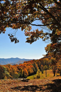
 (1024x683)") Leaves change colors when trees stop producing chlorophyll–the food producing stuff that keeps the leaves green all summer. When the chlorophyll is gone, the other brilliant colors emerge.Elevation plays a key role in determining when the fall spectacle occurs. At the highest elevations–4,500 to 6,000 feet–colors can begin turning in mid-September, when the yellow birch, American beech, and mountain maple begin to turn. During the first two weeks of October, leaves are at their peak colors above 4,000 feet. The remaining weeks of October present the Smokies at their very best for color. The sugar maple, scarlet oak, sweetgum (our favorite), red maple, and dogwood explode with color.
Leaves change colors when trees stop producing chlorophyll–the food producing stuff that keeps the leaves green all summer. When the chlorophyll is gone, the other brilliant colors emerge.Elevation plays a key role in determining when the fall spectacle occurs. At the highest elevations–4,500 to 6,000 feet–colors can begin turning in mid-September, when the yellow birch, American beech, and mountain maple begin to turn. During the first two weeks of October, leaves are at their peak colors above 4,000 feet. The remaining weeks of October present the Smokies at their very best for color. The sugar maple, scarlet oak, sweetgum (our favorite), red maple, and dogwood explode with color.
Though most people don’t question why the Smokies are so beautiful in the Fall–they just enjoy it–it’s interesting to know that the remarkable variety of trees are responsible for the autumn show. Nearly 100 species of trees–most deciduous–offer up their contribution to the timing and palette of the Fall spectacular.
A Sample of Tree Varieties and What They Have To Offer
 (1024x683)") The sweetgum is a favorite because it offers several colors including reds, purples, and yellow. These trees are found mostly in the lower elevations along streams and will peak mid-to-late October.
The sweetgum is a favorite because it offers several colors including reds, purples, and yellow. These trees are found mostly in the lower elevations along streams and will peak mid-to-late October.
The scarlet oak gives us a brilliant scarlet color and can be found in the low-to-mid elevations.
The sugar maple can be found all the way to 4,000 foot elevations and presents yellows and oranges for our enjoyment. These trees proliferate in the Sugarlands Valley, where pioneers tapped them for maple syrup.
The red maple gives us reds and yellows and ranges up to 6,000 feet. The Park boasts the world’s largest red maple, which is 23 feet in circumference and is 135 feet tall.
The flowering dogwood evolves to a deep red color and can be found anywhere in the lush woods below 3,000 feet.
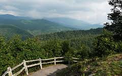
Where To Find Them
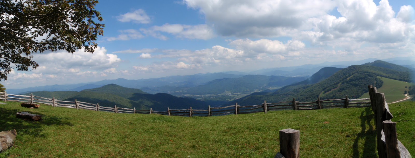
You can find the brilliant Fall colors everywhere in the Smokies. In fact, you can find your Fall “fix” of color on the way to the Smokies–something done by many because of the bumper-to-bumper traffic in certain areas of the Park. For example, the most popular spot in the most popular national park is Cades Cove, which might be the major spot to avoid if you don’t like muffler exhaust with your Fall colors. (1024x683)") Cataloochee, on the eastern side of the Park, is much less crowded at any time because its away from the most traveled routes to and from the Park. It’s on the North Carolina side of the Park and is a little harder to reach than popular spots like Cades Cove. If you are coming from the north and places like Gatlinburg, Pigeon Forge and Sevierville, take Highway 321 north to Interstate 40, and then east towards Asheville. Get off at exit 20 and take Cove Creek Road. Follow the signs 11 miles to Cataloochee.
Cataloochee, on the eastern side of the Park, is much less crowded at any time because its away from the most traveled routes to and from the Park. It’s on the North Carolina side of the Park and is a little harder to reach than popular spots like Cades Cove. If you are coming from the north and places like Gatlinburg, Pigeon Forge and Sevierville, take Highway 321 north to Interstate 40, and then east towards Asheville. Get off at exit 20 and take Cove Creek Road. Follow the signs 11 miles to Cataloochee.
If you are coming from the south or from Cherokee, North Carolina, take I-40 to exit 20 and follow the signs 11 miles to Cataloochee. The trip from Cherokee is estimated by Park officials as being 82 miles round-trip and can take up to four hours.
From the Gatlinburg, travel through the Park via Newfound Gap Road (the major road which traverses the Park) nearly to Cherokee (approximately 32 miles), and take the Blue Ridge Parkway (just after the Oconoluftee Visitor Center and the Mountain Farm Museum but before leaving the Park for Cherokee) for about 13 miles. Exit the Parkway to U.S. 19 and turn towards Asheville. Follow U.S. 19 through Maggie Valley and then north on Highway 276. Just before the entrance to I-40, turn left and follow the signs 11 miles to Cataloochee.
It’s worth the trouble getting to Cataloochee because it will be a new experience even for those who visit the Park
on a regular basis; it offers the same spectacular color show you will find elsewhere in the Park; and it’s bound to be less crowded even during peak color periods.
Rich Mountain. From Townsend, follow the signs to the Great Smokies and Cades Cove. You will dead-end. Turn right and you will be headed to Cades Cove on Laurel Creek Road. It’s approximately 7 miles to the entrance to Cades Cove.
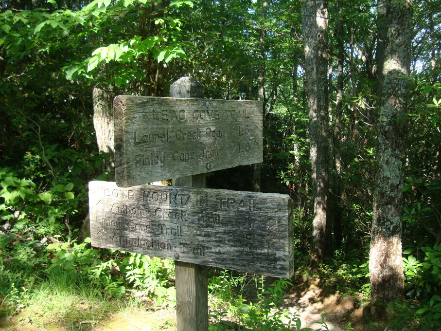
 The Hemphill Bald Trail is the furthest trailhead on the right at the parking area. Once you’ve started hiking, you’ll notice the Caldwell Fork Valley to the left of the trail. Sugar maples, ferns, and a few remaining chestnuts can be found on this part of the hike as you reach Whim Knob a mile in.
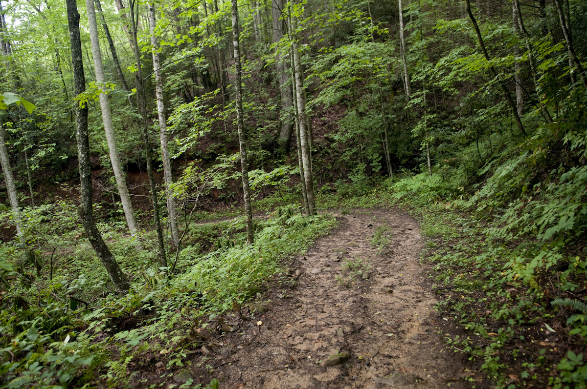

 River otters eat the small aquatic and amphibious animals that live in and around rivers. In the Smokies, that means that throughout the year these graceful creatures feast on trout and rock bass, on salamanders and frogs. Otters hunt in the water for their prey. They swim through the water and after spying something that looks particularly good to eat, they use their tail to produce a surge of speed. They catch their meal and then roll over on their back in the water to eat their newest catch.
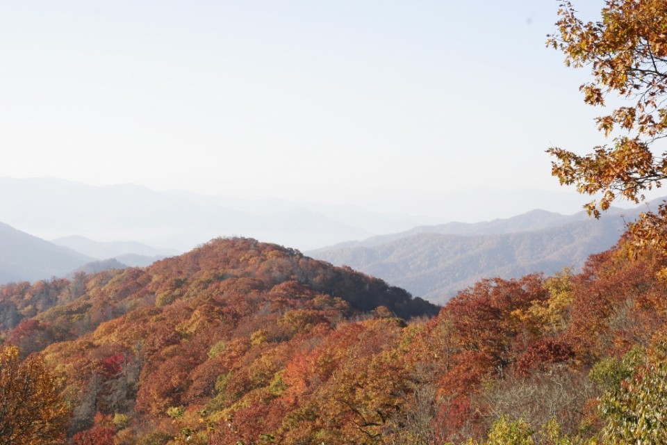
 The Cataloochee Valley derives its name from the Cherokee word Gadalutsi which most likely referred to the trees that line the ridges surrounding the valley. The Cherokee used this valley as a hunting ground for elk and deer before the European settlers came to the area. When the first settlers saw the beautiful valley of Cataloochee they knew that they had found a home in the Smoky Mountains. From using the fields around the ridges for free range cattle to graze to actually moving into the valley itself to establish communities, Cataloochee became a thriving town in the Smokies complete with churches, a schoolhouse and much more. The people of Cataloochee were the first to embrace the sound to be founded tourism industry in the mountains. City Folk came to the area to experience the mountains and the town embraced them and their money.
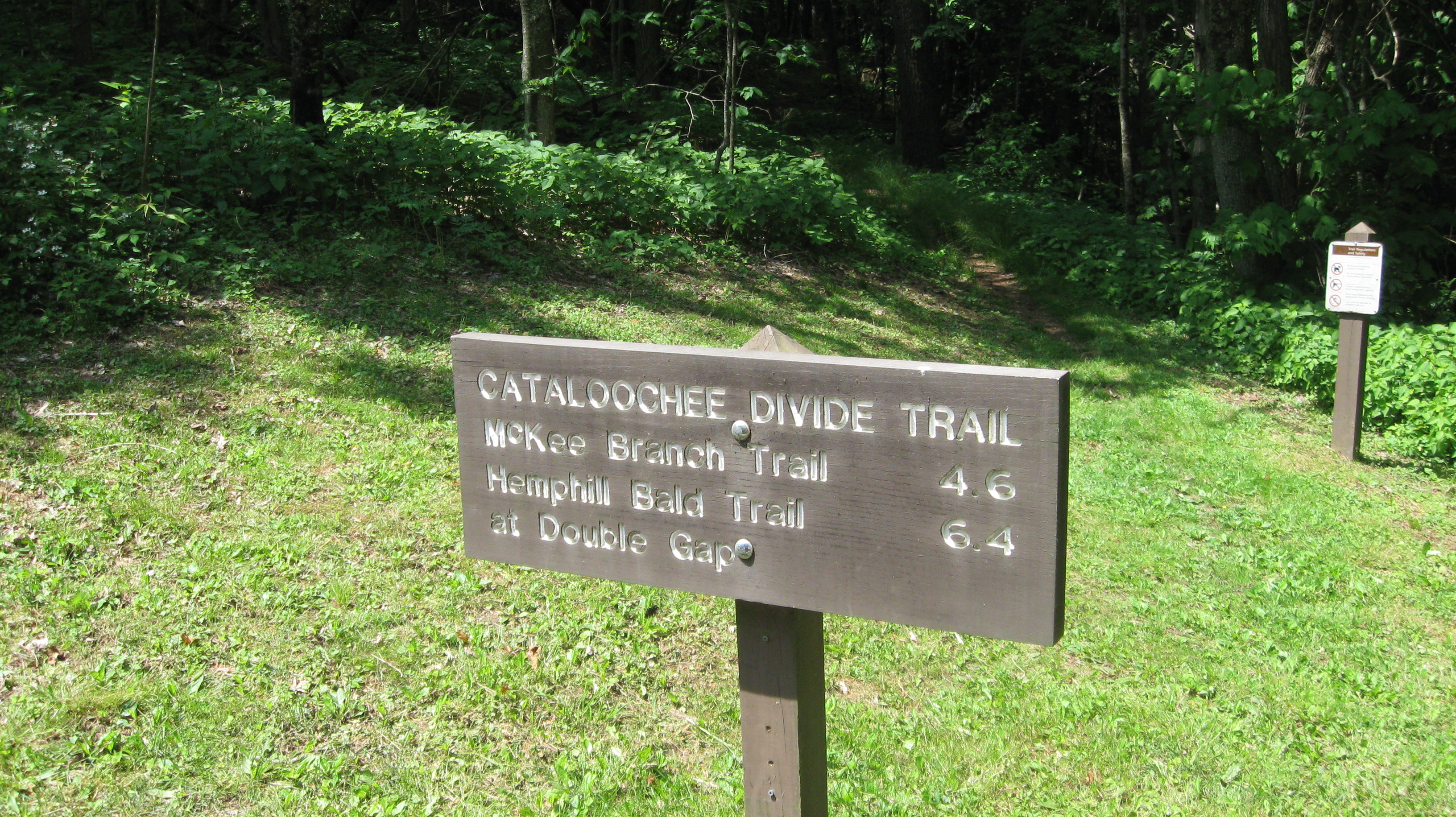
")

 When you are driving around
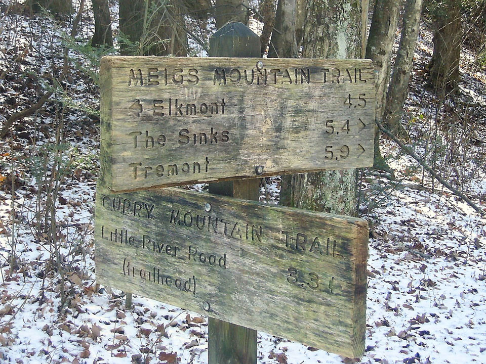
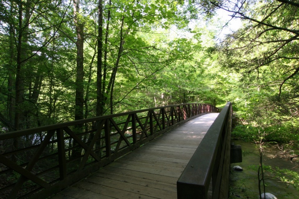
 A great little history hike in the Smokies can be had on the Curry Mountain Trail, a 3.3 mile jaunt from Little River Road to the junction with the Meigs Mountain Trail.
 As you set out on the trail, notice the various hemlocks and other hardwoods as you parallel Little River Road to begin. The trail turns from grassy to rocky before you come upon a switchback that leads the hiker into a more open forest with wildflowers that bloom in abundance during the spring months.