Sugarlands to Oconoluftee
 The 33-mile drive from Gatlinburg, Tennessee to Cherokee, North Carolina along Newfound Gap Road (US 441) is the only route that completely traverses the Great Smokies National Park (GSMNP). The drive offers a unique opportunity to enjoy an abbreviated experience of everything the Park has to offer, without necessarily trekking far from your automobile. The drive takes about one hour, depending on traffic. The experience can take several hours if you stop at each of the suggested points of interest. June through August and the month of October are the busiest months of the tourist season, and you can spend a lot of time looking at a bumper in front of you. You shouldn’t let the congestion discourage you from the experience, however. Quiet walkways, unforgettable views of the various peaks in the Smokies, a vast variety of trees, flowers, and wildlife; campgrounds, picnic areas–they all await you on this wonderful journey.
Let’s begin our drive from Gatlinburg and go less than a mile to the Sugarlands Visitor Center. It’s worth the stop here to view the displays of the natural history of the Park, get an idea of what to expect on the drive, pick up reading material to accompany your trip; and ask the Park Rangers those questions you always wanted to ask. As you leave the Sugarlands Visitor Center you turn onto Newfound Gap Road. The road takes its name from a discovery in the 1850s that Indian Gap, once believed to be the lowest point through the mountains, actually was not the lowest point–hence the name Newfound Gap.
At approximately the 1 and 2 mile points from Gatlinburg, you begin to see small signs indicating “quiet walkways”. These walkways, while you are still in Sugarlands Valley, offer wonderful opportunities to view Fall color. The valley takes its name from the multitude of sugar maples in the area. As you move away from your vehicle down these quiet paths you become surrounded by sugar maples, resplendent with color.
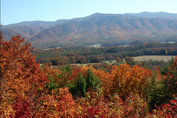
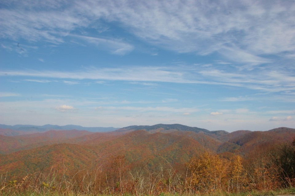
As you continue along Newfound Gap Road, a little over two miles you will come upon the Campbell Overlook, which offers arguably the best vistas in the Park. Mt. LeConte rises to 6,593 feet in front of you–the third largest peak in the Smokies. The overlook is named for Carlos Campbell, who wrote Birth of A National Park (available at the Sugarlands Visitor Center). Campbell was a devoted outdoorsman and was a devout supporter for the establishment of the Great Smokies National Park.
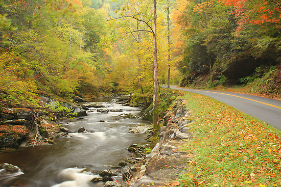
As you continue along US 441, you approach the Chimney Tops at the 4.5 mile mark. Here you will find the Chimney Tops picnic area which is home to one of the few remaining stands of mature cove hardwoods in the U.S. The Little Pigeon River runs through the picnic area. White settlers named the Chimney Tops after stone chimneys which, if you use a little imagination, resemble the peaks. This area, and many of the higher regions of the Smokies, were once owned by paper and lumber companies, which highly prized the spruce fibers growing there for making quality paper.
At about the 7-mile point you will come upon two tunnels. They exhibit the beautiful stone work found throughout the Park–work that was accomplished in the 1930s by the Civilian Conservation Corps (CCC) established by President Franklin D. Roosevelt. The second tunnel, a switchback referred to as “the loop”, curves around and back over itself. This feature was added to alleviate the extreme slope of the mountain.
Around the 9-mile point you will find the Alum Cave Bluffs parking area and trailhead. The hike is moderately challenging. You climb 2.3 miles to the cave bluff and then continue another 2.7 miles on to LeConte Lodge. The Appalachian Trail lies not far beyond the lodge. At approximately the 13-mile point you find the Morton Overlook. From here you can look back and see the Little Pigeon River and Newfound Gap Road area you just left. To your left is Sugarland Mountain, Mount Mingus, and the Chimney Tops.
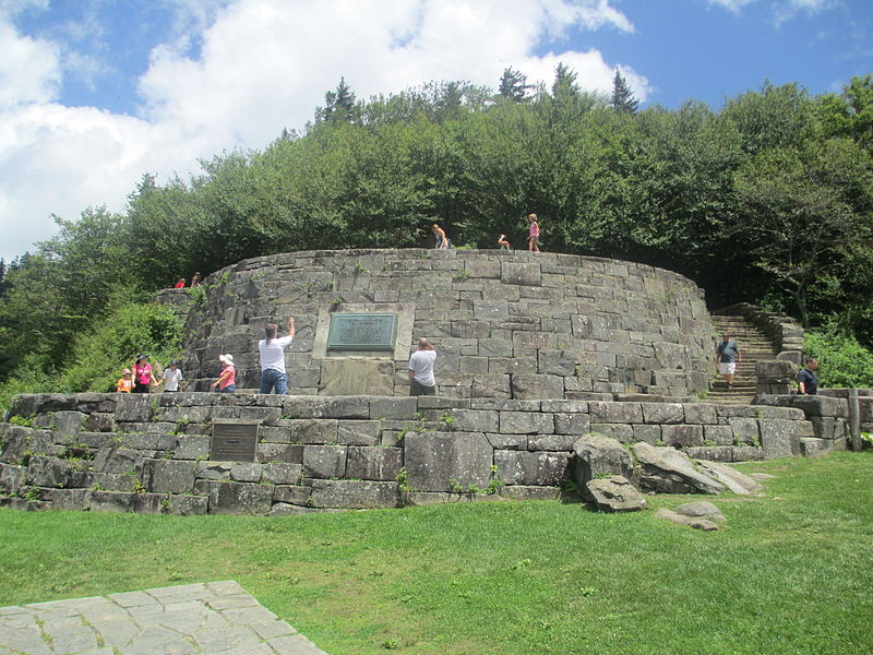
Three-quarters of a mile beyond the Morton Overlook you come to Newfound Gap itself. You are at 5,048 feet and can enjoy views to both the Tennessee and North Carolina sides of the ridge. Here you find the State Line Ridge, which serves as the spine for the entire distance of the Park, and it also comprises the sixty-nine miles of the Appalachian Trail in the Park. If you want to tell people you walked on the Appalachian Trail, you can traverse a short distance of it here before returning to your vehicle. Here you will also find the Rockefeller Memorial, which lies half in Tennessee and half in North Carolina. It memorializes the support and $5 million donated by the Rockefeller family to help establish the Park, which was dedicated here by President Franklin D. Roosevelt in 1940.
Just beyond Newfound Gap and State Line Ridge, you will come to Clingmans Dome Road, which takes you to the Clingmans Dome parking area. You hike the last half-mile and climb the 45-foot observation tower, the highest point in the Park and in Tennessee. On a clear day, it’s said you can see seven states. After you leave Clingmans Dome and continue down Newfound Gap Road toward Cherokee, you will travel approximately one-half mile to the Oconoluftee Valley Overlook, affording you spectacular views of the Oconoluftee River Valley. As you look to where the valley falls away, you can see where you will follow the road downward to Cherokee, North Carolina.
Continuing on, you will approach several quiet walkways and overlooks in the next two miles. Most notable is the Webb Overlook, named for Senator Charles Webb of North Carolina, another staunch supporter of the Park’s establishment. At the 18.5 mile point is one of the most interesting walkways–certainly in North Carolina. Shortly after entering the walkway, the trail splits. The left fork parallels the Oconoluftee River, and the right fork follows the path of the old Newfound Gap Road.
One-half mile further you approach Smokemont Campground. Once a lumber company town sustaining a school, church, store and boarding houses, it now consists of 140 campsites.
The next, and final, stop on Newfound Gap Road in the Park is the Oconoluftee Visitor Center. Here, as at the Sugarlands visitor Center, information about the Park can be obtained. A bookstore and exhibits, as well as an on-duty Park Ranger, can provide information about the Park and the people who once lived here. Next to the visitor center is the Mountain Farm Museum, which is comprised of pioneer buildings moved from throughout the Park and permanently preserved here.
 Elkmont – Elkmont, formerly a vacation spot for the elite from Knoxville, is one of the neatest places to visit in the Smokies. The homes that the people lived in and vacationed in are still there. Along with the the history there is also a campground located in Elkmont.
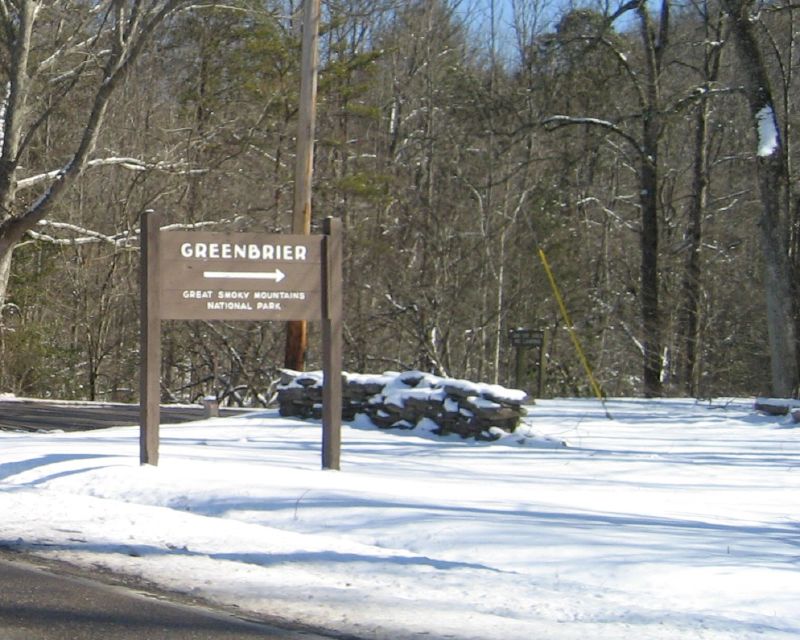


 Milepost 469 – The Blue Ridge Parkway intersects with US 441 in Cherokee, NC
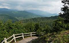
 The Cataloochee Valley derives its name from the Cherokee word Gadalutsi which most likely referred to the trees that line the ridges surrounding the valley. The Cherokee used this valley as a hunting ground for elk and deer before the European settlers came to the area. When the first settlers saw the beautiful valley of Cataloochee they knew that they had found a home in the Smoky Mountains. From using the fields around the ridges for free range cattle to graze to actually moving into the valley itself to establish communities, Cataloochee became a thriving town in the Smokies complete with churches, a schoolhouse and much more. The people of Cataloochee were the first to embrace the sound to be founded tourism industry in the mountains. City Folk came to the area to experience the mountains and the town embraced them and their money.
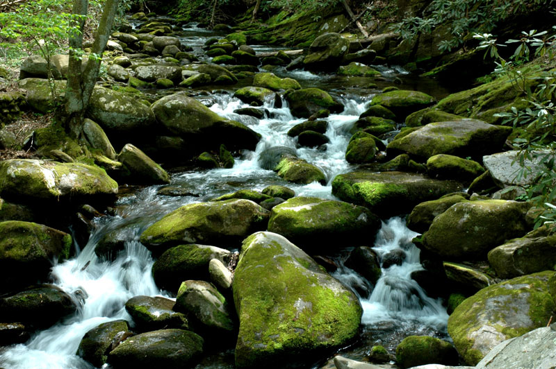

 The people that lived in the Roaring Fork area were the first residents of White Oak Flats – the area that became Gatlinburg. The Reagans and the Bales established this rugged mountain community. They lived off the land and unlike the other auto tours of valley areas lie Cades Cove and Cataloochee, Roaring Fork is a sharp contrast. They built saw mills, they trapped and hunted for food. Their lives were very different from those that lived in the valleys. Nevertheless, getting to drive through this area and see the homes that the park service keeps up and the scenery that these settlers lived in is remarkable.
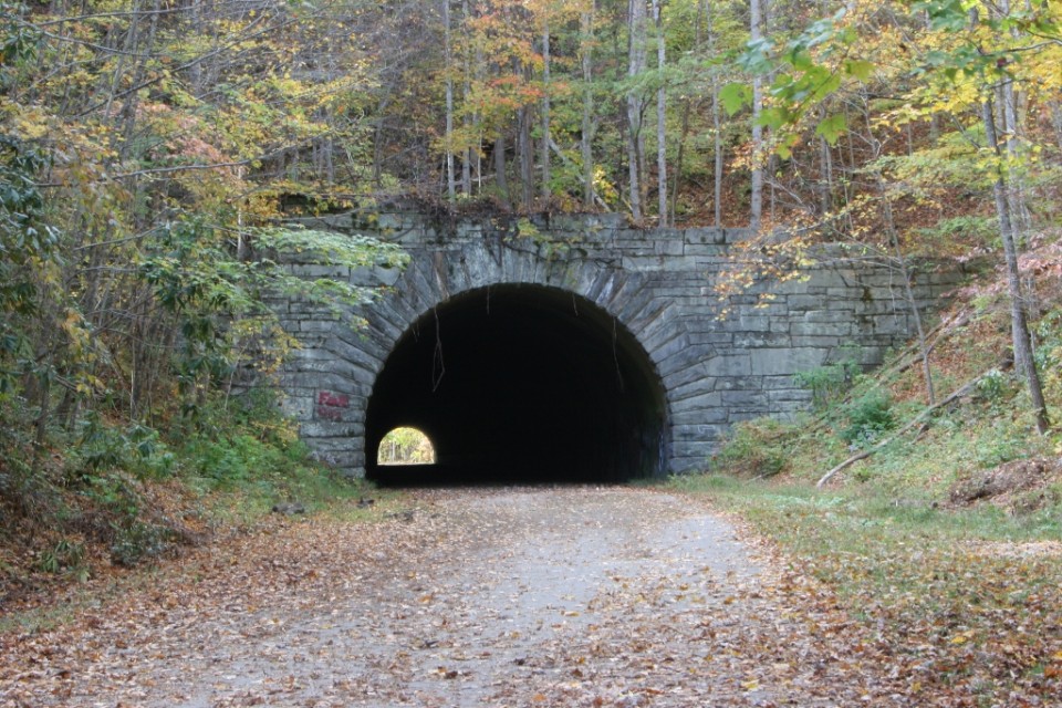
 (800x533)") This six-mile drive is also known as “the Road to Nowhere” and affords great views of Fontana Lake. Lakeview Drive ends one mile beyond a viaduct at the mouth of a tunnel. Work on the road stopped in 1943 and was never continued. “The Road to Nowhere” actually takes you to some nice hiking trails. Lakeshore and Tunnel Trails begin at the end of the parking area. The Lakeshore Trail is one of the newer trails in the Park, extending along the south boundary for about 44 miles. It is actually a configuration of trails developed from old manways, older existing trails, and roads.
This six-mile drive is also known as “the Road to Nowhere” and affords great views of Fontana Lake. Lakeview Drive ends one mile beyond a viaduct at the mouth of a tunnel. Work on the road stopped in 1943 and was never continued. “The Road to Nowhere” actually takes you to some nice hiking trails. Lakeshore and Tunnel Trails begin at the end of the parking area. The Lakeshore Trail is one of the newer trails in the Park, extending along the south boundary for about 44 miles. It is actually a configuration of trails developed from old manways, older existing trails, and roads. (800x533)") They were promised a road that would extend into the park and all the way to these areas that were cut off. The construction of Lakeview Drive began in 1943 and though progress was slow it continued until 1972 when funding ran out and the construction halted. The matter of whether this road would be finished was batted around on a local, state and federal level until 2010 when it was decided that a payout would be made to Swain County,
They were promised a road that would extend into the park and all the way to these areas that were cut off. The construction of Lakeview Drive began in 1943 and though progress was slow it continued until 1972 when funding ran out and the construction halted. The matter of whether this road would be finished was batted around on a local, state and federal level until 2010 when it was decided that a payout would be made to Swain County, 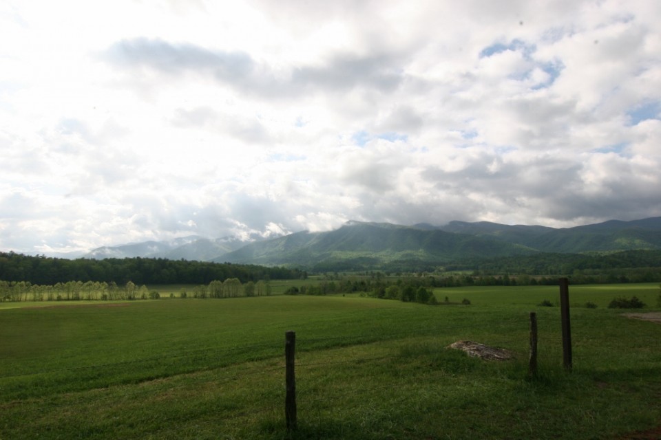
 (1024x683)") Cades Cove is the most popular
Cades Cove is the most popular  (1024x683)") The people of Cades Cove farmed the land, fellowshipped with each other and were happy for the most part. Then in the early 1900s, the Great Smoky Mountains National Park went from being an idea to being a reality. The people of Cades Cove were the most resistant to the creation of the park and to their inclusion in the park. In 1927 the General Assembly of the state of Tennessee declared that Cades Cove would be included in the GSMNP. The residents of the Cove fought the inclusion but in the end they were forced out of the area. In the end, some of the residents were given a lifetime lease. In fact the last resident out of Cades Cove was Kermit Caughron who passed way in 1995 and his home was dismantled soon after that.
The people of Cades Cove farmed the land, fellowshipped with each other and were happy for the most part. Then in the early 1900s, the Great Smoky Mountains National Park went from being an idea to being a reality. The people of Cades Cove were the most resistant to the creation of the park and to their inclusion in the park. In 1927 the General Assembly of the state of Tennessee declared that Cades Cove would be included in the GSMNP. The residents of the Cove fought the inclusion but in the end they were forced out of the area. In the end, some of the residents were given a lifetime lease. In fact the last resident out of Cades Cove was Kermit Caughron who passed way in 1995 and his home was dismantled soon after that. (683x1024)") Today you get to tour a Cades Cove that looked much as it did in the early 1900s. The eleven mile loop road around the Cove gives you access to all the historic structures, hiking trails and of course the wildlife that the cove is famous for. Before you enter the Cove you come to the riding staples, a picnic area and the campground and store. Cades Cove has it all.
Today you get to tour a Cades Cove that looked much as it did in the early 1900s. The eleven mile loop road around the Cove gives you access to all the historic structures, hiking trails and of course the wildlife that the cove is famous for. Before you enter the Cove you come to the riding staples, a picnic area and the campground and store. Cades Cove has it all.