Hiking to Mt LeConte

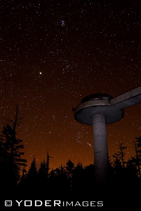
For viewing spectacular Smoky Mountain sunrises and sunsets, there is no better place than Mt. LeConte. Countless visitors have huddled together to view the sunrise from Myrtle Point on the eastern side, and hurried to see the sun set over Clingman’s Dome from Clifftops on the western flank.

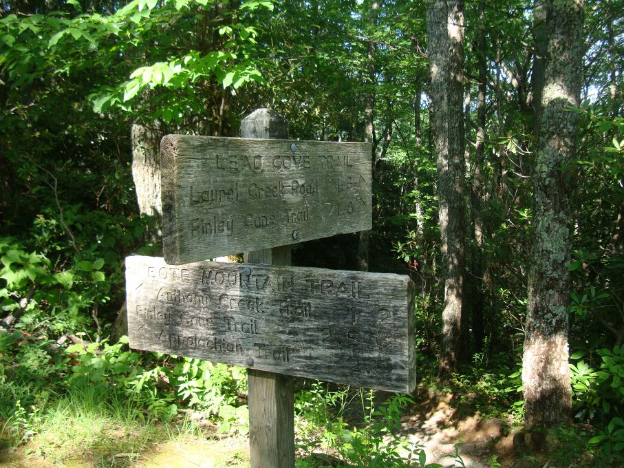
Trails to LeConte: More than 10,000 hikers use the trails to LeConte each year. Five major trails drape the mountain. The shortest (5 miles one-way) and most popular is the Alum Cave Bluffs Trail, without a doubt the most spectacular trail in the whole Park!

The longest trail (but with the least elevation gain) is the Boulevard Trail at 8 miles. Many visitors with two cars go up the Boulevard Trail and come down Alum Cave Bluffs. Rainbow Falls Trail is 6.5 miles and Bullhead 7 miles. These two trails can he used as a “loop” beginning at the same trailhead in Cherokee Orchard near Gatlinburg. The Trillium Gap Trail, which passes by Grotto Falls, comes up the mountain from the Greenbrier area and is 8 miles, providing spectacular views of LeConte from Brushy Mountain

For an interesting account about hiking the trails of LeConte, be sure to visit Ed Wright’s website. Since retiring in 1991, Ed hikes LeConte 2 to 5 times a week and works as a Volunteer in the Park (VIP). He has written a book “1001 Hikes to Mount LeConte and Counting,” which documents his trips and the hikers he meets along the trails.

Little Cataloochee Trail

The Little Cataloochee Trail is a 5.2 mile hike filled with historic structures as well as rolling Smoky Mountain hills and valleys on the North Carolina side of the park.

To get you started, you need to make your way to the Pretty Hollow Gap Trail, which lies 0.8 mile on Cataloochee Road. You’ll begin the trail along an old road through overgrown fields before crossing Little Davidson Branch by way of a few stepping stones. From here you’ll begin a steep ascent, crossing over the stream several more times.

You’ll notice a number of wildflower species as you move along the trail before reaching the first switchback a mile in. At 1.5 miles on the trail, you’ll see the first historic structure  on the left – on old farmstead.

Davidson Gap is reached at 1.8 miles on the trail following a rather steep climb. Hiking on, your descent begins in earnest as you hike past a rock wall before a switchback spits you out into the valley and the trail turns into a road. The farm is reached at 1.9 miles on the trail and you can take a break to observe the house and springhouse. To other structures, the apple house and the barn, are located in Oconaluftee and the Cataloochee Ranger Station respectively.

The Dan Cook log home is approached at the 2.5 mile marker. It’s not the original structure as it was reconstructed in 1999 following damage that had occurred at the site in years past. Dan Cook himself was known as a master carpenter in his day and built a number of structures in the area. Notice the fence posts that still stand in the vicinity where old homesteads once stood and at 3.2 miles you can climb up to the Little Cataloochee Baptist Church – one of the most picturesque places along the trail.

Follow the trail as it goes on behind the church and cross Little Cataloochee Creek around 3.7 miles in. The John Jackson Hannah cabin appears soon thereafter at about 4 miles via a side trail. This cabin was also restored, but in 1976 by the park service.

The Long Bunk Trail goes left at 4.1 miles leading to the Mount Sterling Trail. The Hannah Cemetery is just 0.2 miles in on this trail and one might think about making that quick side trip to view the historic cemetery.

Back on the Little Cataloochee Trail, you’ll hike around the end of a ridge until you cross Correll Branch and go on to the meeting of NC 284 and the finale of the Little Cataloochee Trail. Enjoy the Smokies!

Little Greenbrier Trail

Here’s a great little nature trail in the Smokies and a fairly moderate hike to the Laurel Falls Trail, it’s called the Little Greenbrier Trail. It covers 4.3 miles from its start at Wear Cove Gap Road to its meeting with the Laurel Falls Trail.

To get to the Little Greenbrier Trail, make your way to Wear Cove Road. The trail can also be accessed from the Metcalf Bottoms picnic area, across the bridge. From there it’s 1.25 miles to the trailhead which is reached just prior to the park boundary. However, there is limited parking here, so be advised you may have to search for a spot if they’re all filled up at the trailhead.

As noted, if you’re a nature-lover of wildflowers and majestic scenery this is a great trail for you even though it is mostly an uphill hike. Still, if you feel that you can hack it, you’re rewarded with scenery that many have chosen to forego in their search for the perfect Smoky Mountain hike.

You’ll climb through mixed hardwoods throughout most of the trail. For those in the know, the Little Greenbrier Trail is known for its surplus of blueberries which make it a great summer/fall trail.

Notice Wear Cove as you hike along the ridge. This is just the first of many great look outs you’re afforded along the Little Greenbrier Trail. Markers along the trail will notify you when you cross the national park boundary, of which there are many.

A few of more popular wildflower species found on the trail include orchids and they’re seen throughout as you move on and reach the 1.9 mile marker and Little Brier Gap Trail. Taking a right onto the Little Brier Gap Trail will lead you to the Walker Sisters’ home site. It’s one of the more historical sites located in the park that is still standing and worth making a little side trip if you have time.

Continuing straight on the Little Greenbrier, you’ll keep climbing as you ascend Chinquapin Ridge. As you hike around the ridge, one of the best views in the park makes its presence known as Wear Cove comes into full view. From its beautiful valleys to its lush green hillsides, you’re gonna want to make good use of any camera you may have brought with you.

The rest of the trail takes hikers straight to the junction with Laurel Falls Trail. From there, it’s a 1.8 mile hike down to spectacular Laurel Falls. Enjoy the Smoky Mountains!

Stargazing in the Smokies

The Great Smoky Mountains National Park is a very quiet place at night, which is good for all you stargazers out there.  It’s a totally different world as most people leave, the cars seem fewer and far between and most of the animals have gone in for the night. Nothing to see, right? Wrong. In fact, you could argue that there is even more to see at night than during the day.  Stargazing in the Smokies is a great way to get to know the natural elements of the Smoky Mountains minus all the daily visitors

The term “celestial wildlife” comes to mind when talking about stargazing in the Smoky Mountains.  Stars that are usually hidden due to city lights are seen majestically undeterred.  Orion’s belt seems to be accessorized by additional stars.  Ursa Major and Ursa Minor come into clear view and their resemblance to a large bear is more distinct. From any of the observation points in the Smoky Mountains, or from any backcountry vantage point, the night sky opens up as you leave the vestiges of civilization and work your way towards the Smokies.  Speaking of vantage points, Newfound Gap Trailhead, which doubles as a parking area for one of the most hiked portions of the Appalachian Trail, is a prime spot to stargaze in the Smokies.

Newfound Gap Trailhead is void of any street lights and there are no cities close enough to muddy up the sky at night. At night, the parking lot is usually vacant with the exception of a few cars and the passing cars won’t affect your night vision. Once you reach the trailhead, go to the furthest end of the parking lot, dim the lights and wait for your eyes to adjust to the darkness.  Then you’ll slowly start to see some eye-popping sights in the night sky.  This parking lot is 6,000 feet above sea level so you may want to pack a coat if you decide to stargaze in the early spring or fall. For example, if it’s 60 degrees in Pigeon Forge, then it will be at least 10 degrees cooler in the Smokies.

The moon and its position in the night sky is another thing to keep in mind.  The moon at its peak is ten times brighter in the Smoky Mountains than the stars.  A full moon on top of the mountain is a spectacular sight to behold but if you’re planning on looking at stars keep the phase of the moon in mind. A new moon is the perfect time to see the most stars. Sans a full moon, your view of the stars will be unobstructed and your stargazing trip to the Great Smoky Mountains will be complete.  If you want to see an amazing moonrise, then get to the summit early during a full moon and it will bright enough to read by.

Because of the lack of lights on the mountain it is possible to take pictures of this starry expanse.  You will need to turn the flash off on your camera and you will have to use fairly long exposures.  Long exposures (one and half to two minutes minimum) will produce star lines on the exposure.  The Earth’s constant movement in relation to the unmovable positions of the stars causes the star lines. This is what you want.  Lots of light into the camera and giving the camera enough time to absorb the light you are letting it will make the outline of the trees hazy and the stars will be small streaks in the sky.  You’ll need to use a tripod to eliminate movement of the camera.

If you are looking for an after-hours opportunity for your family to enjoy something they may not get to see anywhere else, get out of the cabin or hotel room, pack up the cool weather gear and head to the top of the Smokies, or a place like Cades Cove.  Put a sleeping bag on the hood of your car, lean back and enjoy the view.  Instead of looking at the gorgeous mountains below the heavens, turn your eyes upward and look at the stars.

Lead Cove Trail

Spence Field has become one of the most visited sites in the Great Smoky Mountains for its majestic views and vistas. There are a number of ways to get there including by way of the Lead Cove Trail – a 1.8 mile hike from Laurel Creek Road to the Bote Mountain Trail.

Not only does the Lead Cove Trail put you on the way to Spence Field, it also takes you by an old cabin site. To get there, by way of Big Spring Cove on Laurel Creek Road to Cades Cove, keep your eye out for a trail sign on the east side of the road. There is limited parking there (under 10 spots), so fair warning.

As the upper loop of a 7-mile trail to Spence Field, which also includes the Finley Cane and Bote Mountain trails, the Lead Cove Trail starts out following Laurel Creek Road before turning into the Smoky Mountain backcountry. You’ll find hemlock, tuliptrees, and a variety of hardwoods as you move along this first part of the trail. You’ll soon cross Sugar Cove Prong as the trail continues to rise. Sugar Cove follows the trail and you’ll see the ruins of an old chimney and stone foundation soon thereafter. The cabin that at one time stood here belonged to Gibson Tipton whose family were some of the first white settlers of Cades Cove.

Continuing your ascent, several areas with prevalent wildflower growth are hiked. Wildlife including bears are said to frequent these paths because of the appearance of the wildflower squawroot. Black cherry trees are also found in this area – a favorite of bears, as well as the chestnut oak.

You’ll come upon the trail’s lone overlook as you approach the junction with the Bote Mountain Trail. In the distance, Scott Mountain makes an appearance. Hiking on, you’ll reach the Bote Mountain Trail after a few hundred yards. Enjoy your time in the Smokies!

Hemphill Bald Trail

If you’re going to be taking in the outdoors from the North Carolina side of the Great Smoky Mountains National Park, one of the great day hikes is the 8.4 Hemphill Bald Trail – a horse and hiking trail with some great views of the Smokies, as well as an area where elk are known to roam.

To reach the trailhead, take the Blue Ridge Parkway and follow the signs to the Balsam Mountain Campground. Once you reach the campground, park at the Polls Gap area. You can actually hike the Hemphill Bald Trail as one part of a 13.6 mile loop and comes back around to Poles Gap, which many people do. However, if you’d rather just as soon back track, turn around once you’ve reached the junction with the Caldwell Fork Trail.

hemphillbald
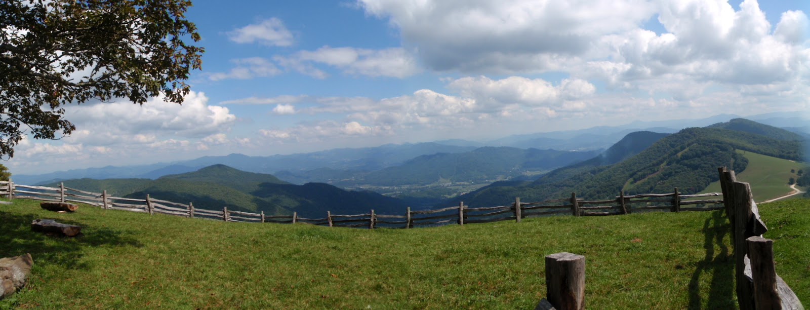
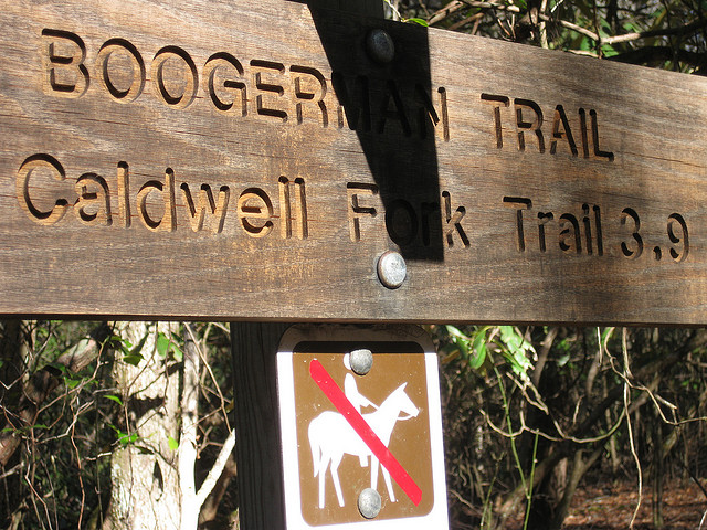
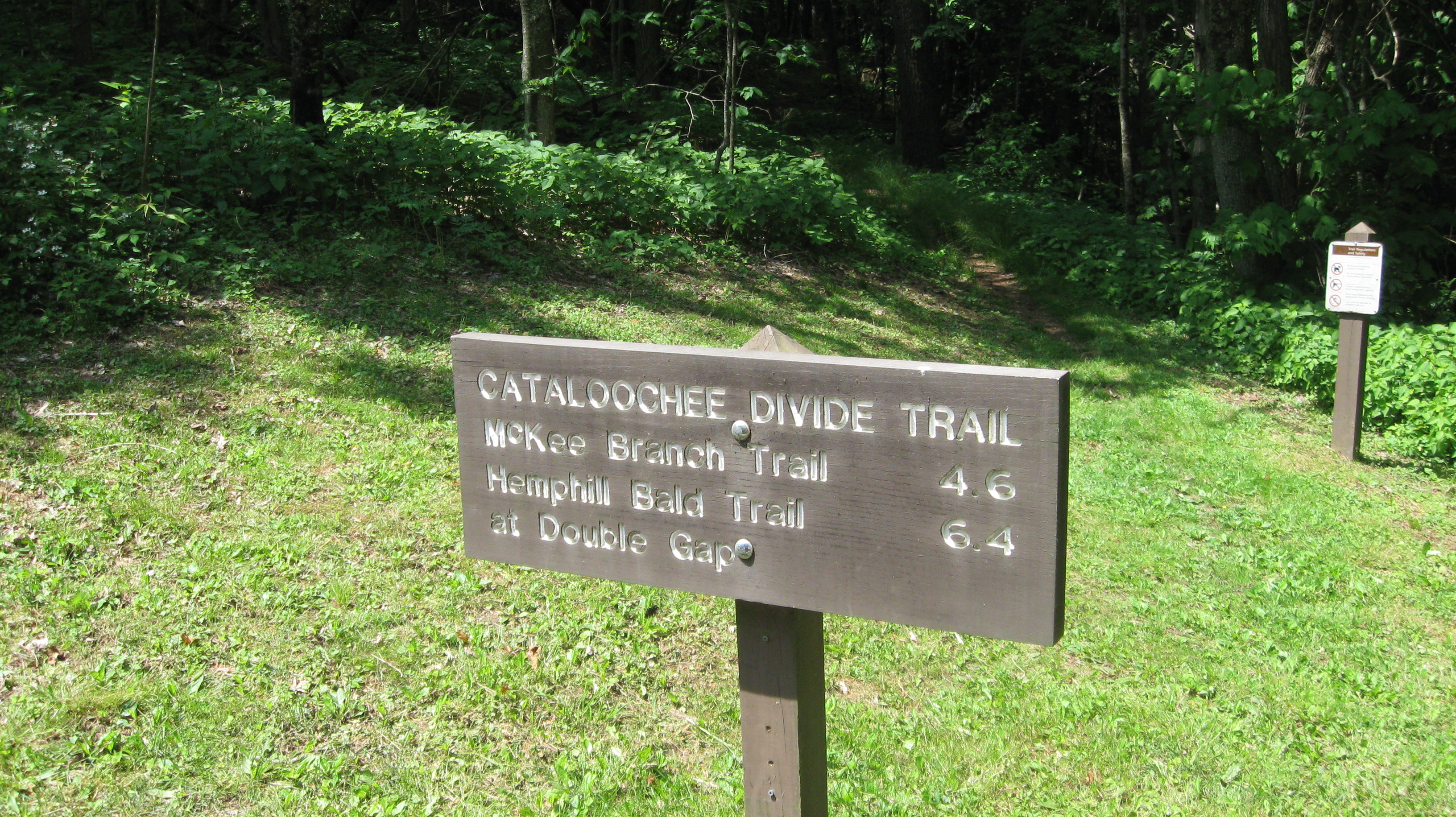
The Hemphill Bald Trail is the furthest trailhead on the right at the parking area. Once you’ve started hiking, you’ll notice the Caldwell Fork Valley to the left of the trail. Sugar maples, ferns, and a few remaining chestnuts can be found on this part of the hike as you reach Whim Knob a mile in.
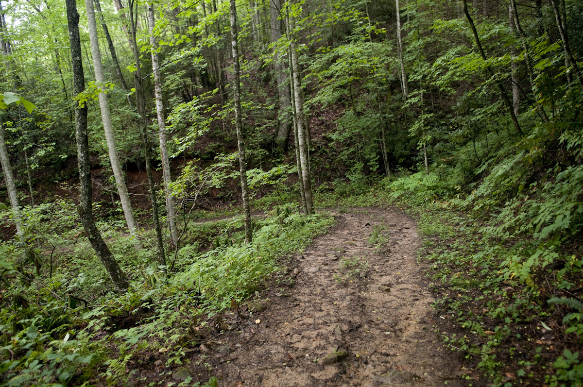
Following a descent toward the boundary of the Great Smoky Mountains National Park, the trail begins its climb up Buck Knob, which is lined with yellow birch and various mountain wildflowers. If you notice it coming down, you’ll even pass a spring, and a slew of other wildflower species.

Once you’ve hiked four miles, you’re likely making the up Hemphill Bald. Take in the majestic views to your right. Hopefully someone has packed a camera. Hemphill Bald gets its name because it is literally bald of trees from when sheep and cattle used to graze there. It’s a large grassy opening that is now sought out by many a Smoky Mountain hiker. Not only that, it’s an amazing place to do a bit of bird watching if that’s what you’re into. Meanwhile, the wildflowers, herbs, and various plants seem to outnumber the blades of grass in some areas.

Hikers approach the summit of Hemphill Bald at 4.7 miles on the trail. From there it’s a downhill hike to Double Gap then a number of water crossings over Double Gap Branch – 6 miles on the trail until you reach the junction with the Caldwell Fork Trail at mile 8.4. Now, if you’re looking for a spot out camp out, backcountry campsite No. 41 is just up the Caldwell Fork Trail from this point. Enjoy the Smokies!

Indian Creek Motor Trail

A connector trail if there ever was one, the Indian Creek Motor Trail stretches for all of 1.8 miles on the North Carolina side of the Great Smoky Mountains. What it connects are two larger trails – the Thomas Divide Trail and the Deeplow Gap Trail. To put it simply, it’s a quick trip through the forest.

To get to it, make your way on over to Bryson City, NC. From there you’ll follow the signs to the Deep Creek Ranger Station, then drive a mile up Tom Branch Road to the trailhead for the Thomas Divide Trail. After a 3.2 mile hike on the Thomas Divide Trail, you’ve reached the Indian Creek Motor Trail.

This was at one time the proposed site of a scenic auto tour, hence the “motor trail” portion of the name, until the project was abandoned totally. And just so that everyone is on the same page, automobiles are not allowed on this trail.

The Indian Creek Motor Trail makes its way downhill through tulip trees, yellow birches, and red maple, among various other species. Spring wildflowers can be found in abundance along the trail as well.

Moving on along the trail, a small waterfall can be seen to the right especially during the wetter months and in the spring. A small creek is even seen following the trail on the left as you walk on. In mid April this is a great place to spot the popular dogwood tree which bloom out in magnificent white.

More tulip trees can be seen before you reach mile 1.8 and the junction with the Deeplow Gap Trail.

Cataloochee Divide Trail

The 6.4 mile Cataloochee Divide Trail is excellent hiking trail for seeing some of the majestic views and vistas offered in Great Smoky Mountains.

To get there, travel Interstate 40 to North Carolina 276, exit 20, and drive west to Cove Creek Road. From there, you’ll turn north and travel 3 miles to the Cove Creek Gap where you find the trailhead.

Climb through the white pine grove as you begin on the trail, pass a rock outcropping, and walk along the fence line. You’re well on your way on the Cataloochee Divide Trail. It levels out at 1.2 miles in. You’ll notice a green cove to the right – the perfect spot for a bear sighting. If you look through the trees further down the trail on the right, you might even get a glimpse of the Cataloochee Valley.

Hikers will come to another clearing on the left. From there, hikers will be able to make out Interstate 40 and Cove Creek Valley. When you reach 1.9 miles on the trail more climbing begins through oaks and maples and hickories before heading downward again and leveling off

Hiking Trails

Juney Whank FallsHiking is probably the most popular activity in the Smokies.  There are hikes for every level of hiker.  Strenuous to easy, leisurely walks in the woods to all day and overnight hikes that require permits to stay in the backcountry the Great Smoky Mountains National Park has everything a hiker could want in a trail.

Make sure, if you are going to spend a lot of time hiking in the Smokies that you pick up their little brown book.  Titled “Hiking Trails of the Smokies” this book has every trail in the Smokies and gives pertinent information like, elevation, length, highlights and even landmarks so that you track your progress along the trail.

Abrams Falls Trail – This is the trail that starts at the Abrams Creek Trailhead in Cades Cove and runs to Abrams Falls.  This is a highly trafficked trail and one that is wide enough through the majority of its length to walk two or three abreast.  Rolling hills add a touch of difficulty but the payoff of the beautiful Abrams Falls and the swimming hole around it is spectacular.

Kephart Prong Trail – Named after one of the people that helped the Smokies become a national park, Horace Kephart, the Kephart Trail is 2 miles into the mountains from the North Carolina side of the park.  At the end of the Kephart Prong Trail, you come to the Kephart Shelter, which you can reserve for backcountry camping before you make your choice of the other trails to branch off from after a night spent in the shelter.

Gatlinburg Trail – This trail connects Gatlinburg and the Sugarlands Visitors Center.  A well maintained, easy trail with no steep grade or elevation change, the Gatlinburg Trail is an quick 2.5 mile hike through lush forest along the side of a bubbling mountain river.  Within the first mile and a half from Gatlinburg, you cross a foot bridge and then began a slow assent past a former CCC camp.

Laurel Falls – This is the most popular trail in the Smokies.  Easy is the best word to describe this trail.  Paved, wide and short, you can hike this trail in an afternoon.  At Laurel Falls you get to experience the fun of hiking in the Smokies while not having to get off road and hike on a dirt trail.  And the payoff is a beautiful view of Laurel Falls – one of the most photographed waterfalls in the Smoky Mountains.

Boogerman Trail

The Boogerman Trail in the Great Smoky Mountains has it all – old growth forest, picturesque streams and waterfalls, and what’s left of a few early Smoky Mountain homesteads. Now that you know that, a challenging 7.4 mile round-trip doesn’t seem all that bad.

You’ll find the trailhead in the Cataloochee section of the park, which is located on the North Carolina side of the Great Smoky Mountains National Park and can be a little more difficult to reach, but well worth the effort. From Interstate 40, NC State Route 276, and Cove Creek Road, navigate your way to the Caldwell Fork Trail (follow the signs).

During the Boogerman Trail hike, you’ll gain approximately 800 feet and reach an altitude of 3,600 feet. The trail gets its name from Robert “Boogerman” Palmer, whose old homestead in seen along the trail, as well as some of the region’s largest trees and various mountain streams. The Boogerman Trail also passes through some pristine wilderness that was untouched by logging companies who made their way through the Smokies before the land was purchased by the federal government and subsequently designated for use by the national park.

Upon arrival at the Caldwell Fork Trail, cross Cataloochee Creek by footbridge before coming across a slew of white pines. You’ll stay right when the trail splits before crossing Caldwell Fork on a footbridge.

At mile 2.8, you will encounter the Palmer homestead.

The trail turns to follow Snake Branch at 3.8 miles into the loop, before turning again around a rock wall, and traversing a small stream. Old fence posts and piles of stone now dot the landscape, indicating an area of early homesteads which once stood by the creek.

Snake Branch is crossed at nearly 5 miles into the hike. Towering hemlocks are also seen before the path takes you across Caldwell Fork a hand full of times via log footbridges. Several hundred yards before crossing Cataloochee Creek at approximately mile 7.4–and completion of the loop–you will see the remains of a cabin and barn built by Carson Messer.

The Boogerman Trail hike is a wonderful way to get to know the Cataloochee area of the national park, and I came away feeling stronger and more fulfilled than when I arrived.