Cooper Road Trail

If you’re in the Cades Cove area and you’re looking for a good, all day hike; look no further than the Cooper Road Trail just off the Cades Cove Loop Road. It’s a 10.9 mile hike from the loop road, around 4.3 miles in, to the Abrams Creek campground.

A former Indian trail, Cooper Road, at one time, was the main access way into Cades Cove for early settlers venturing into the Smoky Mountain region for the first time.

cooper road trailIt’s an easy hike going in as maples, oaks, and pine trees are prevalent before reaching a small sign for the Wet Bottom Trail – a connector trail if you’d like to go back to the Elijah Oliver Place.

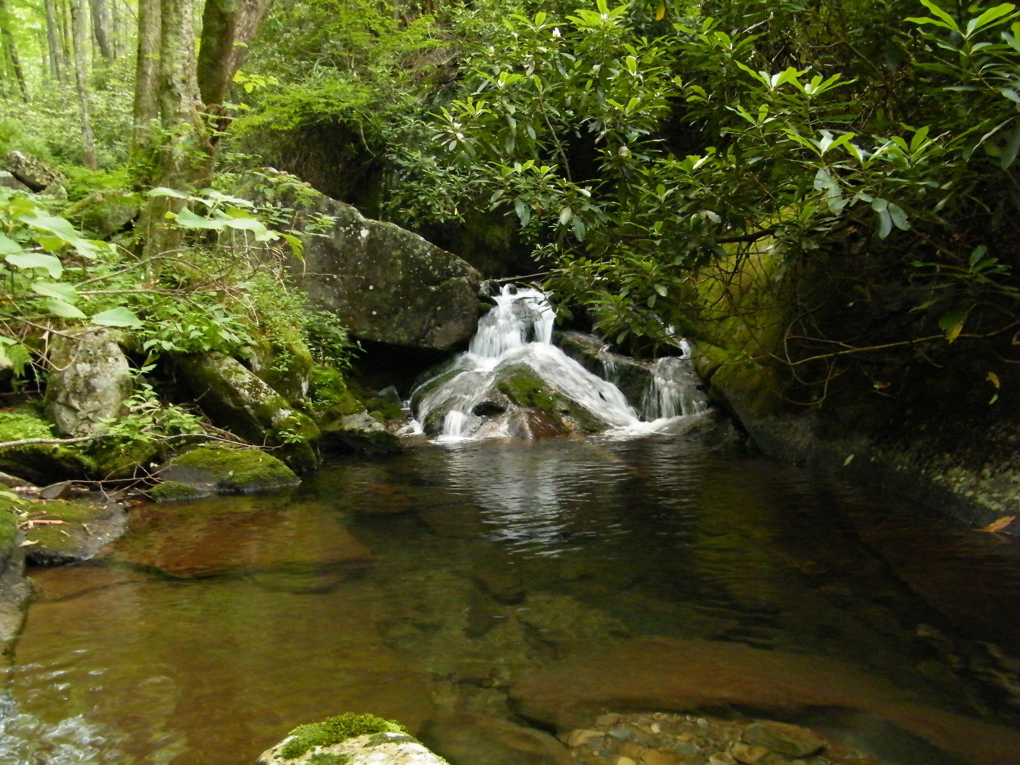
Continuing straight, the trail soon rises over a few ridges and a creek, then descends into a ravine. More ridges appear and the trail continues higher and higher on a rockier path. Two miles into the hike, the trail begins to cut back and forth above a creek. This is a great area to gaze at some beautiful spring wildfowers.

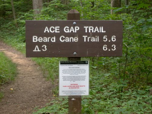
You’ll come to the junction with the Hatcher Mountain Trail and Little Bottoms Trail at mile 5.7. The Cooper Road Trail continues straight at this intersection through more maples and oaks. Once you’ve hiked 7.4 miles, you’ll notice 3 large rocks that mark the intersection with the Cane Creek Trail.

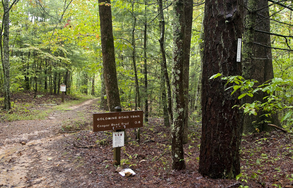
Hikers moving along will climb left to the junction with Goldmine Road. Here, you’re at 1750 feet and it’s downhill for most of the way, with one exception up a creek.

During your gradual descent, you’ll notice a scraggly wooded area, drop into a ravine, and cross yet another creek. More water crossings are a sign of Kingfisher Creek’s tributaries before coming to backcountry campsite No. 1 on the left. Ten people can camp here and Kingfisher Creek runs behind the site.

The Little Bottoms Trail junction is reached at mile 9.6 and leads left to Abrams Falls in a little over 4 miles. Abrams Creek Campground is seen at mile 10.5 and the ranger station is just a bit further.

Ace Gap Trail

Looking for a great hike where you can see the Smoky Mountain fall foliage in all its glory? Try the Ace Gap Trail which travels 5.6 miles from Rich Mountain Road to Beard Cane Trail.

The trailhead is close to Cades Cove which is a good thing for all those visitors who come to the park either looking for the entrance or Cades Cove – two of the more known locales of the Great Smoky Mountains National Park. You can access Rich Mountain Road from the Cades Cove Loop Road.

At the trailhead along Rich Mountain Road, hikers will notice a large sinkhole – evidence of the abundance of limestone in the area. Once you start, you’ll notice a side trail to the Bull Cave. Only hikers with special permits and equipment can enter the Bull Cave as it descends 420 feet. It was given the name Bull Cave as Rich Mountain Road was at one time a cattle passage and legend has it a bull fell into the cave, thus the Bull Cave.

Large growth oak trees align the start of the Ace Gap Trail, which is considered one of the park’s easier trail as it runs nearly level throughout the 5.6 miles. If you look closely at the white pines on the left of the trail you’ll notice the lightning scar on one that runs the length of its trunk.

Hikers will reach Kelly Gap at 2.3 miles. Further hiking brings you along a ridge line before you reach the Beard Cane Trail. In May, numerous Pink Lady’s Slippers give the higher a “How do you do?” upon reaching the Beard Cane Trailhead.

You’ll be able to distinctly tell when you’ve reached Ace Gap at 4.8 miles by the old railroad bed that crosses the trail. This was the property of the Little River Lumber Company during its heyday. It is said that Ace Gap gets its name from the timbermen who gathered to play cards at this spot during their break.

Eagle Creek Trail

The Eagle Creek Trail in the Great Smoky Mountains is an 8.9 miler with various streams crossing the trail throughout. Starting on the North Carolina side of the Smokies, the trail begins at the junction of the Lakeshore Trail – 6.1 miles northeast of Fontana Dam. To reach that point, you’ll have to take a boat across Fontana Lake to backcountry campsite No. 90. In other words, you’ve got to really want to hike the Eagle Creek Trail because it takes some maneuvering to get there.

eaglecreektrail1Eagle Creek has been used for years by various people to make a living, as well as for travel purposes. Today, the TVA harnesses its water for electricity. Hiking the Eagle Creek Trail starts out at the base of the creek. It’s a strenuous, challenging hike so be prepared and wear good shoes or boots.

At 0.5 miles past campsite No. 90, the trail crosses the stream by way of a foot log with a handrail. It’s a pretty aggressive stream at this point so proceed with caution when crossing the foot bridge.

The junction with Pinnacle Creek is reached at 0.7 miles on the trail. Eagle Creek is crossed again in about a quarter mile, sans a foot bridge. You’ll be tasked with crossing the creek at least 15 miles within the first 4.6 miles so be prepared and make sure to wear the appropriate gear. Sometimes the water levels may not allow you to go on. This trail depends a lot on the recent weather.

Backcountry campsite No. 89 is passed at mile 1.6 and can hold as many as 6 tents. You’ll rock hop Ekaneetlee Creek following the campsite and cross Eagle Creek again soon thereafter. And at the 2.6 mile mark, you’ll reach backcountry campsite No. 96, which is basically an island and can hold 4 tents. However, if you want to use the bathroom, you’ll have to ford the creek back to the other side as the island does not meet backcountry regulations when it comes to bathroom use.

More stream crossings are met 4 miles in. You’re beginning to get the picture when it comes to the large amounts of tributaries that crisscross the trail. Good shoes are imperative. Backcountry campsite No. 97 is passed before reaching Spence Field. The washtub at the campsite is to be left untouched, but feel free to imagine what early settlers may have used it, or in fact lived in the area.

Continuing along the shores of Eagle Creek, the trail begins to climb and get steeper. Gunna Creek – a major tributary of Eagle Creek is reached as you climb the mountain. It’s rough descent down the mountain in no way reminds the hiker of Eagle Creek.

You’ll cross Gunna Creek for the first time at mile 6.2 by way of a somewhat difficult rock hop. There is no fishing beyond this point either as the park looks to protect such species as the brook trout.

As you hike up and up, Spence Cabin Branch follows the trail. You won’t cross it until the path levels. On up the mountain you’ll come to Spence Field Shelter where hikers can find shelter and bathrooms. If you plan to stay here, be sure you make reservations beforehand. Spence Field is east only 0.1 miles. If you want a great view of Cades Cove, walk on over an admire the beauty of the Smokies. Enjoy it, you’ve hiked a very challenging trail and should be proud of your perseverance.

Forney Creek Trail

The Forney Ridge Trail joins the Forney Creek Trail on a 7.6 mile descent from Clingman’s Dome to the Jonas Creek Trail intersection. While few might choose this as an out-and-back, it’s part of a popular 20.5 mile backcountry loop that continues up to Silers Bald on the Appalachian Trail and back to Clingman’s Dome.

forneycreektrail2No matter your route, the Forney Creek Trail is compelling for its passage through several distinct ecotones, a stop at Forney Creek Cascade, light crowds, and several unaided, potentially challenging creek crossings:

Begin on the Forney Ridge Trail, which drops steeply past the Clingman’s Dome Bypass Trail through dense bands of Fraser fir and red spruce. Though swaths of forest exhibit extensive beetle damage, the trail corridor itself is healthy and verdant.

Forney Ridge drops in rugged stages to the Forney Creek Trail, which narrows on a variously steep and sloppy descent. Notable along the way are open grassy hillsides – a relative rarity in the Park – which are good places to find turkey and bear.

The trail reaches the top of Forney Creek and turns down beside it, transitioning from spruce and fir into an upper-hardwood forest. Birch and rhododendron appear as you head downstream to the 1st of two spurs for Backcountry Campsite #68.

This is potentially confusing, as the falls and 2nd site are still .4 miles away, and the two are not depicted separately on most maps.

Continue through a steep hairpin turn down to the second site #68 at the base of Forney Creek Cascade. This long, two-tier fall slides down wide rock slabs into a narrow pool along the creek.

Grades moderate past the falls across a tributary, the first of many wet encounters. Hardwoods emerge in greater numbers on a steady, if uneventful descent along dry southwest-facing slopes.

The creek is audible but mostly concealed until reaching the first major crossing at 4.95 miles. This scenic area is highlighted by a tumbling tributary and several cascades upstream.

The trail continues above and away from the creek into the heart of a northern hardwood forest. Rhododendron envelops portions of the trail while vines drape from towering maple, beech, and poplar. The understory is notably lush and diverse at these lower, wetter elevations.

You’ll reach a second major crossing at 6.0 miles to Backcountry Campsite #69, which is unceremoniously located right along the trail.

Travel levels considerably to consecutive crossings at 6.25 miles, 6.6 miles, and 7.0 miles. Concentration and fatigue management are key on these more voluminous fords.

The Forney Creek Trail meets the Jonas Creek Trail at a log bridge near the creeks’ confluence. Whether continuing on a loop or returning the way you came, a minimum 3,800′ net climb awaits back to Clingman’s Dome.

Baxter Creek Trail

Looking for a Smoky Mountain trail the really gets your heart and leg muscles going? Look no further than the Baxter Creek Trail – a 6.1 mile rocky trail that goes no where but up. Get your good fitting boots ready and stretch those quads because this trail will make a man, or woman, out of you.

The trail starts out at the Big Creek Picnic area at the Big Creek Campground in Newport, TN and travels upward to the junction of the Mount Sterling Trail and Campsite #38. A handful of logging companies used the land over the course of a century to 1930s with various degrees of success. Still, the mountain’s steep grade seemed to have its way with most as each eventually abandoned its efforts.

The trail starts off at the Big Creek Picnic Area before crossing a metal bridge over Big Creek. From there, the trail begins to rise and you’ll notice a large island in Big Creek to the right. You’ll encounter number tree and wildflower species along the trail from toothwort to the American beech before moving through forests of hickory, maple, and dogwood. A side trail leads to a large stone chimney at 0.3 miles.

You’ll hear Baxter Creek before coming to a large Eastern hemlock with a number of branches on its lower trunk. The trail is becoming narrower, rockier, steeper, and at times more hazardous at this point as you approach Baxter Creek again. This is where the climbing really begins and doesn’t end till you reach the fire tower. Eventually you’ll reach a small ridge overlooking Big Creek Valley where you can see Mount Cammerer.

Ober Gatlinburg

Great skiing isn’t just found out west or in the northeast portion of the country… A trip to Gatlinburg, TN and the Great Smoky Mountains means you can enjoy skiing and snowboarding in the heart of the south as well!

Ober GatlinburgThe Ober Gatlinburg Ski Resort has been known for years as a place to visit for ski-enthusiasts in Gatlinburg, Tn, offering guests numerous slopes with which to test their skills. In all, they can experience skiing or snowboarding on eight different trails, and at contrasting levels of difficulty. You’ll also get a bird’s eye view of the Smoky Mountains, with spectacular views of snowy peaks, wintry forests, and illuminated skylines around each turn!

Do you’re just starting out in the recreational sport, or have never skied; it doesn’t matter, the staff is here to help! The Smoky Mountain Snow Sport School, at the Ober Gatlinburg Ski Resort, can provide guests with lessons for individuals or groups. This is a fun way to bond together as a group, or a family.

And if you don’t have a pair of skis, Ober has you covered. Their rental shop has everything you need – clothing and gear available for rental in a variety of sizes, for both kids and adults!

Ober GatlinburgDuring the spring and summer months, Ober Gatlinburg’s Amusement park is filled with fun and excitement for the entire family! Enjoy the Alpine Slide, indoor ice arena, and scenic chairlift. Who needs snow to have fun? Take a trip down the waterslide, push some quarters in the arcade, ride the bumper cars, and do some bungee jumping, Oh, and I failed to mention the velcro jump wall, the shooting range, and mini golf course!

Now, if you plan on skiing in Gatlinburg, Tn at Ober during your next vacation, then you have two options of getting up to the resort. You can either ride the aerial tramway (which happens to be the largest aerial tramway in America) from downtown Gatlinburg or you can drive up the mountain on Ski Mountain Road. Simply turn at traffic light No. 9 on the south end of Gatlinburg (closest to the Great Smoky Mountains National Park) and follow the winding road (Ski Mountain Road) all the way to the top. And be sure to bring some cash with you to park once you get there. The earlier you go the better. There are three tiers of parking lots at the resort and if you get there early, you have a better shot at getting a parking spot at the top near the resort. Otherwise, it’s a short hike from the lower parking lots, but the locals call that the warm up!


Corn Mazes

What’s better than the fall colors cascading down the mountains as summer slowly turns into crisp autumn nights? I know what most of you were thinking and that’s nothing really, especially when you’re talking about fall. And that’s OK, but for some fall brings the outdoor fun of corn mazes in all different shapes and sizes. In the Great Smoky Mountains, there are quite a few of these attractions beginning with the Kyker Farms Corn Maze in Sevierville. It’s a great way to enjoy the autumn air and snuggle up to fire with smores and hot chocolate afterward.

So on with our list, here are some of the best corn mazes, as well as haunted corn mazes, in the Smokies – Tennessee and North Carolina:

Kyker's Corn Maze

Kyker Farms Corn Maze – Located in Sevierville, TN, this 5 acre maze runs from September 21 – October 28 with a haunted portion opening in October, running on Friday and Saturday nights through the end of the month. Kyker also features a “Tater Tot” maze for small children, a pumpkin patch, hay rides and much much more. There is also a petting critter barn and straw crawl for the kids. Check out Kyker Farm’s Website for up to date times and events. Located at 938 Alder Branch Road, Sevierville, TN  37876. Phone: (865)679-4848

Fender Farms Corn Maze

Fenders Farm Corn Maze – Head northeast to Tennessee’s oldest town – Jonesborough, and experience the corn maze at Fender’s Farm. The maze opens on September 14 and runs through November 14. There, you’ll find a haunted maze, animal shows, playground, milking parlor, calf roping, a cow train, horseshoes, wagon rides, and a zipline. If you can’t find something to do and entertain you at Fender Farms, well, you’re out of luck. Located at 254 Highway 107 in Jonesborough, TN or visit their website at fendersmaze.com.

Blue Ridge Corn Maze

Blue Ridge Corn Maze – The Blue Ridge Corn Maze in Brevard, NC boasts 6 acres of “Corn-fusion”, opens in July and operates through the end of October. *By appointment only July – August. They claim that their haunted maze is one of the best in the western North Carolina area. Located at 1605 Everett Rd. in Pisgah Forest, NC, they have tents for large parties and pumpkins and Black Angus beef for sale. Visit their website at blueridgecornmaze.com.

Eliada's Corn Maze

Eliada’s Annual Corn Maze – Eliada’s annual corn maze is a 12 acre maze and Western North Carolina’s largest. Besides a maze, come play with corn cannons, take a hay ride, a cow train, play in the giant sandbox filled with corn, ride a giant tube slides, and so much more! The maze will open September 7th and remain open each Friday, Saturday and Sunday through October 28th. The maze will open from 4-9 on Fridays, 10-9 on Saturdays, and 11-8 on Sundays. Contact Nora Scheff at 828.254.5356 x 303 or via email at nscheff@eliada.org.

Miniature Golf

Davy Crockett Mini GolfThere is something about a good game of miniature golf that brings people together.  Whether you are looking for a day out with the kids or you are a local looking for a nice afternoon out with friends, there is just a togetherness that is formed when you take to the mini-links with friends and family.  The Smoky Mountain area has many options when it comes to your mini-golf needs.  Standard courses, themed courses and even some venues that have a lot more to offer than just golf, both sides of the Smokies have mini-golf and they are all fantastic.

HillBilly GolfGatlinburg – This is one of the oldest in Gatlinburg.  You start out taking a ride up the mountain to start your golf experience.  With two courses, Hillbilly Golf has been making history for families for decades.  Located right as you get into Gatlinburg, near traffic light 1, It is easy to find and easy to walk to.

Professor Hacker’s Lost Treasure GolfPigeon Forge – Lost Treasure Golf is located in the center of Pigeon Forge.  Two courses of adventurous fun, this course is built around all the adventure movie fun that you ever saw in the movies.  This venue is easy to spot, look for the plane that hangs in the air over the courses and the train that takes you to the start of each course.

Tropical Gardens Mini-GolfAsheville – In Asheville you can step into a tropical setting as you participate in a great round or two of mini-golf.  Animals from the jungle dot the landscape as you work your way through the challenging courses.  The landscaping is fantastic and may actually be as big a draw as the courses themselves. Of course, you can’t putt with a plant.

Old MacDoanald’s Farm Mini-GolfSevierville – Right in front of Tanger Five Oaks Outlet Mall is Old MacDoanald’s Farm Mini-Golf.  This is a Ripley’s attraction and they have brought their knowhow in making family attractions into the creation of one of the best min-golf courses that you will ever play.  Three courses at one location means that you can spend the better part of an afternoon playing golf while the shopper sin your party shop and shop and shop.

Whitewater Rafting

Whitewater RaftingIt is no surprise with the amount of water that flows out of the Smokies, that whitewater rafting is a hugely popular pastime in the Smokies.  Companies occupy almost every major river from the North Carolina side of the Smokies to Tennessee.  Find an outfitter in any of the towns or at shops like the Nantahala Outdoor Center that line the roads.  Here are some things that all of the whitewater rafting companies have in common:

  • Expert Guides – You are not going to be left to your own devices while you are on the river.  Each boat gets its own trained expert guide.  They are there to make sure that not only do you enjoy the trip in safety but to guide your boat so that you get to experience all that the river has to offer.
  • Some of the rivers are controlled by dams  – The whitewater rafting companies depend on the water control from those dams to make sure that you have a great trip.  These companies send boats down the river have been working with these dams for years, they know the best times to go so that you have an amazing experience.
  • Transportation – You park at their office.  They load you and your family and friends onto a bus.  The boats go on top, you go inside.  They drive you to the point that you will start on the river.  When you have finished the trip, soaked and out of breath from the fun that you have had, they pick you up again and bring you back to your vehicle that has been parked in security at their office.
  • Know what to expect – If this is our first whitewater trip or your first time down a new river, it is nice to know what to expect as you step into the boat.  You will know turn by turn, from the discussion you have in the outfitters before you start and from the guide in the boat what is coming next.  This knowledge won’t keep you from feeling the adrenaline surge of dropping into the rapids but it is nice to know what to expect.

Each of the rivers has its own nature and terrific qualities.  The turns, the rapids the structure of the river change day to day and at times if the water is right, the amount of adventure might be double what it was the last time you were on that river.  Find the whitewater company you like and try every river they have at their disposal.  Explore the rivers of the Smokies.  Get wet and have a blast!

Mount Jefferson State Park

Mount Jefferson is a great rocky prominence that juts 1600 feet above the surrounding area.  Used as a landmark for people that travel in the area, Mount Jefferson is not only an amazing physical feature on the outskirts of the new River area but it is a remarkable container for countless species of plants and animals.  In modern times, this has become a State Natural Area, that is designed to tell people about the mountain, the history of the area and protect some of the species that live in its shadow.

Mount Jefferson State ParkMount Jefferson has gone by many names in its long history.  For a number of years before the American Revolution, the mountain was called Panther Mountain.  This was due to the legend that a child was killed by a panther on the mountain itself.  In 1952, the mountain was named after Thomas Jefferson, the third President of the United States.  This was due to a 1749 visit by Thomas Jefferson and his father as they surveyed what would become the border of North Carolina and Virginia.  Now, Mount Jefferson is a tribute to the man and a landmark state park that allows people to come and play outside in the great wide open spaces.

Due to the extreme nature of the mountain itself, the activities are built around the exploring the mountain and teaching about the mountain.  The Park rangers that manage the land provide education talks about the area and interpretive programs to allow you to learn more about Mount Jefferson and the part that it plays in the ecosystem.  In fact, if you call and schedule it ahead of time, they will supply a park ranger or a local historian to give you a private tour of the mountain.

Mount Jefferson State ParkBesides the history that surrounds the name and nature of the mountain, Mount Jefferson is home to thousands of species of plants and animals.  Due to the diversity in the altitude, the forests and the animals are broken up by the elevations.  The hardwood forest at the top of the mountain contain a much different set of animals and shrubs then you will find at the lower levels of Mount Jefferson.

Mount Jefferson, one of the most majestic mountains in the Southern Appalachians, is a North Carolina State Park.  Beautiful scenery brought Thomas Jefferson and his father to the area to establish the border between Virginia and North Carolina.  Now the Mountain and the state park bear his name.  Bring the family and your friends to the slopes of Mount Jefferson State Park.  Enjoy the scenery, enjoy the activities and learn about the ecology of this steep environment.