Cooper Road Trail

If you’re in the Cades Cove area and you’re looking for a good, all day hike; look no further than the Cooper Road Trail just off the Cades Cove Loop Road. It’s a 10.9 mile hike from the loop road, around 4.3 miles in, to the Abrams Creek campground.

A former Indian trail, Cooper Road, at one time, was the main access way into Cades Cove for early settlers venturing into the Smoky Mountain region for the first time.

cooper road trailIt’s an easy hike going in as maples, oaks, and pine trees are prevalent before reaching a small sign for the Wet Bottom Trail – a connector trail if you’d like to go back to the Elijah Oliver Place.

Continuing straight, the trail soon rises over a few ridges and a creek, then descends into a ravine. More ridges appear and the trail continues higher and higher on a rockier path. Two miles into the hike, the trail begins to cut back and forth above a creek. This is a great area to gaze at some beautiful spring wildfowers.

You’ll come to the junction with the Hatcher Mountain Trail and Little Bottoms Trail at mile 5.7. The Cooper Road Trail continues straight at this intersection through more maples and oaks. Once you’ve hiked 7.4 miles, you’ll notice 3 large rocks that mark the intersection with the Cane Creek Trail.

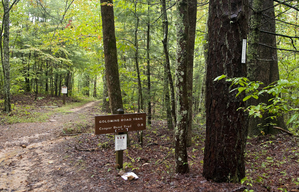
Hikers moving along will climb left to the junction with Goldmine Road. Here, you’re at 1750 feet and it’s downhill for most of the way, with one exception up a creek.

During your gradual descent, you’ll notice a scraggly wooded area, drop into a ravine, and cross yet another creek. More water crossings are a sign of Kingfisher Creek’s tributaries before coming to backcountry campsite No. 1 on the left. Ten people can camp here and Kingfisher Creek runs behind the site.

The Little Bottoms Trail junction is reached at mile 9.6 and leads left to Abrams Falls in a little over 4 miles. Abrams Creek Campground is seen at mile 10.5 and the ranger station is just a bit further.
Gatlinburg Trail

  • 1.9 miles in length
  • Starting Points – Sugarlands Visitors Center or River Road in Gatlinburg near traffic light 10
  • Points of Interest – Footbridge over the West Prong of the Little Pigeon River & CCC homesites
  • Difficulty – 1

Gatlinburg TrailAre you looking for an easy trail?  Are you wanting to hike but not end up passed out on the side of the mountain because the elevation was just too much to take?  Then the Gatlinburg Trail might be your best option.  Starting from either Gatlinburg or from the Sugarlands Visitors Center, you are looking at an almost 2 mile hike with very little elevation climb and a beautiful scenery as you wind through the lower altitudes of the Smokies along the Little Pigeon River.

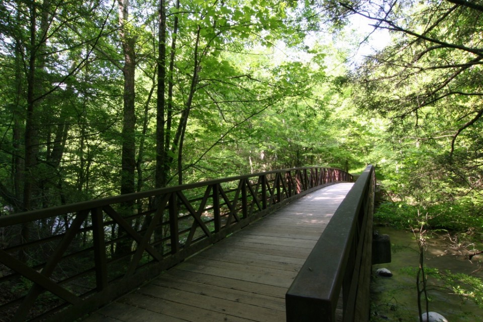
I like to start this hike from the Gatlinburg end if the trail.  Park in Gatlinburg along River Road or arrive early and you might can park across from the trailhead itself.  Hop out of the car and start on the trail.  You start right next to the river – and if you are just looking to go wading, this is the spot.  Within the first half a mile of the trail there are several places that you can walk right down to the river.  Also, in the first half you will come to the first big highlight on this trail – the footbridge.

Gatlinburg TrailThe footbridge over the Little Pigeon River is THE reason to hike this trail, and it is also part of the reason that most people start from the Gatlinburg end of the trail.  The footbridge allows you to see upstream and downstream on the Little Pigeon.  It is a perfect place for a family photo.  Also, right past the bridge there is a path that leads down under the bridge for a great opportunity to play in the water.  When you are ready to continue your hike, jump out of the water and head back up to the bridge, hiking away from Gatlinburg into the mountains.

Another half mile of hiking, about halfway down the trail, you will come to the next big highlight.  You will have gained some elevation slowly over the course of the trail and on your right (again if you are headed toward Sugarlands) you will see a chimney.  This chimney marks one of the CCC Camps that helped to make this trail into the wilderness.  The CCC or Civilian Conservation Corps were conscientious objectors to World War II that were used to help establish the trails and facilities in the National Park.  Around the park you will find relics, left over from where these people lived and worked in the GSMNP.

Gatlinburg TrailThere is one thing to remember when you are hiking the Gatlinburg Trail, it is a one way trail.  This is not a loop that will bring you back to the place you started so you will have to hike the 2 miles back to the trailhead you started from unless you have dropped a car off at the other end of the trail.  That means that you are looking at around 4 miles of hiking inside of almost 2 if you have to hike back.  This is just something to keep in mind for any of the trails in the park that are not loop trails.

Ace Gap Trail

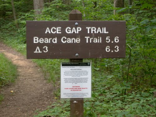
Looking for a great hike where you can see the Smoky Mountain fall foliage in all its glory? Try the Ace Gap Trail which travels 5.6 miles from Rich Mountain Road to Beard Cane Trail.

The trailhead is close to Cades Cove which is a good thing for all those visitors who come to the park either looking for the entrance or Cades Cove – two of the more known locales of the Great Smoky Mountains National Park. You can access Rich Mountain Road from the Cades Cove Loop Road.

At the trailhead along Rich Mountain Road, hikers will notice a large sinkhole – evidence of the abundance of limestone in the area. Once you start, you’ll notice a side trail to the Bull Cave. Only hikers with special permits and equipment can enter the Bull Cave as it descends 420 feet. It was given the name Bull Cave as Rich Mountain Road was at one time a cattle passage and legend has it a bull fell into the cave, thus the Bull Cave.

Large growth oak trees align the start of the Ace Gap Trail, which is considered one of the park’s easier trail as it runs nearly level throughout the 5.6 miles. If you look closely at the white pines on the left of the trail you’ll notice the lightning scar on one that runs the length of its trunk.

Hikers will reach Kelly Gap at 2.3 miles. Further hiking brings you along a ridge line before you reach the Beard Cane Trail. In May, numerous Pink Lady’s Slippers give the higher a “How do you do?” upon reaching the Beard Cane Trailhead.

You’ll be able to distinctly tell when you’ve reached Ace Gap at 4.8 miles by the old railroad bed that crosses the trail. This was the property of the Little River Lumber Company during its heyday. It is said that Ace Gap gets its name from the timbermen who gathered to play cards at this spot during their break.

Eagle Creek Trail

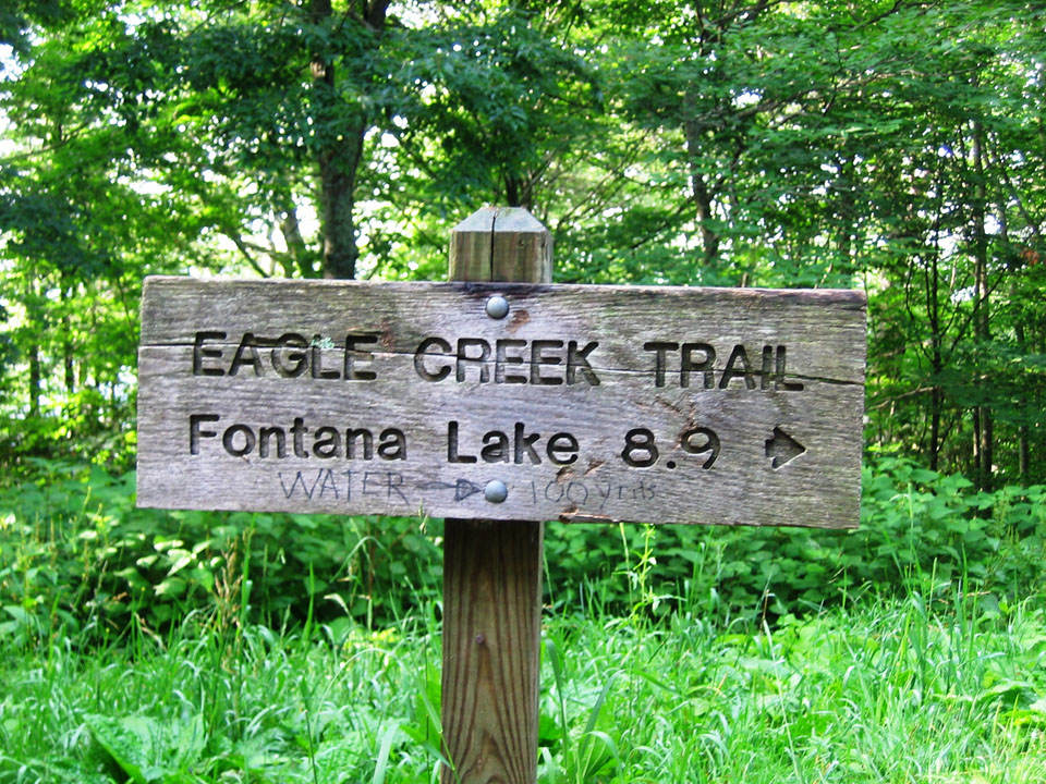
The Eagle Creek Trail in the Great Smoky Mountains is an 8.9 miler with various streams crossing the trail throughout. Starting on the North Carolina side of the Smokies, the trail begins at the junction of the Lakeshore Trail – 6.1 miles northeast of Fontana Dam. To reach that point, you’ll have to take a boat across Fontana Lake to backcountry campsite No. 90. In other words, you’ve got to really want to hike the Eagle Creek Trail because it takes some maneuvering to get there.

eaglecreektrail1Eagle Creek has been used for years by various people to make a living, as well as for travel purposes. Today, the TVA harnesses its water for electricity. Hiking the Eagle Creek Trail starts out at the base of the creek. It’s a strenuous, challenging hike so be prepared and wear good shoes or boots.

At 0.5 miles past campsite No. 90, the trail crosses the stream by way of a foot log with a handrail. It’s a pretty aggressive stream at this point so proceed with caution when crossing the foot bridge.

The junction with Pinnacle Creek is reached at 0.7 miles on the trail. Eagle Creek is crossed again in about a quarter mile, sans a foot bridge. You’ll be tasked with crossing the creek at least 15 miles within the first 4.6 miles so be prepared and make sure to wear the appropriate gear. Sometimes the water levels may not allow you to go on. This trail depends a lot on the recent weather.

Backcountry campsite No. 89 is passed at mile 1.6 and can hold as many as 6 tents. You’ll rock hop Ekaneetlee Creek following the campsite and cross Eagle Creek again soon thereafter. And at the 2.6 mile mark, you’ll reach backcountry campsite No. 96, which is basically an island and can hold 4 tents. However, if you want to use the bathroom, you’ll have to ford the creek back to the other side as the island does not meet backcountry regulations when it comes to bathroom use.

More stream crossings are met 4 miles in. You’re beginning to get the picture when it comes to the large amounts of tributaries that crisscross the trail. Good shoes are imperative. Backcountry campsite No. 97 is passed before reaching Spence Field. The washtub at the campsite is to be left untouched, but feel free to imagine what early settlers may have used it, or in fact lived in the area.

Continuing along the shores of Eagle Creek, the trail begins to climb and get steeper. Gunna Creek – a major tributary of Eagle Creek is reached as you climb the mountain. It’s rough descent down the mountain in no way reminds the hiker of Eagle Creek.

You’ll cross Gunna Creek for the first time at mile 6.2 by way of a somewhat difficult rock hop. There is no fishing beyond this point either as the park looks to protect such species as the brook trout.

As you hike up and up, Spence Cabin Branch follows the trail. You won’t cross it until the path levels. On up the mountain you’ll come to Spence Field Shelter where hikers can find shelter and bathrooms. If you plan to stay here, be sure you make reservations beforehand. Spence Field is east only 0.1 miles. If you want a great view of Cades Cove, walk on over an admire the beauty of the Smokies. Enjoy it, you’ve hiked a very challenging trail and should be proud of your perseverance.

Forney Creek Trail

The Forney Ridge Trail joins the Forney Creek Trail on a 7.6 mile descent from Clingman’s Dome to the Jonas Creek Trail intersection. While few might choose this as an out-and-back, it’s part of a popular 20.5 mile backcountry loop that continues up to Silers Bald on the Appalachian Trail and back to Clingman’s Dome.

forneycreektrail2No matter your route, the Forney Creek Trail is compelling for its passage through several distinct ecotones, a stop at Forney Creek Cascade, light crowds, and several unaided, potentially challenging creek crossings:

Begin on the Forney Ridge Trail, which drops steeply past the Clingman’s Dome Bypass Trail through dense bands of Fraser fir and red spruce. Though swaths of forest exhibit extensive beetle damage, the trail corridor itself is healthy and verdant.

Forney Ridge drops in rugged stages to the Forney Creek Trail, which narrows on a variously steep and sloppy descent. Notable along the way are open grassy hillsides – a relative rarity in the Park – which are good places to find turkey and bear.

The trail reaches the top of Forney Creek and turns down beside it, transitioning from spruce and fir into an upper-hardwood forest. Birch and rhododendron appear as you head downstream to the 1st of two spurs for Backcountry Campsite #68.

This is potentially confusing, as the falls and 2nd site are still .4 miles away, and the two are not depicted separately on most maps.

Continue through a steep hairpin turn down to the second site #68 at the base of Forney Creek Cascade. This long, two-tier fall slides down wide rock slabs into a narrow pool along the creek.

Grades moderate past the falls across a tributary, the first of many wet encounters. Hardwoods emerge in greater numbers on a steady, if uneventful descent along dry southwest-facing slopes.

The creek is audible but mostly concealed until reaching the first major crossing at 4.95 miles. This scenic area is highlighted by a tumbling tributary and several cascades upstream.

The trail continues above and away from the creek into the heart of a northern hardwood forest. Rhododendron envelops portions of the trail while vines drape from towering maple, beech, and poplar. The understory is notably lush and diverse at these lower, wetter elevations.

You’ll reach a second major crossing at 6.0 miles to Backcountry Campsite #69, which is unceremoniously located right along the trail.

Travel levels considerably to consecutive crossings at 6.25 miles, 6.6 miles, and 7.0 miles. Concentration and fatigue management are key on these more voluminous fords.

The Forney Creek Trail meets the Jonas Creek Trail at a log bridge near the creeks’ confluence. Whether continuing on a loop or returning the way you came, a minimum 3,800′ net climb awaits back to Clingman’s Dome.

Baxter Creek Trail

Looking for a Smoky Mountain trail the really gets your heart and leg muscles going? Look no further than the Baxter Creek Trail – a 6.1 mile rocky trail that goes no where but up. Get your good fitting boots ready and stretch those quads because this trail will make a man, or woman, out of you.

The trail starts out at the Big Creek Picnic area at the Big Creek Campground in Newport, TN and travels upward to the junction of the Mount Sterling Trail and Campsite #38. A handful of logging companies used the land over the course of a century to 1930s with various degrees of success. Still, the mountain’s steep grade seemed to have its way with most as each eventually abandoned its efforts.

The trail starts off at the Big Creek Picnic Area before crossing a metal bridge over Big Creek. From there, the trail begins to rise and you’ll notice a large island in Big Creek to the right. You’ll encounter number tree and wildflower species along the trail from toothwort to the American beech before moving through forests of hickory, maple, and dogwood. A side trail leads to a large stone chimney at 0.3 miles.

You’ll hear Baxter Creek before coming to a large Eastern hemlock with a number of branches on its lower trunk. The trail is becoming narrower, rockier, steeper, and at times more hazardous at this point as you approach Baxter Creek again. This is where the climbing really begins and doesn’t end till you reach the fire tower. Eventually you’ll reach a small ridge overlooking Big Creek Valley where you can see Mount Cammerer.

Appalachian Trail – A History

Appalachian Trail

A History

The Appalachian Trail is one of the big draws for the Great Smoky Mountains National Park. Conceived in the 20s, this brain child of Benton MacKaye had the first section established in 1923 and now it is one of the three big trails in the United States.  Starting in Georgia and ending in Maine, this 2,200 mile trek is one of the accomplishments that makes a Thru-Hiker drool.  The first part of the Appalachia Trail starts in Northern Georgia inside the Smokies and the most hiked portion of the Appalachian Trail is the 1.7 miles that starts at the Newfound Gap Trailhead.

at logo on trailThe Appalachian Trail, or AT as it had come to be known, was thought of by Benton MacKaye and fellow hiking enthusiasts in New England.  They had been kicking around the idea of a national trail, an eastern trail that would cover the beauty of the Appalachian mountains for years.  Trail blazing started in the north, with trees and trails being emblazoned with the familiar diamond shaped logo that still marks trails to this day. As the years progressed people got more and more into the idea of a trail that covered most of the Appalachians.  Eventually this movement culminated in the idea that the trail would stretch from Georgia to Maine.  The AT grew in both fame and length as the years went on until it reached its current length of 2,200 miles from Springer Mountain in Georgia to Mt Katahdin in Maine.

Since the establishment of the AT, not only has the trail received national attention but it has received national funding too.  A national Appalachian Trail Conference was established in the 30s, which later became the Appalachian Trail Conservancy.  This organization helps to track the number of people that are hiking the AT each year and also spends time making sure that the trail stays maintained and usable by guests.  Maintaining over 2,000 miles of trails is a huge undertaking but one that the AT Conservancy delights in.  Along with this, they provide tools and resources for Thru-Hikers, those people that take the time to hike from Georgia to Maine, a trip that might take 5-7 months depending on how many miles you are hiking a day.

at newfound gapThru-Hikers make up a huge number of the people that hike the AT each year.  These Thru-Hikers depend on the people that visit the area and the locals alike to keep them going as they cover the miles.  The people that hike the trails, especially the Thru-Hikers find themselves at the mercy of the elements and the conditions on the trails.  The brief respite that they get are jaunts into town in the back of a pickup to pick up supplies and get a break from the rigors of the trail.  They are hiking history on the AT.  They are covering the ground that was hiked by the frontiersmen, pioneers and the Native American people that inherited the land before white settlers arrived.  As Thru-Hikers make their way from Georgia toe Maine, or from Maine to Georgia, they pass through some of the most beautiful land that the country has to offer – the Smokies, the Blue Ridge the Shenandoah Valley and of course through the gorgeous landscape that is all of New England.

Getting Ready to Hike

So you have decided to go hiking for the first time in the Smokies.  Congratulations!  Now, next comes what do you need to take with you when you start your first hike in the Smokies?

gettingreadytohike1We are going to start with the idea that you are planning a day long hike.  Not a simple jaunt into the woods for a few hours but a trip down one of the trails that might take you most of the day to complete.  In fact, let us assume that your hike is going to be around 8 miles, round trip, and you are giving yourself 8 hours to complete it (more on this later).

Your Feet
One of the most important things you can do, to make sure that you have a fun day hiking, is make sure that you have good shoes to protect your feet.  This is vital, if you are a hiker, you know that your feet are going to keep you going.  If you are not a hiker, you will soon learn that the proper foot wear is going to make your trek into the woods a lot more enjoyable.  If you are going to be climbing in elevation, crossing rough terrain or if you are going to have to go along a trail that is not as cared for as some, get a pair of boots.  Keep your ankles healthy, keep the soles of your feet happy and your feet will treat you well in return.

Food and Water
You are going to be on the trail for 8 hours.  You will need water, you will need food.  Pack something easy to eat while you are on the trail.  Sandwiches, peanut butter, trail mix (pun intended), anything easy to eat.  You also want to take food items that have plenty of protein and carbs.  You will need the energy that these foods provide to get you up and down the trail.  Water is also a necessity.  Take enough to get you to the destination on the trail and back.  You will feel very bad having consumed all of your water on the way in and not having any to drink on the way back to the trailhead.  And remember, as with all things in the Great Smoky Mountains National Park “Leave No Trace” – pack out what you take in.

Elevation
If you are not used to the elevation, keep in mind that the elevation change is going to effect you.  The air gets thinner the more elevation you gain and the harder it is going to be to get the air you need to finish your hike.  Take your time and plan for short breaks to catch your breath.  If you find that you are ‘sucking wind,’ don’t get alarmed – this is normal.

Time
Plan for plenty of time on the trail.  When you talk to a Park Ranger, they are going to tell you to plan to average 1 mile each hour.  Certainly experienced hikers will realize that they can average a much quicker pace but if this is your first long hike, 1 mile an hour is about right.  Plan ahead.  Don’t assume because it is an 8 mile round trip that you are going to make the journey in 3 hours.  Give yourself plenty of time.

This is by no means an exhaustive list of things you need when you go hiking but it is a place to start.  Stop by one of the outfitters in the area or the ranger stations and check with them. See what they recommend for the hike you are taking.

Little River Trading Company

Little River Trading CompanyIf you’re looking for outdoor gear just outside the national park, one place that should definitely be on your list is Little River Trading Company (LRTC) in Maryville, TN. The right gear is a must if you’re visiting the Great Smoky Mountains National Park for a number of reasons.

Many people come to the Smokies to camp, backpack, and hike. Before setting out on your adventure in the national park you look at your gear to make sure that you have everything you need on your excursion. Looking over your check list, you notice that you’ve left a jacket or maybe some long underwear at home… 10 hours away. You can’t drive back so what do you do?

Take a short drive down East Lamar Alexander Parkway and stop at Little River Trading Company in Maryville, TN. The outdoor store is literally right down the road from Townsend just outside of Walland, TN and the Great Smoky Mountains National Park.  They have everything you need for a stay in the great outdoors. They also know everything there is to know about the gear they sell and what the types you will need during that particular season.

Little River Trading Company has gear and supplies for any outdoor adventure that you can think of.  From kayaking to camping, mountain biking to hiking and climbing, they have gear and clothing for anything you have planned. There’s even a bike shop at the store. Though you can’t mountain bike in the Smokies, Little River Trading Company can certainly get you ready and  set on the right path to finding trails to bike on.

A few of the Brands that you’ll find at Little River Trading Company:

  • Asolo
  • Birkenstock
  • Camelback
  • Chaco
  • Columbia River Knife and Tool
  • Kavu
  • Kelty
  • Life is Good
  • Marmot
  • Merrell
  • Mountain Hardwear
  • National Geographic
  • Ocean Kayak
  • Patagonia
  • Teva
  • The North Face
  • Vasque
The staff is another reason to stop by Little River Trading Company on your way to the Smokies. All the staffers have used the gear that they sale. They know the outdoors, especially the local outdoors. They hike, climb, mountain bike, camp, and repel, among other things. This isn’t some big outdoor superstore trying to get you to commit to a North Pole exploration. They’re here because they love spending time in the Great Smoky Mountains. They are experts and they can tell you what you actually need when you are backcountry camping or climbing because they have already been there and done that.

Little River Trading Company
2408 E Lamar Alexander Parkway
Maryville, TN
865-681-4141
Web

Chimney Rock State Park

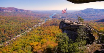
Chimney Rock is one of North Carolina’s most majestic state parks offering spectacular views of the North Carolina Mountains as well as Lake Lure. Chimney Rock’s 75-mile views of Hickory Nut Gorge and Lake Lure attract visitors the world over seeking that perfect picture in the mountains.

Chimney Rock

Chimney Rock’s numerous hiking trails and natural attractions offer the best of the mountains in one place. Hickory Nut Falls trail offers one of the highest waterfalls in the eastern half of the United States with its 404 foot falls. Hickory Nut Falls was so thought of that filmmakers from the movie The Last of the Mohicans staring Daniel Day-Lewis filmed the movie’s epic fight scene at the falls.

The park also offers a number of amenities including rock climbing instruction, a gift shop and numerous events including bird walks, dulcimer workshops, homeschool programs, and much more. In more recent years they’ve even helped provide the setting for a number of outdoor weddings at the Hickory Nut Falls and atop Chimney Rock.

Chimney RockPlan on getting to the top of Chimney Rock? It’s a three-mile drive up a winding road to a large parking area and an elevator ride to the top. Or just do what most choose to do and climb 500 steps to Chimney Rock.

Want to throw your boots on and give it your all on some of the park’s hiking trails? Check out these three great hikes:

Hickory Nut Falls Trail: An “easy” trail, hike the path to the bottom of the 404-foot Hickory Nut Falls waterfall. It’s a 1.5-mile roundtrip in a forest setting with a handful of inclined hikes. Good for hikers seeking wildflower opportunities, birding and rhododendron. A great summer hike that leads to a cool falls.

The Outcroppings: Follow this network of stairs from the parking area to the Chimney. Along the way, check out the views from Vista Point. Strenuous with 500 steps, but all ages and fitness levels can enjoy the challenge with many places to stop along the way.
Skyline Trail: At the staircase leading up to the Chimney, find the beginning of the Skyline Trail. After climbing quite a few stairs, the trail levels out as you walk along the cliff with dramatic views. Stop at the Opera Box for great views of the Chimney and Lake Lure and continue up to see the Devil’s Head and end at Exclamation Point, the highest elevation at Chimney Rock, for breathtaking views.

Four Seasons Trail: Get your heart pumping on this short trail with a 400-foot elevation gain. The trail winds through hardwood forest, rhododendron and mountain laurel thickets and abundant wildflowers as well as rare and indigenous plants, some species not found along the Park’s other trails.

Great Woodland Adventure: This whimsical trail is perfect for kids and kids-at-heart. Twelve discovery stations along the ½ mile loop give a peak into the lives of the many animals that call the Park home. All sculptures were handcrafted by Western North Carolina artisans.