Chipmunks

When you walk trails in the lower elevations of the Great Smoky Mountains National Park you are bound to see Chipmunks.  These furry, striped members of the squirrel family have fascinated people for thousands of years with their antics as the frisk about the Smoky Mountains.  The term chipmunk comes  from the Odawa word Ajidamoo which translates to “one who descends trees headlong.” This of course is a reference to the fact that chipmunks are adept enough at climbing that the come down the tree the same way the go up: face first.

Animalia – Chordata – Mammalia – Rodentia – Sciuridae – Marmotini – Tamias – Striatus

Behavior and Diet
Chipmunks live, primarily, in deciduous wooded areas.  This is especially true of the GSMNP where the chipmunk can range across all the lower elevations of the park.  In the Smokies, no bulb, nut, fruit, seed, green plant, insect or bird egg is safe from these voracious eaters.   During the day, the chipmunk spends almost all of its waking hours foraging for food.  Running from tree to tree and digging in the soft soil looking for food.  The chipmunk will store the food it finds in its cheeks and then eat it at a later time.

Though you will see the chipmunk racing from tree to tree in the National Park, they actually make their homes in burrows in the ground.  These burrows are lined with small rocks and other detritus that the chipmunk finds to make it more difficult for predators to see.  The live alone until mating season.  After mating the female will have litters of 3 to 5 young.  Chipmunks have two mating seasons a year and during the mating season you will hear them chattering to each other throughout the forest.

The chipmunk has many natural predators in the Smokies:  foxes, raccoon, weasels, snakes, hawks and other birds of prey all keep an eye out for the unguarded chipmunk as a quick source of protein.  The chipmunk uses its speed and ability to climb to stay out of the reach of the various enemies that it has in the park.

Where to Find Chipmunks

Again, the best place to find a chipmunk is in the lower elevations of the park.  At dawn and dusk, you will see them scurrying from their burrows looking for food.   But, throughout the day you will find chipmunks out, looking for food.  They always seem to be on a mission and they are skittish creatures. If you happen to see one, stay back and enjoy the show as they scurry from point to point along the trail.  You will also see chipmunks in the picnic areas of the National Park.  And though they would be happy to take food from you, remember that feeding animals in the GSMNP is strictly prohibited and bad for the animals.

Parsons Branch Road

Parsons Branch Road

Have you ever wondered where the two roads that branch out of Cades Cove go? Here is where you can find these two roads in Cades Cove:

  1. Rich Mountain Road – Before the halfway point around Cades Cove, and the entrance is across from the Cades Cove Missionary Baptist Church.
  2. Parsons Branch Road – At the halfway point around the loop road, at the same intersection that takes you into the Cades Cove Visitors Center.

Parsons Branch is another one way road out of Cades Cove.  When you get to the intersection next to the visitors center inside Cades Cove, if you drive straight across, you will start your path to Parsons Branch.  With this being one way, there are a few things that you need to think about.

  • You are on a rural / primitive road.  Dirt and gravel are the building materials and you will be on it for 8 miles.
  • You are also on a one way road, so don’t think you can just turn around if the going gets rough.
  • The other end of this road – the portion that is not in Cades Cove – drops you out onto US 129 on a portion known as the Dragon.  The Dragon may be the twisty-est road in the south-eastern United States and is a destination for drivers seeking a true driving experience.

Parsons Branch RoadNow that you have made the decision to take Parsons Branch Road, let me tell you what to expect along the way.  You are not going to run into a lot of traffic and with it being a one way road you are not going to encounter ANY oncoming traffic at all.  This rough, bumpy road is going to take you past beautiful scenes of the mountains that are not seen by the weak of heart.  You will follow a stream that runs along the road and you will explore terrain that you may never have been to before.  With a couple of stream crossings you might find that your spirit of exploration has been ignited by an 8 mile journey into the woods toward a road called the Dragon.

Newfound Gap Road

Sugarlands to Oconoluftee

Newfound Gap RoadThe 33-mile drive from Gatlinburg, Tennessee to Cherokee, North Carolina along Newfound Gap Road (US 441) is the only route that completely traverses the Great Smokies National Park (GSMNP). The drive offers a unique opportunity to enjoy an abbreviated experience of everything the Park has to offer, without necessarily trekking far from your automobile. The drive takes about one hour, depending on traffic. The experience can take several hours if you stop at each of the suggested points of interest. June through August and the month of October are the busiest months of the tourist season, and you can spend a lot of time looking at a bumper in front of you. You shouldn’t let the congestion discourage you from the experience, however. Quiet walkways, unforgettable views of the various peaks in the Smokies, a vast variety of trees, flowers, and wildlife; campgrounds, picnic areas–they all await you on this wonderful journey.

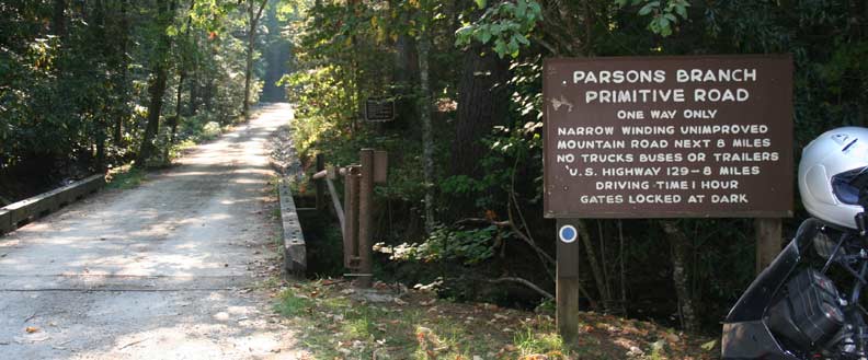
Let’s begin our drive from Gatlinburg and go less than a mile to the Sugarlands Visitor Center. It’s worth the stop here to view the displays of the natural history of the Park, get an idea of what to expect on the drive, pick up reading material to accompany your trip; and ask the Park Rangers those questions you always wanted to ask.  As you leave the Sugarlands Visitor Center you turn onto Newfound Gap Road. The road takes its name from a discovery in the 1850s that Indian Gap, once believed to be the lowest point through the mountains, actually was not the lowest point–hence the name Newfound Gap.

Newfound Gap Road
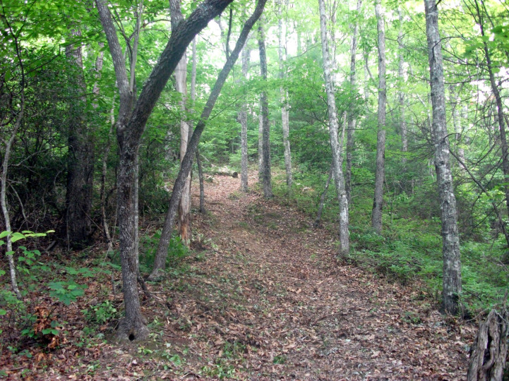
At approximately the 1 and 2 mile points from Gatlinburg, you begin to see small signs indicating “quiet walkways”. These walkways, while you are still in Sugarlands Valley, offer wonderful opportunities to view Fall color. The valley takes its name from the multitude of sugar maples in the area. As you move away from your vehicle down these quiet paths you become surrounded by sugar maples, resplendent with color.

As you continue along Newfound Gap Road, a little over two miles you will come upon the Campbell Overlook, which offers arguably the best vistas in the Park. Mt. LeConte rises to 6,593 feet in front of you–the third largest peak in the Smokies. The overlook is named for Carlos Campbell, who wrote Birth of A National Park (available at the Sugarlands Visitor Center). Campbell was a devoted outdoorsman and was a devout supporter for the establishment of the Great Smokies National Park.

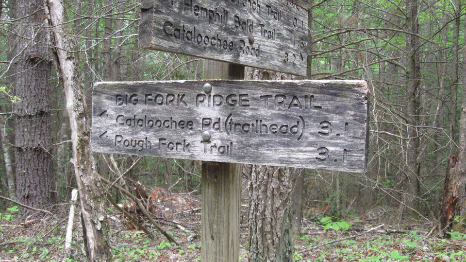
As you continue along US 441, you approach the Chimney Tops at the 4.5 mile mark. Here you will find the Chimney Tops picnic area which is home to one of the few remaining stands of mature cove hardwoods in the U.S. The Little Pigeon River runs through the picnic area. White settlers named the Chimney Tops after stone chimneys which, if you use a little imagination, resemble the peaks. This area, and many of the higher regions of the Smokies, were once owned by paper and lumber companies, which highly prized the spruce fibers growing there for making quality paper.

At about the 7-mile point you will come upon two tunnels. They exhibit the beautiful stone work found throughout the Park–work that was accomplished in the 1930s by the Civilian Conservation Corps (CCC) established by President Franklin D. Roosevelt. The second tunnel, a switchback referred to as “the loop”, curves around and back over itself. This feature was added to alleviate the extreme slope of the mountain.

Around the 9-mile point you will find the Alum Cave Bluffs parking area and trailhead. The hike is moderately challenging. You climb 2.3 miles to the cave bluff and then continue another 2.7 miles on to LeConte Lodge. The Appalachian Trail lies not far beyond the lodge.  At approximately the 13-mile point you find the Morton Overlook. From here you can look back and see the Little Pigeon River and Newfound Gap Road area you just left. To your left is Sugarland Mountain, Mount Mingus, and the Chimney Tops.

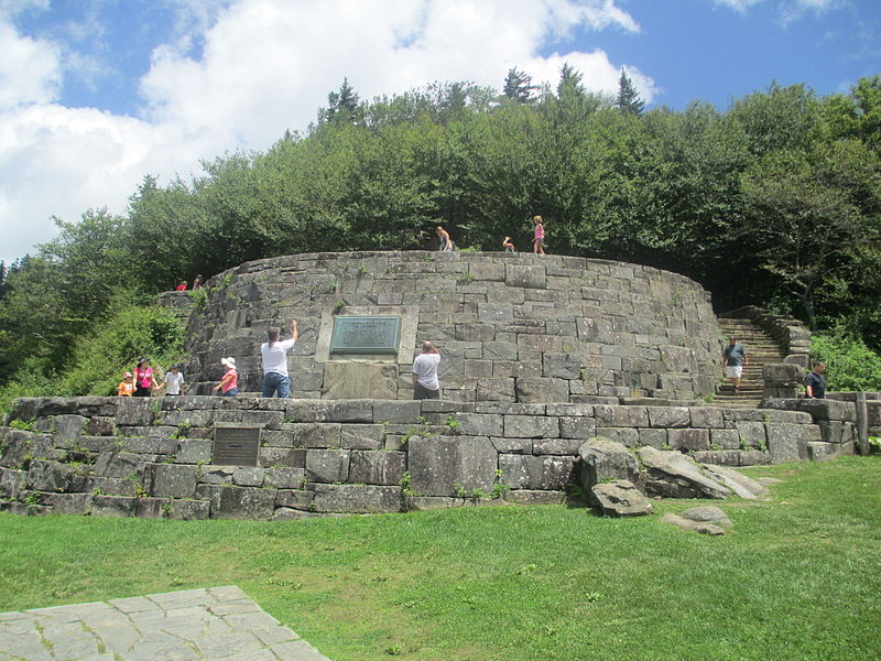
Three-quarters of a mile beyond the Morton Overlook you come to Newfound Gap itself. You are at 5,048 feet and can enjoy views to both the Tennessee and North Carolina sides of the ridge. Here you find the State Line Ridge, which serves as the spine for the entire distance of the Park, and it also comprises the sixty-nine miles of the Appalachian Trail in the Park. If you want to tell people you walked on the Appalachian Trail, you can traverse a short distance of it here before returning to your vehicle.  Here you will also find the Rockefeller Memorial, which lies half in Tennessee and half in North Carolina. It memorializes the support and $5 million donated by the Rockefeller family to help establish the Park, which was dedicated here by President Franklin D. Roosevelt in 1940.

Just beyond Newfound Gap and State Line Ridge, you will come to Clingmans Dome Road, which takes you to the Clingmans Dome parking area. You hike the last half-mile and climb the 45-foot observation tower, the highest point in the Park and in Tennessee. On a clear day, it’s said you can see seven states. After you leave Clingmans Dome and continue down Newfound Gap Road toward Cherokee, you will travel approximately one-half mile to the Oconoluftee Valley Overlook, affording you spectacular views of the Oconoluftee River Valley. As you look to where the valley falls away, you can see where you will follow the road downward to Cherokee, North Carolina.

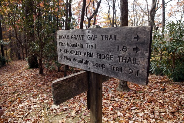
Continuing on, you will approach several quiet walkways and overlooks in the next two miles. Most notable is the Webb Overlook, named for Senator Charles Webb of North Carolina, another staunch supporter of the Park’s establishment.  At the 18.5 mile point is one of the most interesting walkways–certainly in North Carolina. Shortly after entering the walkway, the trail splits. The left fork parallels the Oconoluftee River, and the right fork follows the path of the old Newfound Gap Road.

One-half mile further you approach Smokemont Campground. Once a lumber company town sustaining a school, church, store and boarding houses, it now consists of 140 campsites.

The next, and final, stop on Newfound Gap Road in the Park is the Oconoluftee Visitor Center. Here, as at the Sugarlands visitor Center, information about the Park can be obtained. A bookstore and exhibits, as well as an on-duty Park Ranger, can provide information about the Park and the people who once lived here. Next to the visitor center is the Mountain Farm Museum, which is comprised of pioneer buildings moved from throughout the Park and permanently preserved here.

Jenkins Ridge Trail

You’ll start out right smack dab on the border of Tennessee and North Carolina if you’re upcoming hiking plans call for a trip along the Jenkins Ridge Trail in the Great Smoky Mountains. It’s an 8.9 mile trek to be specific, and not for the novice hiker either.

The starting point for the Jenkins Ridge Trail is at a place called Spence Field where it meets the Appalachian Trail. It ends at the junction of the Hazel Creek Trail and backcountry campsite No. 84. It’s a wonderful trail to take in some of the Smokies’ most majestic views.

As mentioned, the Jenkins Ridge Trail begins high up in the Smokies at Spence Field. Traveling south, the Jenkins Ridge Trail leaves the Appalachian Trail at 0.6 mile into the hike. This is prime blueberry area too, so take notice as you start out. This also means that this is bear and deer country. The blueberries are known to attract both creatures, especially during the month of September when the berries are at their most ripe.

Entering a hardwood forest, you’ll make a rock hop 1.8 miles in across Gunna Creek. The trail goes on to climb Blockhouse Mountain and after a slight descent makes its way back up Haw Gap 2.8 miles in. This is another area full of lush vegetation including blackberries, bee-balm, serviceberry and the like. Haw Gap itself lies between Blockhouse Mountain to the north and De Armond Bald to the south. Hiking along the ridgetop, you along pass along tributaries like Paw Paw Creek to the west.

Hikers reach Cherry Knob at 4.2 miles on the trail. From here the trail will start to drop off steeply through various hardwoods, then you’ll cross Woodward Knob and continue on the descent.

Pickens Gap is reached at mile 6.5 on the trail. From here, you’re hiking down a roadway to the Hazel Creek Trail. You’ll also pass the confluence of the Little Fork and Sugar Fork creeks about a mile from Pickens Gap. From the meeting with the Little Fork, about a quarter mile, you’ll notice a tub meal in the creek which at one time supplied corn meal to about 40 families living in the area.

Two miles from Pickens Gap you’ll notice a trail that leads up to the right, however light it may be, that leads to Higdon Cemetery. It’s about a quarter of the mile up the trail and contains around 20 graves. Moving on, you reach the junction with the Hazel Creek Trail at mile 8.9 and the end of the Jenkins Ridge Trail. Enjoy the rest of your time in the Smoky Mountains and happy hiking!

Hyatt Ridge Trail

As challenging as a 4.4-mile trail can be, the Hyatt Ridge Trail is for the most part a straight uphill hike on its way to backcountry campsite No. 44 in the Smoky Mountains.

To reach the Hyatt Ridge Trail, coming from the Oconoluftee entrance to the Great Smoky Mountains National Park, take Big Cove Road for 8 miles and continue when it becomes Straight Fork Road for about 2.5 miles. The trailhead will come up on the left.

Hikers start their climb along Hyatt Creek. This was area that was once heavily logged for the highly sought-after red spruce. These days it’s a mixed hardwood forest. The trail is rocky as you continue beside the stream before reaching the creek’s main outlet 1.2 miles in. At the points you do have to make a water crossing, most are easy hops along steady rocks.

At 1.8 miles the trail reaches a point called Low Gap, because it’s low. The trail’s junction with the Enloe Creek Trail is here. Meanwhile, Hyatt Ridge turns right and hikers ascend out of the gap. From here, the trail levels off for a bit.

Climbing to Hyatt Bald is a bit of a mystery as the so-call Bald is primarily wooded and grassy. You’ll pass the trail’s intersection with the Beech Gap Trail before continuing along the ridge on the Hyatt Ridge Trail.

Before long, you’ve hiked a hearty 4.4 miles and you notice a sign indicating the way to McGee Spring, or backcountry campsite No. 44. Enjoy the beauty of Smokies!

Indian Grave Gap Trail

A wildflower famous in and around the Great Smoky Mountains National Park, the flame azalea, is one of the highlights for people seeking out the Indian Grave Gap Trail – a 3.7 mile hike from Rich Mountain Road just outside Cades Cove to the junction of the Crooked Arm Ridge and the Scott Mountain trails…. And the views aren’t bad either.

As mentioned, to get to the trailhead take the Cades Cove Loop Road in Townsend, TN to Rich Mountain Road which is located right across Loop Road from the Cades Cove Missionary Baptist Church. From there it’s 2.2 miles up Cades Cove Mountain. You’ll also have to cross Tater Ridge and Branch, then the Indian Grave Gap Trail veers off the road to the right. At the trailhead there is a small parking area. And just so you know, Rich Mountain Road is usually closed from November-March.

Now, if you think that you’ll find a bunch of Indian Graves on the trail, fear not. No one really knows why it was named what it was, but there are no Indian Graves to be found. Only beautiful views of the Smokies.

However, numerous Indians did pass through these areas when the Cherokee outnumbered the European settlers, especially in the Cades Cove area. You’ll notice at the start of this trail there is a gate which which was used as access for jeeps at one time. You’ll make a moderate climb at the start of the trail before it descends to Indian Grave Gap. For the next mile, you’ll gain over 1,000 feet in elevation.

The next marking on the trail is the junction with the Rich Mountain Loop Trail. At that point you know you’re nearing the height of Tater Ridge and almost 1.1 miles on the trail. Take a look off to your right and you’ll see some great views of Cades Cove.

Continuing your climb, along this part of the hike you should notice the flame azalea’s and their bright orange blossoms that erupt in June and July. You’re now ascending Double Mountain which gets its name due to its twin peaks.

The Rich Mountain Trail is met at the 1.9 mile marker and to your left sits backcountry campsite No. 5 – about 100 yards from here. Ahead is Cerulean Knob, 0.3 mile further. The three-trail junction is reached at mile 3.7 and Crooked Arm will take hikers back down to Cades Cove. Happy hiking!


Fork Ridge Trail

Those of you outdoor enthusiasts looking for a downhill jaunt in the Smokies with a back-woodsy feel, look into the Fork Ridge Trail on the Tennessee side of the park. It’s a 5.1 mile hike from Clingmans Dome Road to the trail’s intersection with the Deep Creek Trail.

forkridgetrail1To reach the trailhead, travel along Newfound Gap Road in the park until you reach Clingmans Dome Road and travel 3.5 miles till you reach the trailhead parking area.

From its start, it’s a downhill hike through a number of Smoky Mountain tree species including fir and birch as you descend the Fork Ridge. You’ll notice ferns and rhododendron as you hike the first mile before hopping a stream and coming to a large opening which is full of native wildflowers in the spring.

A small stream is crossed again at the 2 mile mark on the trail. Spruce birch and maple can be seen near the trail at this point. The trail will level out for a bit before heading downhill again.

When you reach 4 miles in, a large dead American chestnut marks this point – said to have been dead for over 50 years and counting now. This is also a drier place on the trail which could possibly have something to do with it.

The Fork Ridge Trail will soon bend left into a more lush forest and hikers will get a good look at Noland Divide. Descending again, keep your eyes peeled for black bears. It’s said that this is a particularly popular place for them and their cubs as they make their way in search of food.

You’ll reach a knife ridge 5 miles on the trail ripe with flowering plants. Creeks now flow on both sides of the ridge and hikers come to a clearing. The sounds of Left Fork and Deep Creek can drown out the other sounds in the immediate area. In spring this isn’t a problem as one’s eyes are distracted by the beauty of the clearing’s wildflower display.

Deep Creek should be coming into view below as hikers finish off the last part of the Fork Ridge Trail. You’ll cross Deep Creek by a wide footbridge before connecting with the trail again on the other side. A left takes you back to Newfound Gap Road, a right takes the hiker to backcountry campsite No. 53 . Hope you enjoyed the Fork Ridge Trail and its Smoky Mountain wonders.

Chestnut Top Trail

If you know the Townsend “Y” is, then you’re halfway to hiking the Chestnut Top Trail in the Smoky Mountains. In all, it’s a 4.3 mile trail filled with Smoky Mountain wildflowers and a slew of great vistas and views of the Smokies that finishes at the Schoolhouse Gap Trail intersection.

The trailhead is located at the intersection of Little River Road and the Townsend, Tn entrance road. There are plenty of parking spots available along the road, as well as in a large parking lot near the “Y”.

Ask most people and they’ll say that the Chestnut Top Trail is best enjoyed in Spring when the wildflowers are in full bloom. Hikers can easily spot near 50 species if you’re so educated. But beware, poison ivy lurks in heavy amounts at spots along the beginnings the trail.

Hiking the trail, you’ll find a smooth slope once you reach 0.5 miles into the hike. You’ll also notice that the forest becomes heavily covered by pines and oaks.

As the trail climbs Chestnut Ridge, you’re met by a set of switchbacks a mile in. Atop the ridge, you’re welcomed by the sight of Thunderhead Mountain and the crest of the Smokies – the highest on the western end of the national park.

At mile 2.8, hikers reach the highest peak of the trail before descending to Bryant Gap. If you look out to the right of the trail, you get a great shot Townsend, to the left is the park.

As the trail moves on it levels out until you reach the Schoolhouse Gap junction. To the left, the trail leads 2 miles to Laurel Creek Road which splits Cades Cove and Townsend.

Bote Mountain Trail

The 6.9 mile Bote Mountain Trail will challenge even the most experienced of hikers among you.

This somewhat rocky hike is accessed via Laurel Creek Road, which is 3.5 miles from the Townsend “Y”. Hikers can park at the Schoolhouse Gap trailhead, nearly 250 years past the Bote Mountain trailhead going toward Cades Cove in Townsend, Tn.

History surrounds the Bote Mountain Trail as during the 1800’s, James Spence tended the Cades Cove farmer’s cattle in a majestic meadow that became known as Spence Field. Hiking the Bote Mountain trail to Spence Field affords the hiker intermittently rocky terrain and rhododendron covered footpaths.

The trail ascends for 1.2 miles before meeting with the junction of the West Prong Trail. Soon you’ll come across another meeting place, this time with the Finley Cane Trail. This is where the climb up Bote Mountain really starts. The sounds of the West Prong accompany the hiker up the flanks of the mountain.

You can almost see James Spence and the Cades Cove farmer’s cattle he tended climbing the slopes as you head up the Bote Mountain Trail. In those days, as it would now, it must have been a difficult climb. It was the grass at the higher elevations that made the effort to push the cattle to such heights worthwhile. It’s said that the high mountain grass was better for the cattle than that found on the Cades Cove valley floor and the considerable reduction in heat and flies in the higher altitudes made for a much more comfortable grazing experience.

Once the peak of Bote Mountain is reached, notice the views of Thunderhead and Defeat ridge. It could be argued that these are a few of the best vistas in the Smokies. From here to the junction with the Lead Cove Trail, the views are breathtaking.

The Anthony Creek Trail joins the hiker at mile 5.2 and descends 3.6 miles to the Cades Cove Picnic Area. Hike on to Spence Field where you’ll come to the junction with the Appalachian Trail and you’ve now fully experienced the Bote Mountain Trail.

Numerous visitors who have hiked the Bote Mountain trail have come to look upon people like James Spence as a very lucky man. His was a life spent overlooking Cades Cove from his mountain paradise. Through its view alone, the Bote Mountain trail is one of the most rewarding to originate in Cades Cove and the entire Smoky Mountains.

Enloe Creek Trail

If you like smaller, more picturesque waterfall made by a Smoky Mountain stream, you’ll love the opportunities afforded to hikers along the Enloe Creek Trail. It’s a 3.6 mile trail from the Hyatt Ridge to the Hughes Ridge Trail, though it can be muddy in places.

To reach Enloe Creek, hike 1.8 miles on the Hyatt Ridge Trail from the Straight Fork Road trailhead – that’s the simplest and easiest route.ect1The part of the park was virtually untouched by the logging companies that plundered the area before it was deemed a national park. Therefore, it’s traveled by many including horses that have torn through the trail at some points. Regardless, the waterfalls produced by Raven Fork and Enloe Creek are worth the hike on its own, separate from the virgin growth forest.

From its beginning, the trail descends immediately into Raven Fork Gorge. A rock outcrop is passed 0.5 miles into the trail and you’ll pass several cascades before reaching Raven Fork a mile in. It’s a large, loud stream, but it does not have a trail that parallels it.

Across the steel bridge on Raven Fork is backcountry campsite No. 47. It’s small and most of the time wet and muddy, but some still brave it out to camp and hear the roar of the stream.

Back on the trail, several more cascades are noticed and passed, some that are blocked by the summer plants that line the forest floor. You’ll cross Enloe Creek by a foot log at mile 2 on the trail.

Climbing the trail, hikers will get a great view of Katalsta Ridge at 2.5 miles. It’s named in honor of a late Cherokee Indian chief’s daughter.

Switchbacks are prevalent before reaching the 3.4 mile mark and entering an open forest. You’ll reach the Hughes Ridge Trail intersection and the conclusion of the Enloe Creek Trail at mile 3.6. Happy hiking!