As challenging as a 4.4-mile trail can be, the Hyatt Ridge Trail is for the most part a straight uphill hike on its way to backcountry campsite No. 44 in the Smoky Mountains.
To reach the Hyatt Ridge Trail, coming from the Oconoluftee entrance to the Great Smoky Mountains National Park, take Big Cove Road for 8 miles and continue when it becomes Straight Fork Road for about 2.5 miles. The trailhead will come up on the left.
Hikers start their climb along Hyatt Creek. This was area that was once heavily logged for the highly sought-after red spruce. These days it’s a mixed hardwood forest. The trail is rocky as you continue beside the stream before reaching the creek’s main outlet 1.2 miles in. At the points you do have to make a water crossing, most are easy hops along steady rocks.
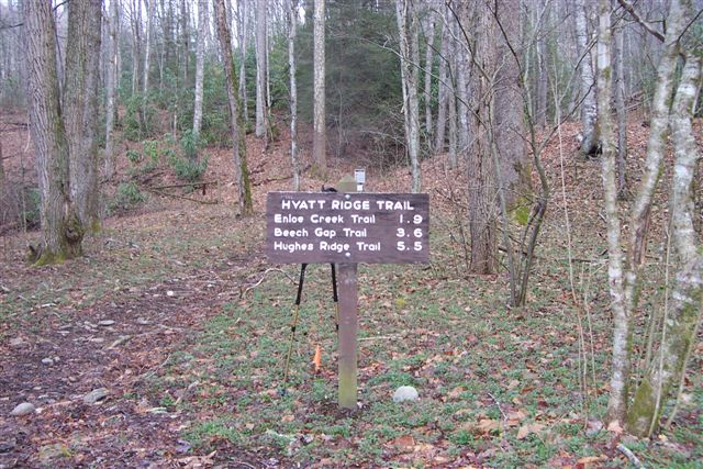
At 1.8 miles the trail reaches a point called Low Gap, because it’s low. The trail’s junction with the Enloe Creek Trail is here. Meanwhile, Hyatt Ridge turns right and hikers ascend out of the gap. From here, the trail levels off for a bit.
Climbing to Hyatt Bald is a bit of a mystery as the so-call Bald is primarily wooded and grassy. You’ll pass the trail’s intersection with the Beech Gap Trail before continuing along the ridge on the Hyatt Ridge Trail.
Before long, you’ve hiked a hearty 4.4 miles and you notice a sign indicating the way to McGee Spring, or backcountry campsite No. 44. Enjoy the beauty of Smokies!
Hyatt ridge trail is not a real thing. We drove way out there and it was in Sketchtown with inbreds. DO NOT GO THERE.
sincerely,
concerned citizen.