Big Fork Ridge Trail

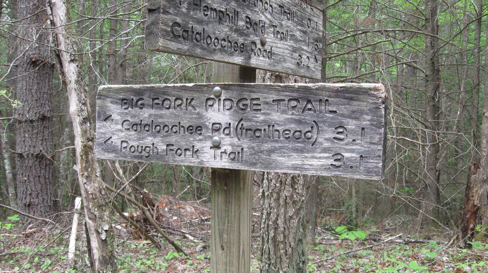
At 3.2 miles in length the Big Fork Ridge Trail is an easy jaunt for new hikers and a great day hike for those of you who want to get out and see the majestic splendor of the Great Smoky Mountains National Park.

From Interstate 40 in North Carolina, take exit 20 – NC Hwy. 276, to Cove Creek Road traveling west. You’ll follow it to Cataloochee Road, past the campground and ranger station before reaching the trailhead 0.8 miles down Rough Fork Road on the left.

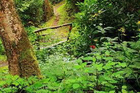
Who would’ve known that this trail travels over the Big Fork Ridge? Crazy, right? At 0.8 miles into the trail, you’ll pass the Rough Fork by foot log, then be spit out into an open field. The trail leads across the field to a red maple forest – a wonderful sight during the fall months. You’ll start climbing soon after and at the 1 mile mark you’ll bend tot he right on a slope that really gets its share of sun during good weather. the trail and the ridge levels and if you’ll notice, you can hear the Rough Fork below.

You’ve reached the summit of Big Fork Ridge at the 1.8 mile marker. There are two horse hitches here so if you’re on horseback, hop off and enjoy the view! You’ll proceed down the southside as the trail continues down the ridge. It’s a sassafras and mountain laurel haven in this dry ecosystem.

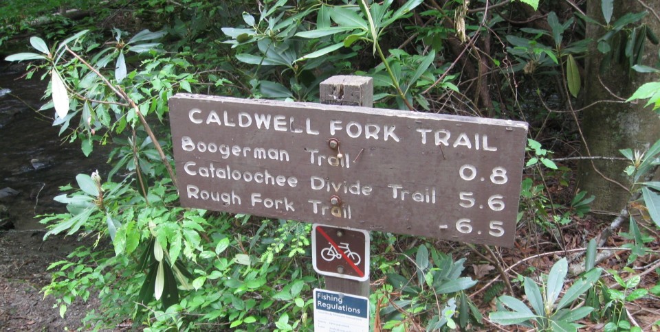
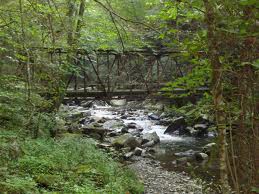
Notice the views from the northern end of the Caldwell Fork Valley. At 3.1 miles, the trail crosses Caldwell Fork by footbridge before reaching the finale of the Big Fork Ridge Trail at its junction with the Caldwell Fork Trail. Happy hiking!

Dry Sluice Gap Trail

Hiking the Dry Sluice Gap Trail is a great way to spend a nice day in the park and just outside Gatlinburg, Tn. The trail is a most downhill hike for 4.2 miles from its junction with the Appalachian Trail to the Cabin Flats Trail.

drysluice
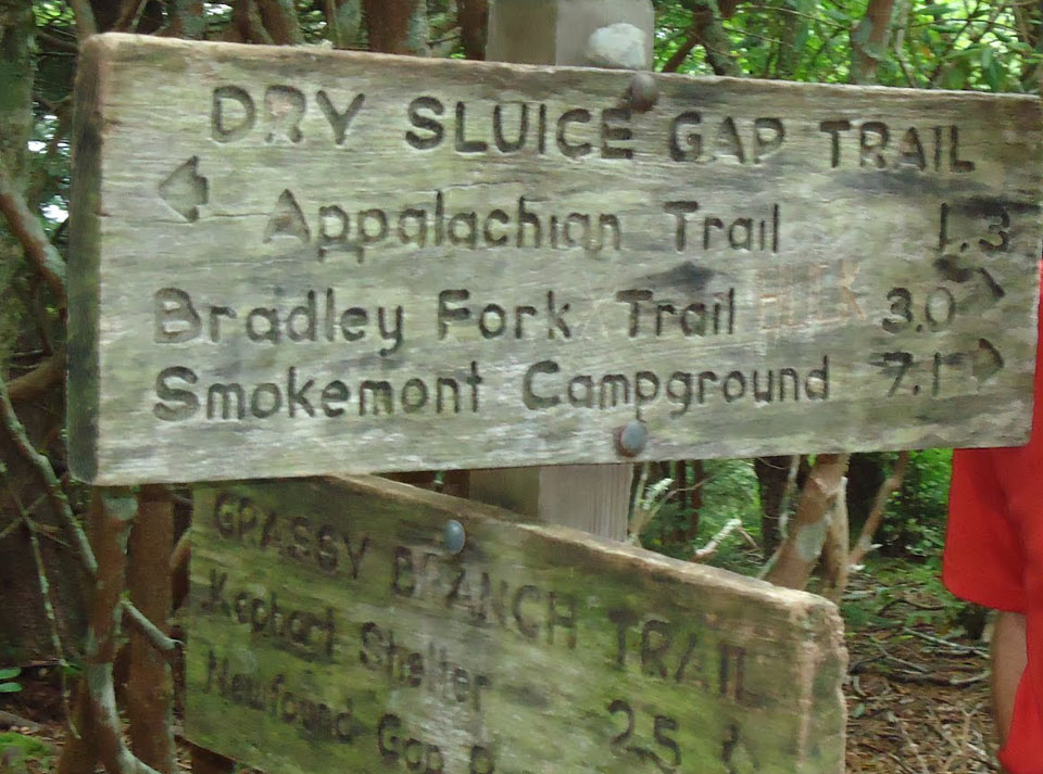
Starting out at Newfound Gap, you’ll hike a good 4.4 miles before reaching trail by way of the AT north east past Icewater Springs.

Dry Sluice is another one of the connector trails in the Smokies that is more known for getting hikers from one place to another rather than its actual hiking qualities. Its claim to fame is as a connector for the Appalachian Trail and Smokemont Campground. It was said that this trail was used as a shortcut years ago by early settlers hauling goods to and from homesteads.

At the trail’s beginnings, a large open spot can yield some wondrous views and blueberries, balckberries, and huckleberries in August. The junction with the Grassy Branch Trail awaits the hiker at mile 1.3. From here, you’ll hike to the left of the Richland Mountain ridge.

The trail will continue to descend, get rockier and pass a slew of wildflower species, oaks and evergreens. You’ll rock hop along the Tennessee Branch and continue down the trail passing more ferns and ground cover.

You’ll cross a log bridge with a hand rail across the Tennessee Branch as it appears again. At mile 4.2, the trail sign appears and it’s 0.6 miles to backcountry campsite No. 49.

Flat Creek Trail

For all you North Carolina Smokies hikers, here’s a quick trail on your side that even sounds inviting: the Flat Creek Trail. In all, it’s a 2.6 mile hike from the Heintooga picnic area to Heintooga Ridge Road.

flatcreektrail1
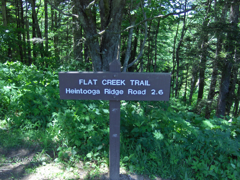
There are some great sights and lookouts along the way as well as a few stream crossings that are said to contain native brook trout along this trail, just off the Blue Ridge Parkway and past the Balsam Mountain Campground.

You’ll find overgrown grass along this trail even through the shade and overgrowth of the forest, evidence of the early logging efforts that cut through a great deal of this section of the park before it was a park.

At mile 0.5, the trail descends to Flat Creek and the forest overcomes everything sight. Rhododendron, moss, and mushrooms are aplenty in this well-watered area.

Keeping on the trail, a foot log and a number of stream crossings take the hiker away from Flat Creek and along the ridge to Bunches Creek. You can even see the Flat Creek valley from wince you came at various points . Bunches Creek is passed by foot bridge twice before coming to the end of this Smoky Mountain trail and another successful jaunt on the North Carolina side of the national park.

Boogerman Trail

The Boogerman Trail Hike, first and foremost, takes you away from the traffic and population of the Tennessee side of the Great Smoky Mountains National Park. It takes a bit of trouble to get to Cataloochee (see the directions on the map below), but I’ll bet my last dollar you’ll enjoy the Cataloochee area—and you’ll be back.

The Boogerman Trail is named for Robert “Boogerman” Palmer, whose homesite you’ll pass as you complete this moderately challenging 7-mile loop trail, which can take between 2 and 3 hours to complete. You will gain nearly 850 feet on your way to 3,600 feet at the trail’s highest point.

The trail is well maintained and this hike offers up views of some of the largest trees in the area, old homesites (including Palmer’s) and mountain streams. This area was spared from the logging operations which dominated much of the Smokies area before the land was purchased for the Park.

After following the directions from I-40, NC 276, and Cove Creek Road, navigate your way to the Caldwell Fork Trail (follow the signs). Cross Cataloochee Creek on a footbridge and you’ll enter a stand of white pines. When the trail splits, stay right and climb a narrow edge along Caldwell Fork. You’ll cross Caldwell Fork on a footbridge and enter an area of old-growth trees. You will pass through a gap, and traverse an area dominated by white pines. At mile 2.8, you will encounter the Palmer (Boogerman) homesite.

At mile 3.8 of your loop, the trail turns down to the right alongside Snake Branch, around a rock wall, and across a small stream. Here you will see some clearings, old fence posts and piles of stone, which indicate where homesites previously existed near the creek.

Nearing the five-mile point you will cross Snake Branch , and in an area of towering hemlocks you will begin crossing Caldwell Fork several times via log footbridges. The stream offers up picturesque views of both quiet, deep pools and noisy falls. Several hundred yards before crossing Cataloochee Creek at approximately mile 7.4–and completion of the loop–you will see the remains of a cabin and barn built by Carson Messer.

The Cataloochee area can be described as North Carolina‘s answer to Cades Cove. Though the old homesteads are not preserved as well as those in Cades Cove, the remains, combined with the overpowering beauty of the area, give you a good sense and feel for those old times when things were simpler. The “Boogerman” Trail hike was a great way to introduce myself to the Cataloochee area, and I came away feeling stronger and more fulfilled than when I arrived.

If your trek to Alum Cave Bluff is a day-hike, take a knapsack and carry a few extra items. Include some bottled water and a snack. Never drink the water from a Park stream without boiling it first. Though the streams in the park are invitingly cool and deceptively clear, they contain bacteria that can wreck your trip and a substantial period thereafter, if you succumb to the temptation to drink from them. You might even include a camera in your knapsack too. If you are making an overnight trip to LeConte Lodge, you’ll be carrying a backpack, and we assume here that you have included all the necessary items and arranged for the required reservation at the lodge. A backcountry permit is required for overnight stays in the backcountry. Certain campsites are reserved in advance. Permits are available at visitors centers or by calling (865) 436-1231.

Bradley Fork Trail

The Bradley Fork Trail makes for quite a climb along its 7.3 mile ascent. To get to the trailhead, locates at Smokemont Campground, take Newfound Gap Road to the campground and begin at the far end of D loop.

You’re bound to see a number of picturesque creeks along this hike as it winds along with the Oconoluftee River. The first 4 miles are an easy rising grade as you get used to the land before rising sharply up Hughes Ridge for 3.3 miles. Notice that there is a bridge at every creek crossing

At 1.1 miles in hikers will come upon a wooden bridge before reaching the junction with Chasteen Creek Trail at 1.2 miles. Campsite No. 50 comes upon the trail soon thereafter – one of the easier sites to reach in the Smokies.

Smokemont Loop Trail is reached is bit further down the trail. If you decide to loop it out here, it’s a total of 5.5 miles before returning 3.9 miles on a strenuous route back to the Smokemont Campground.

Continuing on the Bradley Fork Trail, the forest shows ferns before you notice large sycamores and tuliptrees. A horserail comes up on the right before coming to another open section of the trail. Two bridges cross Bradley Fork where it splits and forms an island.

At the 4 mile mark, you come to a “No Camping” sign. You’ll start the climb to Hughes Ridge here – 3.3 miles away. At the trail’s junction with the Hughes Ridge Trail, you are but 2.2 miles from the Appalachian Trail and 7.3 miles from Smokemont.

Gold Mine Trail

Not to be confused with the “Goldmine Trail,” another Smoky Mountain path on the North Carolina side of the Smokies, the Gold Mine Trail lies on the Tennessee side and is more of a connector-type trail from the Cooper Road Trail to the park boundary.

Hikers will start out at the junction with the Cooper Road Trail, which is 2.5 miles from the Abrams Creek Campground. This trail is essentially what remains of an old track between Montvale Springs and Cooper Road. It’s named for a mine found in the mountain, but for what gold it did yield wasn’t enough to cover mining costs. You’ll run by an old log cabin site on the trail as you ascend through a mix of hardwood trees and rhododendron.

The trail shows a bit of a climb and at 0.8 miles you reach the park boundary. You can also see newer construction at this point as developers have chosen to get up as close to the park as humanly possible over the years in order to make their homes more desirable to buyers.

Cane Creek Trail

To get right to the point, the Cane Creek trail is one of the easiest Smoky Mountain trails to hike, it’s just getting there that takes some effort. To reach the Cane Creek Trail, hikers must  hike part way up the Cooper Road Trail.

In all, the Cane Creek Trail is only 2.1 miles long from its starting point at Cooper Road Trail at Cane Gap to the park boundary. Highlights include the Buchanan family land that was once beautiful farmland, the Buchanan family cemetery, and a very pleasant, lightly used campsite (backcountry campsite No. 2) at Cane Creek.

Starting out about 3.7 miles above the Abrams Creek Ranger Station, you’ll go left at the split and hike to the Cane Creek bottoms. Just a warning, you may be wading the creek in times of heavy rain.

Eastern hemlock and mixed hardwoods mark the old fields before you come upon campsite No.2 at 0.6 miles into the hike. From here, the trail immediately crosses Cane Creek and will again twice.

The Buchanan family cemetery comes up at mile 1.3 on the trail, sitting on a rise under two large maples. The Buchanans lived off the land during those times and farmed corn as their main crop.

Continuing on, the path narrows until you reach the park boundary at 2.1 miles.

Gregory Bald Trail

gbt1Looking for another way to access the Appalachian Trail as well as a pretty good warm up? Look no further than the Gregory Bald Trail. It’s 7.3 miles from its junction with the Parson Branch Road intersection to its junction with the Appalachian Trail at Doe Knob.

Of course, the other reason to hike this trail is to take in Gregory Bald – one of the more famous spots in the Smoky Mountains.

To get you started, you’ll have to make your way to Cades Cove and drive its Loop Road. Once you reach the visitor center and Cable Mill area, turn off and follow the signs to Parson Branch Road.

You’ll gradually ascend the trail as you start out. Notice the pines as you walk along. You”l eventually reach Panther Gap, named for Panther Creek whose headwaters form along the path.

Backcountry campsite No. 14 is reached at 4.1 miles on the trail. It’s lush grass provides for a great camping spot and water can be found about 200 yards prior to reaching the campsite. Just be sure to treat the water before drinking it. You’ll also notice the trail sign and the original AT crossing that passed over Gregory and Parsons Bald until 1948. The rest of the trail walks right along with the old Appalachian Trail.

A quick, steep climb is had before you reach Gregory Bald at 4.5 miles in. People flock here in June to get a glimpse of the azaleas. Not only that, but the blueberries that sprout in August brings hikers from all walks of life and locations.

Once you’ve had your fill of the remarkable vistas and views of Gregory Bald, the trail descends to Rich Gap, 5.2 miles in. From Rich Gap it’s an eastward hike along the trail till you reach Long Hungry Ridge’s northward peak. Swinging south, you’ll continue on to the knob on the North Carolina side of the Smokies leading to Brier Lick Gap. You’re on your way to reaching the junction with the new version of the Appalachian Trail and you can tell your friends that you’ve been to and taken in one of the most majestic and picturesque spots in all of the Smoky Mountains: Gregory Bald. Enjoy the AT!

Jenkins Ridge Trail

You’ll start out right smack dab on the border of Tennessee and North Carolina if you’re upcoming hiking plans call for a trip along the Jenkins Ridge Trail in the Great Smoky Mountains. It’s an 8.9 mile trek to be specific, and not for the novice hiker either.

The starting point for the Jenkins Ridge Trail is at a place called Spence Field where it meets the Appalachian Trail. It ends at the junction of the Hazel Creek Trail and backcountry campsite No. 84. It’s a wonderful trail to take in some of the Smokies’ most majestic views.

As mentioned, the Jenkins Ridge Trail begins high up in the Smokies at Spence Field. Traveling south, the Jenkins Ridge Trail leaves the Appalachian Trail at 0.6 mile into the hike. This is prime blueberry area too, so take notice as you start out. This also means that this is bear and deer country. The blueberries are known to attract both creatures, especially during the month of September when the berries are at their most ripe.

Entering a hardwood forest, you’ll make a rock hop 1.8 miles in across Gunna Creek. The trail goes on to climb Blockhouse Mountain and after a slight descent makes its way back up Haw Gap 2.8 miles in. This is another area full of lush vegetation including blackberries, bee-balm, serviceberry and the like. Haw Gap itself lies between Blockhouse Mountain to the north and De Armond Bald to the south. Hiking along the ridgetop, you along pass along tributaries like Paw Paw Creek to the west.

Hikers reach Cherry Knob at 4.2 miles on the trail. From here the trail will start to drop off steeply through various hardwoods, then you’ll cross Woodward Knob and continue on the descent.

Pickens Gap is reached at mile 6.5 on the trail. From here, you’re hiking down a roadway to the Hazel Creek Trail. You’ll also pass the confluence of the Little Fork and Sugar Fork creeks about a mile from Pickens Gap. From the meeting with the Little Fork, about a quarter mile, you’ll notice a tub meal in the creek which at one time supplied corn meal to about 40 families living in the area.

Two miles from Pickens Gap you’ll notice a trail that leads up to the right, however light it may be, that leads to Higdon Cemetery. It’s about a quarter of the mile up the trail and contains around 20 graves. Moving on, you reach the junction with the Hazel Creek Trail at mile 8.9 and the end of the Jenkins Ridge Trail. Enjoy the rest of your time in the Smoky Mountains and happy hiking!

Hyatt Ridge Trail

As challenging as a 4.4-mile trail can be, the Hyatt Ridge Trail is for the most part a straight uphill hike on its way to backcountry campsite No. 44 in the Smoky Mountains.

To reach the Hyatt Ridge Trail, coming from the Oconoluftee entrance to the Great Smoky Mountains National Park, take Big Cove Road for 8 miles and continue when it becomes Straight Fork Road for about 2.5 miles. The trailhead will come up on the left.

Hikers start their climb along Hyatt Creek. This was area that was once heavily logged for the highly sought-after red spruce. These days it’s a mixed hardwood forest. The trail is rocky as you continue beside the stream before reaching the creek’s main outlet 1.2 miles in. At the points you do have to make a water crossing, most are easy hops along steady rocks.

At 1.8 miles the trail reaches a point called Low Gap, because it’s low. The trail’s junction with the Enloe Creek Trail is here. Meanwhile, Hyatt Ridge turns right and hikers ascend out of the gap. From here, the trail levels off for a bit.

Climbing to Hyatt Bald is a bit of a mystery as the so-call Bald is primarily wooded and grassy. You’ll pass the trail’s intersection with the Beech Gap Trail before continuing along the ridge on the Hyatt Ridge Trail.

Before long, you’ve hiked a hearty 4.4 miles and you notice a sign indicating the way to McGee Spring, or backcountry campsite No. 44. Enjoy the beauty of Smokies!