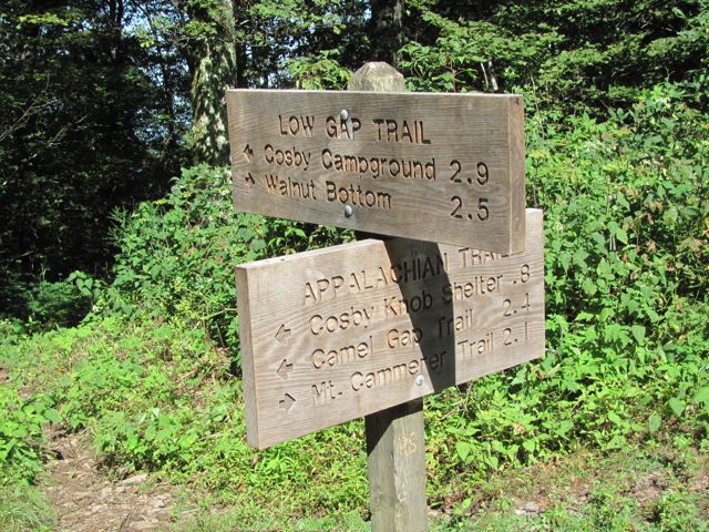
For 4.7 miles, the Camel Gap Trail takes the Smoky Mountain hiker on a gradual ascent up to its meeting with the Appalachian Trail. It’s a great little nature trail in the Smokies that begins at the Big Creek junction just past Walnut Bottom.
Once known as the Yellow Creek Trail, hikers beginning on the Camel Gap Trail come to the intersection with the Gunter Fork Trail at 0.6 miles before narrowing. The trail goes on following Big Creek before its final ascent to Camel Gap and the Appalachian Trail. It’s gradual climb is thanks in part to the numerous logging operations that took part here before it was designated for national park use.
As previously mentioned, the Camel Gap Trail is known throughout the region for its dramatic vistas and forest scenes, especially during the colorful fall months. Rocky Branch is soon crossed by the hiker and the trail afterwards runs parallel with the creek. If you pay close enough attention to some of the stream’s pools, you might catch a glimpse of the oh-so-sought-after Smoky Mountain trout.
You’ll reach a switchback at 2.8 miles on the trail as Yellow Creek merges with Big Creek and the trail begins to become steeper at this point. You might even be able to catch a peek of Balsam Mountain from the trail if you’re able to peer through the forest.
Once you’ve reached the Appalachian Trail, you decide to hike back or go on to the Snake Den Ridge Trail, Low Gap, or the Cosby Knob Shelter.
