Camel Gap Trail

For 4.7 miles, the Camel Gap Trail takes the Smoky Mountain hiker on a gradual ascent up to its meeting with the Appalachian Trail. It’s a great little nature trail in the Smokies that begins at the Big Creek junction just past Walnut Bottom.

Once known as the Yellow Creek Trail, hikers beginning on the Camel Gap Trail come to the intersection with the Gunter Fork Trail at 0.6 miles before narrowing. The trail goes on following Big Creek before its final ascent to Camel Gap and the Appalachian Trail. It’s gradual climb is thanks in part to the numerous logging operations that took part here before it was designated for national park use.

As previously mentioned, the Camel Gap Trail is known throughout the region for its dramatic vistas and forest scenes, especially during the colorful fall months. Rocky Branch is soon crossed by the hiker and the trail afterwards runs parallel with the creek. If you pay close enough attention to some of the stream’s pools, you might catch a glimpse of the oh-so-sought-after Smoky Mountain trout.

You’ll reach a switchback at 2.8 miles on the trail as Yellow Creek merges with Big Creek and the trail begins to become steeper at this point. You might even be able to catch a peek of Balsam Mountain from the trail if you’re able to peer through the forest.

Once you’ve reached the Appalachian Trail, you decide to hike back or go on to the Snake Den Ridge Trail, Low Gap, or the Cosby Knob Shelter.

Finley Cane Trail

finley2So you’ve tripped down to Townsend, Tn for a day to take a dip in the “Y” and do a little hiking afterward…. If you’re looking for a rather close trail that won’t leave you too tired after floating on the river all afternoon, try the Finley Cane Trail. It’s a 2.8 miler from its junction with Laurel Creek Road to its end at the intersection of the Bote Mountain Trail.

To reach the trailhead, it’s a 5.5 mile drive, or walk whichever, west of the Townsend “Y” toward Cades Cove. The trailhead can easily be passed up so keep your eyes peeled if you decide to drive. Parking is found along the road for this Smoky Mountain trail.

You’ll parallel the road to start out on the trail before descending on the path and crossing Sugar Cove Creek by way of stepping stones.

finley1Continuing on, the trail can be rather muddy at times before you cross another small spring branch and then begin the ascent up Bote Mountain. Rhododendron are especially prevalent here as well as other points on the trail as you’ll surely notice.

Laurel Cove Creek and Hickory Tree Branch are rock hopped soon thereafter. If you think that you’ve been hiking up and down, and up and down throughout the forest, you’re right. The same can be said for wet and dry portions of the trail. It’s a hike that contrasts to the extreme throughout.

Notice the various mushroom species that align the trail as well. The park contains a number of species and the Finley Cane Trail is as good a Smoky Mountain trail as any to observe them.

Actual cane will come into view on the last mile of the Finley Cane Trail – possibly one of the ways the trail got its name. It’s the only native relative to bamboo found in the national park.

There are a number of options once you’ve reached 2.8 miles and the Bote Mountain Trail. We’re sure you’ll find an option you like whether it be hiking on to Spence Field or hiking the West Prong. Either way, happy hiking and enjoy the Smokies!

Beard Cane Trail

The Beard Cane trail is a 4.2 mile Smoky Mountain trail named after a type of cane variety that grows in Cades Cove. It’s also one of the few relatively flat trails in Cades Cove.

To get started, put those boots on and get yourself to the Cooper Road Trail – 4.9 miles northeast of the Abrams Creek Campground just off the Foothills Parkway.

It’s as easy a hike as there is in the Smoky Mountains and takes the hiker down a hollow between Beard Cane and Hatcher mountains for 3.5 miles in a fairly straight line.

Hikers will notice wildflowers and flowering shrubs such as polygala, trillium, rhododendron, and dog-hobble. Overhead trees such as oak, tulip, hemlock and maple trees canopy this Cades Cove hike.

You’ll reach campsite No. 11 at the 1 mile mark. This is a site that is rarely used and is pretty quiet most of the time. You’ll cross Beard Cane Creek a dozen times while you’re on the trail as it grows into a full blown creek. Cross on the rocks if you wish, just be wary if it’s rained alot.

Campsite No. 3 at Hesse Creek appears at mile 3.6. It’s located in a cool, shady area and is larger than Campsite No. 11. It rarely sees any use as well.

The junction with Ace Gap Trail at Blair Gap comes along at the 4.2 mile mark which signals the end of the Beard Cane Trail.

Chestnut Branch Trail

The Chestnut Branch Trail is one of your shorter Smoky Mountain hikes at 2.1 miles, but if you’re looking to take pictures of some great old home sites in the Smokies, this is a great hike to do it on.

Hikers start out at the junction with Big Creek Road and walk until they come to the intersection with the Appalachian Trail. The trailhead can be found at the Big Creek Ranger Station, 2.3 miles from Interstate 40 exit 451.

There is a large parking area at the Big Creek Ranger Station which makes this trail extremely easy to access.

Once an old logging road, Chestnut Branch was home to around nine residents before the establishment of the Great Smoky Mountains National Park. Much of the forest surrounding the trail has since reclaimed those former homesteads, though as you walk along the trail you can see the remnants of  rock walls, fence posts, and various metal artifacts.

The trail makes a steady ascension and you’ll be able to make out such things as a metal washtub at 0.3 miles along the trail. This was one of those old home sites. These washtubs and other artifacts are protected by federal law and are to be left untouched.

Just past another home site at mile 1.1 the trail parallels a stream and you’ll notice cascades flowing over a number of mossy stones. A second switchback appears as you ascend the ridge.

A tuliptree cove is reached once you’ve hiked 1.7 miles before reaching the junction with the Appalachian Trail at mile 2.1.

Cabin Flats Trail

As far as trails go, if you’re looking for a short Smoky Mountain hike there aren’t many as quick as the Cabin Flats Trail. At 0.9 miles it’s a quick jaunt across the Bradley Fork to backcountry campsite No. 49.

Hikers start out from the upper end of the Smokemont Campground (off U.S. 441 in North Carolina) with the junction of the Bradley Fork Trail. It’s basically the continuation of an old gravel road that ran alongside the Bradley Fork. You’ll pass over an older trestle bridge that has had a number of updates including rails and new wood flooring. Crossing the bridge, the trail turns left and rises above the creek. A large tuliptree marks the switchback.

Continuing on the trail, a log bridge with a handrail crosses a side creek before coming to Dry Sluice Gap Trail on the left. Dry Sluice climbs for 3.2 miles to the Appalachian Trail.

A log jam on the Bradley Fork is seen soon thereafter along the trail before dropping back to creek level and intersecting with campsite No. 49. Horse rails are locates just down from the campsite. You could almost hike the entirety of the trail before you finished this post.

Greenbrier Ridge Trail

gbrt1Here’s a great spring wildflower trail for anyone interested – the Greenbrier Ridge Trail. When you think of Greenbrier you almost always think about a far less traversed section of the park and this trail doesn’t sway much from that idea. In all, it’s 4.2 miles from its junction with the Middle Prong Trail to the Appalachian Trail.

Wildfowers as well as mountain streams and gorgeous views of the Smoky Mountains highlight this portion of the Great Smoky Mountains National Park. To get you started, the Middle Prong itself is located 4.1 miles from the end of Tremont Road.

There are no camping opportunities along the Greenbrier Ridge Trail so for all you campers finding other means is a must. Starting out on the trail, you’re following an old railroad bed over a ridge, rock hopping a stream then hiking upriver beside the Indian Flats Prong. This ridge you’ve just crossed is called the Mellinger Death Ridge. It’s a hard name to forget. It’s said that a man by the name of Mellinger died years ago in this area after being caught in a bear trap and not being able to free himself. Two brother found him to be still alive but murdered him instead of carrying him back and tossed the body.

Now, back to the trail. The trail crosses a couple of streams, both of which you’ll have to rock hop. Take heed during high water. After crossing each, you’ll begin the hike up Greenbrier Ridge. Spring wildflowers abound. Majestic mountain views appear as well. A mile in, a great view of Blanket Mountain can be seen along the trail.

Clingmans Dome Bypass Trail

Looking for the shortest trail in the Great Smoky Mountains National Park? Well, you’ve found one of them in Clingmans Dome Bypass Trail – a short 0.5 mile trail from the Forney Ridge Trail to the Appalachian Trail.

It’s a trail that features great views of the Smokies and can be accessed by way of Newfound Gap Road in the park. From there, you’ll drive 7 miles on Clingmans Dome Road till you reach the Forney Ridge Parking area. Hikers then start out on the Forney Ridge Trail till they reach the bypass.

In all seriousness, this is really just an access trail to the Appalachian Trail from the Clingmans Dome parking area. This lets you avoid the crowds and walking up the paved area to the lookout tower.

Once you’ve reached the bypass along the Forney Ridge Trail, you’ll take a right turn toward the AT. It definitely gives the hiker some afforded solitude that the walkway to the observation tower would not. This is also a good place to spot some Smoky Mountain deer crossing the trail or grazing in the fields if you’re quiet enough.

At the intersection with the Appalachian Trail, take notice of some majestic views of Sugarland Mountain and the Elkmont section of the park.

Chimney Tops Trail

To reach the Chimney Tops trailhead from Gatlinburg, Tennessee, take Newfound Gap road into the park. Newfound Gap road is the only road which completely traverses the Great Smoky Mountain National Park, linking Cherokee NC to Gatlinburg TN. From the Sugarlands Visitor Center, continue 6.7 miles until you reach the parking lot at the Chimney Tops trailhead. The parking lot and trailhead is located between the lower tunnel and “the loop” on Newfound Gap road. If traveling from Cherokee to Chimney Tops, take the Newfound gap road twenty-two miles from Oconaluftee Visitor Center.

Once at the trailhead, there is plenty of room for parking, but the trail itself is sometimes a bit crowded due to its popularity. A tour bus in the parking lot means more people on the trail, so if you are looking for a back-to-nature experience along this trail, you may enjoy a hike to Chimney Tops during off-season. If so, beware of ice in really cold weather, as the trail is steep, rising 1,300 feet from the trailhead to the chimney-like pinnacles which give this trail its name. Ice tends to form early at the higher elevations of the Great Smoky Mountain National park. The highest point of Chimney Tops trail is 4,840 feet above sea level.

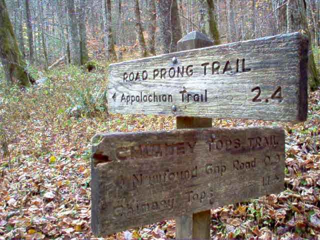
The Chimney Tops Trail begins at the low rock wall bordering the parking lot area. Here you will find Eastern hemlocks. The trail descends to a bridge across the Walker Camp Prong of the Little Pigeon River. In fact the trail crosses several bridges and tributaries along the one mile hike to Beech Flats. The second and third bridge both cross the Road Prong and guide the hikers on to the next landmark, Beech Flats Cove. This is approximately the half way mark of the trail. At Beech Flats, the Chimney Tops Trail crosses the Road Prong Trail that in turn leads to the Appalachian Trail at Indian gap 2.3 miles away. If your destination is Chimney Tops, you will want to stay on the main trail that veers right into a creek valley on the north side of Sugarland Mountain. This part of the trail cuts through an inspiring old growth forest, but beware of tree roots which have tripped many a hiker as they admired these old giants of the Smokies. At the top of the gulch, you’ll see one of the oldest yellow Buckeyes in the Park, and just beyond the Buckeye are two sharp switchbacks that take the hiker to the bottom of the Chimneys as they rise from Sugarland Mountain.

The upper end of Chimney Tops trail is not a graded trail as it was in the beginning. The upper end of the trail narrows to a smaller trail called a manway. Narrowing, the trail continues on quite a distance. At its steepest point, the manway becomes an arduous climb–especially if ice has formed on the trail. The terrain can be rugged in places.

Two miles into the hike, you will be able to see the chimneys themselves. Care should be taken as you follow the path to the right that leads to the top. Here you can see Mount Le Conte to the east, Mount Mingus to the south, and to the west, a steep wooded side of Sugarland Mountain. Injuries have occurred in this area, as there is a hole large enough to fall into, so take precautions to keep yourself and your loved ones safe.

Despite the obvious risks, even the upper end of Chimney Tops trail is worn smooth in places by the hoards of hikers willing to risk life and limb to experience “the chimneys”. Why? Adventure perhaps? Or perhaps the urge to explore the chimneys for themselves? Perhaps others go simply to be edified by the breathtaking views of the surrounding mountains, while others go to enjoy the abundant beauty of the old growth forest and flora to be found there. Whatever the reason, the popularity of this trail continues season after season.

There are many plants of interest along the length of Chimney Tops trail. Old Hemlocks grace its top, and flowering trees and shrubs dot it’s length. See how many you can recognize along your walk. To get you started, there is a large Fraser magnolia near the first bridge along this trail. Its blossoms are large, white and pretty hard to miss when in bloom in late April or early May.

Rhododendron is abundant along Chimney Tops trail. Also common are a variety of wildflowers. In Spring, you can find Trillium (right) and Hepaticas (left). In Summer, Joe-Pye weed, Bee-balm, and Jewelweed can be found. Violets, Toothworts, and Foamflowers also grow nearby. On the trail to the Chimneys people rave about the yellow buckeye trees due to the age of these trees and their unusual leaf structure and the flowers which appear in May. A trek to Chimney Tops will make you understand why it is so popular. You will probably want to return on your next visit to the Smokies–and get fit in the process!

Narrative and photo contributed by Jacqueline Thompson
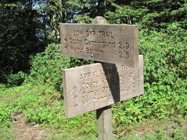
Gunter Fork Trail

gft
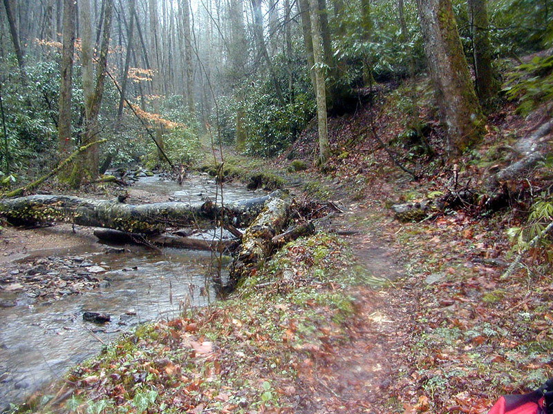
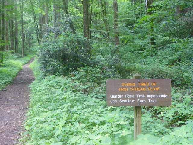
When you look at the Gunter Fork Trail on a map, it can take you aback at the trail’s steep climb, but when you realize it’s only a 4.1 mile hike in the Smokies, it doesn’t seem that bad, even for the novice hiker.

This route starts out at the junction with Camel Gap Trail and finishes at the intersection with the Balsam Mountain Trail. You’ll actually start out on the Big Creek Trail and hike for 6.1 miles to reach the Gunter Fork Trail. It’s a great trail to take if you want to see some Smoky Mountain cascades and do some creek hopping in the process.

The name of the spot that the Gunter Fork Trail begins is called Walnut Bottom. If you’re looking at a map of the park, it’s just past backcountry campsite No. 36. To say that the Gunter Fork Trail offer nature lovers a smorgasbord of appealing qualities would be  putting it about right. Streams, cascades, views and vistas, many types of plants, trees, and animals can be found along this trail which is another reason it has become so popular.

You’ll cross Big Creek once you’re on the trail. You might even see if you can spot some Smoky Mountain trout if you decide to hang around a bit before walking on. Gunter Fork is crossed at 0.3 miles in before ascending again through the forest, then again at the 0.9 mile mark. A beautiful pool is reached by way of a side trail at 1.4 miles and then you come to the previously mentioned cascade at 1.8 miles – 150 feet high.

The trail’s last creek crossing is made soon after and then you begin a series of switchbacks. You’ll continue your steep ascent of Balsam Mountain. This is a great place to be in the middle of fall as the foliage in this area as countless people have referred to it as “magnificent” and “breathtaking” as well as other synonymous words. You reach the crest of Balsam Mountain at 4.1 miles, as well as the meeting point with the Balsam Mountain Trail. The Laurel Gap Shelter lies 1.1 miles to your left. Enjoy the Smokies!

Forbidden Caverns

If you’re looking to cool off in Sevierville, head underground…. Seriously.

The Forbidden Caverns, one of the most well-known Sevierville attractions, keeps a temperature of 58 degrees throughout the year and can be a great respite for families, or just yourself, if you’re driving through Sevierville to the Great Smoky Mountains National Park, Pigeon Forge, or Gatlinburg.

Once a place only known to select few, in particular the Eastern Woodland Indians, Forbidden Caverns is now known by people worldwide for its “buried” earthen structures and rock formations. The Eastern Woodland Indians actually used the caverns to their own benefit. When they weren’t traversing East Tennessee’s forests and mountains in search of good hunting grounds, they used the cave in the winter as a shelter. One of the big draws to staying in the caverns, besides its shelter, is the underground river that provided a consistent water supply.

Forbidden CavernsSo where did that river come from? Its source is believed to stem from an underground lake found beneath English Mountain. Famous for its spring water, chert or flint can also be found on English Mountain, but in limited quantities. Indians once used both to form arrowheads, knives and scrapers to use for tribal hunting and battle. Calcite formations can still be found growing in the cave as well as other rare rock formations. English Mountain boasts the largest wall of rare cave onyx or dripstones known to exist anywhere.

Moonshine was distilled in the cave from the early 1920s until 1943. The cave’s never-ending water supply and the isolated locale was a moonshiner’s dream in order to brew their homemade Tennessee whiskey.

It wasn’t until 1964 that a group of businessmen began the task of preparing Forbidden Caverns for its grand opening to the public. Forbidden Caverns finally opened in June 1967 following three years of excavation work on the expansive cave.

Forbidden CavernsIf you’re making a trip to the caverns these days, a picturesque valley leads you right to the caverns’ opening. You’ll see the peaks of Mount LeConte and English Mountain as make your way through the valley toward the caverns. Along the way, stop and take a look at the grist mill-museum, some primitive farm houses preserved from generations past, and a trout farm.

Looking to make a day of it, well Forbidden Caverns is just a 35-minute drive from Gatlinburg, from Knoxville a short 45 minutes, and should figure into your plans if you’re coming through East Tennessee, specifically the Great Smoky Mountains area. If it’s a tour you’re looking for, plan on at least a 55 minute stop. Cars and buses park for free and guests can peruse the souvenir shop and use the picnic pavilion at their leisure.