First Aid Kit for the Trail

One of the things that most people say that you ought to take with you when you hit the trail for a day or several days of hiking, is a first aid kit. You need to have a small kit with you so that you are prepared for those odd accidents that occur on the trail while you are hiking.  This kit should be small enough to fit in your backpack and should be sized in direct correlation to the length of time you are going to be spending on the trail.

Things to make sure you have in your first aid kit (this is a place to start not the end-all-be-all):

  • first aid kitSelf-Adhesive Bandages – Seems like it is obvious but a box of multi-sized, self-adhesive bandages is a must.  If you get a scrap or a cut, you will be prepared to stop the bleeding.
  • Disinfectant Spray – Another easy to explain item. It is nice to have something to disinfect those cuts when they happen.
  • Gauze  & Gauze Tape – Good for cuts and abrasions that need a little more treatment than a BandAid. Carry enough gauze rolls to treat a wound and at least 4-5 4 inch gauze pads.
  • Alcohol Swabs – Great for cleaning a scrap or a cut.  These sting a little but they are small and easy to carry. Remember though your goal is to leave no trace – pack out what you take in.
  • Aspirin – A no brainer. Pick your favorite painkiller and keep some in your first aid kit.
  • Triple-Antibiotic Ointment – First line of defense for any cut or scrap whether you are on the trail or at home. A little tube of this in your first aid kit does not take up much room and is perfect for easy the pain on that cut, keeping it clean and making it feel better.
  • Tweezers – Splinters, bits of wood, glass, whatever may have found its way into your body, a simple pair of tweezers can remove that object quickly and easily.
  • Moleskin – For blisters, this si the best relief ever invented. Keep a roll of it in your pack even if it is not in your first aid kit.
  • Water-Proof Matches – A good rule of thumb is to pack for your day hike as if you might end up spending the night.  Waterproof matches are have coated heads that will allow them to light even if you are caught in a downpour.
  • Magnesium Based Firestarter – If you have to start a small fire, you will not be able to depend on finding enough tender to make a fire or that the tender you find will be dry enough to light.  A magnesium firestarter comes with a bar of magnesium that can be shaved off into your tender or campfire.  With a waterproof match or with a strike of flint on soem steel you will have a nice fire going without any problem.
  • Signal Mirror – A small highly polished mirror that an allow you to signal passing aircraft or people that you see on other trails.
  • Reflective Emergency Blanket – This reflective blanket harnesses the light and your own body heat to form a temperature barrier between you and the cold.  Staying warm when you find yourself on the trail, stuck overnight.

The best thing is that you can buy small pre-made first aid kits with almost everything you need.  Stop by your favorite big box store and pick up those first aid supplies that you think you might need on the trail .

The AT in the Smokies

The most hiked section of the Appalachian Trail

at logoThe southern tip of the Appalachian Mountains, with its temperate climate, slow changes in elevation and lush greenery, is a haven to hikers from around the world.  People flock to the Smokies especially to spend time on any number of trails, but the trail that is most popular and the one that a lot of people want to tackle part of is the Appalachian Trail. One end of the AT starts in the Smokies, in northern Georgia.  From that point you can work your way north to the heart of the Smokies in North Carolina and Tennessee, passing through state parks and national parks along the way.  It is a gradual climb that will inspire both awe and a renewed sense of respect for the mountain folk and Native Americans that hiked these trails season after season in the time before their were European style cities in the area.

North Georgia

In North Georgia, you will start at Springer Mountain, one of the southern most areas of the Smokies.  Technically you are in the foothills of the Smokies at this point.  The gentle slopes, the gradual climb, the verdant landscapes will help to build your anticipation as you progress north.  In this area, you will pass near towns and civilization.  The hike takes you near several state parks with facilities that are open almost year round, depending on the weather.  The North Georgia part of the AT is some of the easiest hiking that the trail has to offer.  Even if you start here when it is late spring you will find that the elevation is not high enough to give you the extremely cold temps that you will encounter in the highest elevations.

Fontana Dam

fontana dam
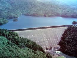
One of the next high points on the trail that you will come across is Fontana Dam.  At this point on the AT you have made your way into North Carolina, your second state if you are heading north from Georgia.  Fontana Lake is one of those TVA created lakes that took in the small towns of Judson and Proctor (near present day Bryson City) when Fontana Dam was established in the early part of the 20th century.  As the trail winds around Fontana Dam, you are going to start to gain some serious altitude.  The elevation change will start to reveal a change in the wildlife and the flora around you.  Just north of Fontana Lake and Dam, yes you follow the dam as you start up the mountain, you will climb until you are walking the ridge of the Great Smoky Mountains in the GSMNP.  You are  also walking the Tennessee / North Carolina line at this point on the trail.

Clingman’s Dome and Newfound Gap Road

The top of the world in the Smokies is Clingman’s Dome.  You will go all the way to the top of this part of the mountain as you progress northward on the AT.  The climb to Clingman’s Dome will take some time even for the most seasoned of hikers but the breath taking views from these peaks are like no other you will find east of the Mississippi River.  As you reach the summit of the Great Smoky Mountains National Park, you will immediately start back down again.  Soon you will arrive at the most visited portion of the GSMNP, the piece of the Appalachian Trail that starts at the Newfound Gap parking area and trailhead.  From this point you can hike almost 2 miles of the AT, the most hiked portion of the 2,200 mile trail.

Roan Mountain State Park

tn nc state line
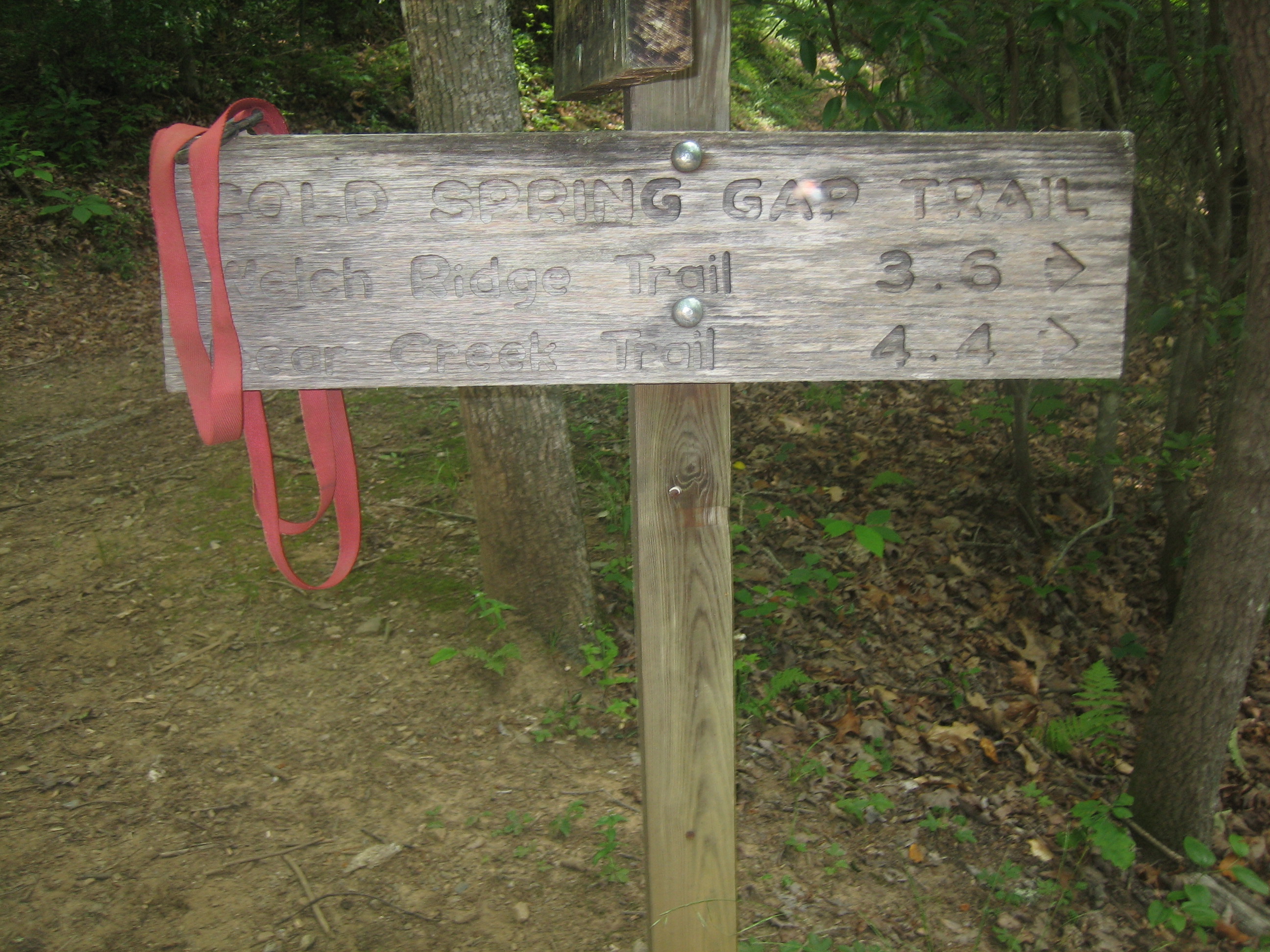
If you were to hike from the Newfound Gap trailhead and continue northward the next focal point you are going to come to is Roan Mountain State Park in Tennessee.  If you happen to plan your hike through accordingly you can spend some time at the top of the mountain in the rhododendron garden while it is in bloom.  Bring a camera and prepare to take a lot of pictures.  With the Catawbas in bloom it is a pink and purple wonderland of color.  Roan Mountain also has lots of facilities that a Thru-Hiker might need to take advantage of like campgrounds and other amenities.

Hike the various pieces of the Appalachian Trail int he Smoky Mountains.  Take in the terrain and the sights and the sounds of nature from the trails that make up the AT.  Hike the most hiked portion of the trail and then you too can say that you hiked the AT!

Albright Grove Loop Trail

The Albright Grove Loop Trail is a short little jaunt into park great for a lunch or side trip. In all, it’s a 0.7 mile hike from the Maddron Bald Trail.

To reach the Albright Gove Loop Trail, begin at the Maddron Bald Trailhead and hike 2.9 miles along Laurel Springs Road. The trail was named to honor the second director of the national park service – Horace Albright.

A looping, twisting trail, the aptly name Albright Grove Loop Trail follows a small creek. Eastern Hemlock provide the trail with a great canopy and tuliptrees, magnolias, and maples have grown to unprecedented sizes here in this untouched heavy growth forest. Massive tree trunks also characterize this section of virgin forest.

You’ll notice that the trail will eventually level before starting downhill where hikers can be on the lookout for a giant tuliptree on the left of the trail at exactly 0.3 miles. There, you’ll also notice a small offshoot trail made by admirers. There is a giant tuliptree further down the trail that sports a trunk over 25 feet in circumference…. Literally. “Wow”!

Keeping on the trail, hemlocks among other species grow at ease before winding up a ridge, taking a rather rough turn, followed by a descent to the Maddron Bald Trail.

Cold Spring Gap Trail

The Cold Spring Gap Trail is another wildflower trail in the Smokies best hiked in the Spring if at all possible. In all, it’s a 3.5 mile trail from its junction with the Hazel Creek Trail to the intersection with the Welch Ridge Trail.

To reach the trailhead, it’s a 6.7 mile hike from backcountry campsite No. 86 on Fontana Lake in western North Carolina near Bryson City.

The Cold Spring Gap Trail is considered more of a connector trail and follows Cold Spring Branch for much of its length. With a number of crossovers, be wary during rainy days. You’ll notice some rusted auto parts at 0.3 miles into the trail. Hazel Creek widens to about 10 feet at this point so be ready to cross it, or ready your horse. The creek’s sandy bottom is said to be the safest way, escuing the rocks.

You’ll climb a switchback after crossing the creek and pass some old home sites before crossing Cold Spring Branch at 1.2 miles. Notice the rock wall soon thereafter before more switchbacks.

A rocky, muddy trail awaits as the hiker ascends the next portion of the trail, crossing Cold Spring a number of times. Be sure to take notice of the wildflowers around here during the spring months.

You’ll reach elevations of 4,500 feet between Welch Bald and High Rocks. Hikers come to the Welch Ridge Trail soon, where it descends 7.3 miles from the AT.

Hiking to Mt LeConte

For viewing spectacular Smoky Mountain sunrises and sunsets, there is no better place than Mt. LeConte. Countless visitors have huddled together to view the sunrise from Myrtle Point on the eastern side, and hurried to see the sun set over Clingman’s Dome from Clifftops on the western flank.

Trails to LeConte: More than 10,000 hikers use the trails to LeConte each year. Five major trails drape the mountain. The shortest (5 miles one-way) and most popular is the Alum Cave Bluffs Trail, without a doubt the most spectacular trail in the whole Park!

The longest trail (but with the least elevation gain) is the Boulevard Trail at 8 miles. Many visitors with two cars go up the Boulevard Trail and come down Alum Cave Bluffs. Rainbow Falls Trail is 6.5 miles and Bullhead 7 miles. These two trails can he used as a “loop” beginning at the same trailhead in Cherokee Orchard near Gatlinburg. The Trillium Gap Trail, which passes by Grotto Falls, comes up the mountain from the Greenbrier area and is 8 miles, providing spectacular views of LeConte from Brushy Mountain

For an interesting account about hiking the trails of LeConte, be sure to visit Ed Wright’s website. Since retiring in 1991, Ed hikes LeConte 2 to 5 times a week and works as a Volunteer in the Park (VIP). He has written a book “1001 Hikes to Mount LeConte and Counting,” which documents his trips and the hikers he meets along the trails.

Little Cataloochee Trail

The Little Cataloochee Trail is a 5.2 mile hike filled with historic structures as well as rolling Smoky Mountain hills and valleys on the North Carolina side of the park.

To get you started, you need to make your way to the Pretty Hollow Gap Trail, which lies 0.8 mile on Cataloochee Road. You’ll begin the trail along an old road through overgrown fields before crossing Little Davidson Branch by way of a few stepping stones. From here you’ll begin a steep ascent, crossing over the stream several more times.

You’ll notice a number of wildflower species as you move along the trail before reaching the first switchback a mile in. At 1.5 miles on the trail, you’ll see the first historic structure  on the left – on old farmstead.

Davidson Gap is reached at 1.8 miles on the trail following a rather steep climb. Hiking on, your descent begins in earnest as you hike past a rock wall before a switchback spits you out into the valley and the trail turns into a road. The farm is reached at 1.9 miles on the trail and you can take a break to observe the house and springhouse. To other structures, the apple house and the barn, are located in Oconaluftee and the Cataloochee Ranger Station respectively.

The Dan Cook log home is approached at the 2.5 mile marker. It’s not the original structure as it was reconstructed in 1999 following damage that had occurred at the site in years past. Dan Cook himself was known as a master carpenter in his day and built a number of structures in the area. Notice the fence posts that still stand in the vicinity where old homesteads once stood and at 3.2 miles you can climb up to the Little Cataloochee Baptist Church – one of the most picturesque places along the trail.

Follow the trail as it goes on behind the church and cross Little Cataloochee Creek around 3.7 miles in. The John Jackson Hannah cabin appears soon thereafter at about 4 miles via a side trail. This cabin was also restored, but in 1976 by the park service.

The Long Bunk Trail goes left at 4.1 miles leading to the Mount Sterling Trail. The Hannah Cemetery is just 0.2 miles in on this trail and one might think about making that quick side trip to view the historic cemetery.

Back on the Little Cataloochee Trail, you’ll hike around the end of a ridge until you cross Correll Branch and go on to the meeting of NC 284 and the finale of the Little Cataloochee Trail. Enjoy the Smokies!

Little Greenbrier Trail

Here’s a great little nature trail in the Smokies and a fairly moderate hike to the Laurel Falls Trail, it’s called the Little Greenbrier Trail. It covers 4.3 miles from its start at Wear Cove Gap Road to its meeting with the Laurel Falls Trail.

To get to the Little Greenbrier Trail, make your way to Wear Cove Road. The trail can also be accessed from the Metcalf Bottoms picnic area, across the bridge. From there it’s 1.25 miles to the trailhead which is reached just prior to the park boundary. However, there is limited parking here, so be advised you may have to search for a spot if they’re all filled up at the trailhead.

As noted, if you’re a nature-lover of wildflowers and majestic scenery this is a great trail for you even though it is mostly an uphill hike. Still, if you feel that you can hack it, you’re rewarded with scenery that many have chosen to forego in their search for the perfect Smoky Mountain hike.

You’ll climb through mixed hardwoods throughout most of the trail. For those in the know, the Little Greenbrier Trail is known for its surplus of blueberries which make it a great summer/fall trail.

Notice Wear Cove as you hike along the ridge. This is just the first of many great look outs you’re afforded along the Little Greenbrier Trail. Markers along the trail will notify you when you cross the national park boundary, of which there are many.

A few of more popular wildflower species found on the trail include orchids and they’re seen throughout as you move on and reach the 1.9 mile marker and Little Brier Gap Trail. Taking a right onto the Little Brier Gap Trail will lead you to the Walker Sisters’ home site. It’s one of the more historical sites located in the park that is still standing and worth making a little side trip if you have time.

Continuing straight on the Little Greenbrier, you’ll keep climbing as you ascend Chinquapin Ridge. As you hike around the ridge, one of the best views in the park makes its presence known as Wear Cove comes into full view. From its beautiful valleys to its lush green hillsides, you’re gonna want to make good use of any camera you may have brought with you.

The rest of the trail takes hikers straight to the junction with Laurel Falls Trail. From there, it’s a 1.8 mile hike down to spectacular Laurel Falls. Enjoy the Smoky Mountains!

Lead Cove Trail

Spence Field has become one of the most visited sites in the Great Smoky Mountains for its majestic views and vistas. There are a number of ways to get there including by way of the Lead Cove Trail – a 1.8 mile hike from Laurel Creek Road to the Bote Mountain Trail.

Not only does the Lead Cove Trail put you on the way to Spence Field, it also takes you by an old cabin site. To get there, by way of Big Spring Cove on Laurel Creek Road to Cades Cove, keep your eye out for a trail sign on the east side of the road. There is limited parking there (under 10 spots), so fair warning.

As the upper loop of a 7-mile trail to Spence Field, which also includes the Finley Cane and Bote Mountain trails, the Lead Cove Trail starts out following Laurel Creek Road before turning into the Smoky Mountain backcountry. You’ll find hemlock, tuliptrees, and a variety of hardwoods as you move along this first part of the trail. You’ll soon cross Sugar Cove Prong as the trail continues to rise. Sugar Cove follows the trail and you’ll see the ruins of an old chimney and stone foundation soon thereafter. The cabin that at one time stood here belonged to Gibson Tipton whose family were some of the first white settlers of Cades Cove.

Continuing your ascent, several areas with prevalent wildflower growth are hiked. Wildlife including bears are said to frequent these paths because of the appearance of the wildflower squawroot. Black cherry trees are also found in this area – a favorite of bears, as well as the chestnut oak.

You’ll come upon the trail’s lone overlook as you approach the junction with the Bote Mountain Trail. In the distance, Scott Mountain makes an appearance. Hiking on, you’ll reach the Bote Mountain Trail after a few hundred yards. Enjoy your time in the Smokies!

Hemphill Bald Trail

If you’re going to be taking in the outdoors from the North Carolina side of the Great Smoky Mountains National Park, one of the great day hikes is the 8.4 Hemphill Bald Trail – a horse and hiking trail with some great views of the Smokies, as well as an area where elk are known to roam.

To reach the trailhead, take the Blue Ridge Parkway and follow the signs to the Balsam Mountain Campground. Once you reach the campground, park at the Polls Gap area. You can actually hike the Hemphill Bald Trail as one part of a 13.6 mile loop and comes back around to Poles Gap, which many people do. However, if you’d rather just as soon back track, turn around once you’ve reached the junction with the Caldwell Fork Trail.

hemphillbald
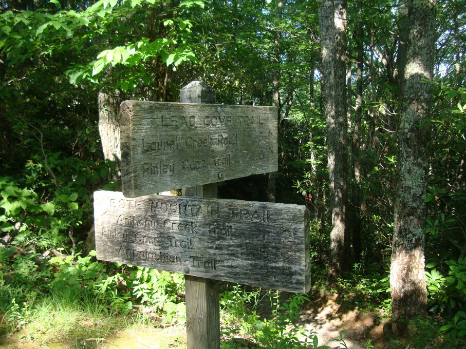
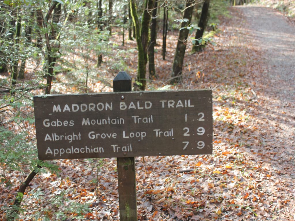
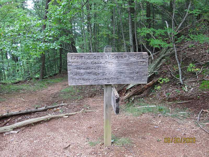
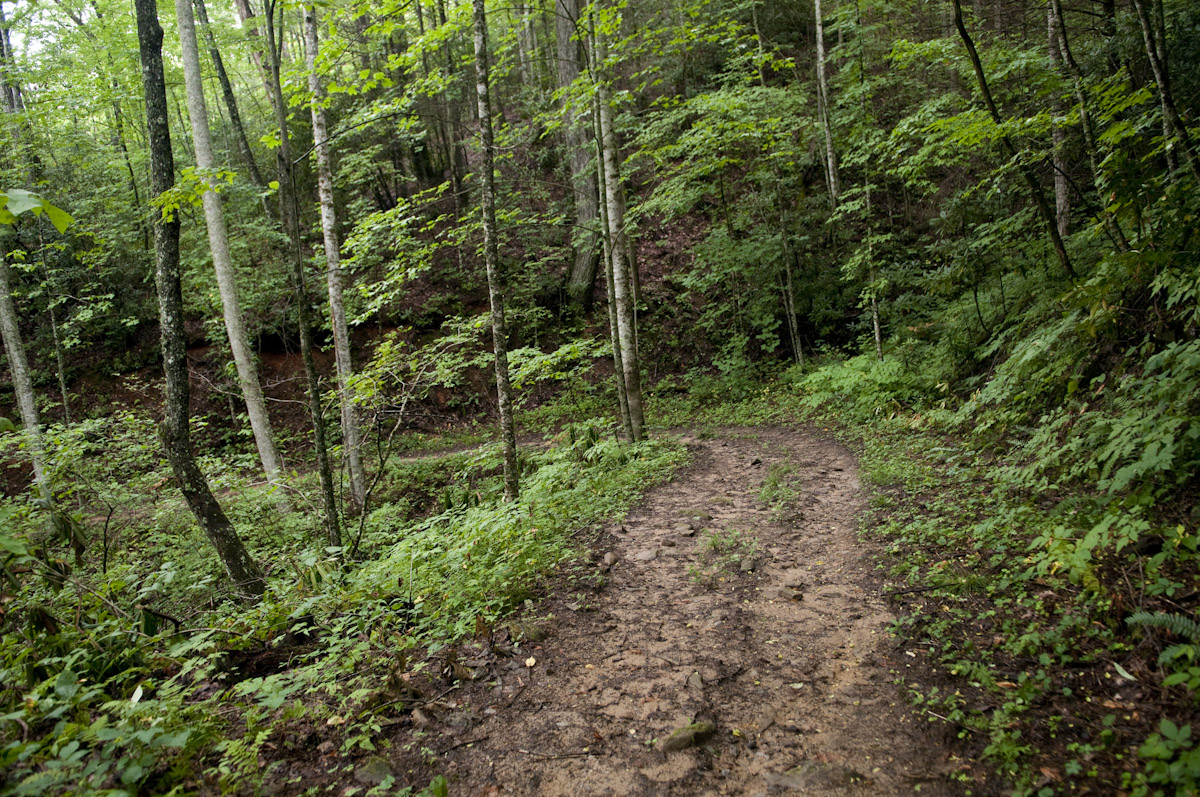
The Hemphill Bald Trail is the furthest trailhead on the right at the parking area. Once you’ve started hiking, you’ll notice the Caldwell Fork Valley to the left of the trail. Sugar maples, ferns, and a few remaining chestnuts can be found on this part of the hike as you reach Whim Knob a mile in.

Following a descent toward the boundary of the Great Smoky Mountains National Park, the trail begins its climb up Buck Knob, which is lined with yellow birch and various mountain wildflowers. If you notice it coming down, you’ll even pass a spring, and a slew of other wildflower species.

Once you’ve hiked four miles, you’re likely making the up Hemphill Bald. Take in the majestic views to your right. Hopefully someone has packed a camera. Hemphill Bald gets its name because it is literally bald of trees from when sheep and cattle used to graze there. It’s a large grassy opening that is now sought out by many a Smoky Mountain hiker. Not only that, it’s an amazing place to do a bit of bird watching if that’s what you’re into. Meanwhile, the wildflowers, herbs, and various plants seem to outnumber the blades of grass in some areas.

Hikers approach the summit of Hemphill Bald at 4.7 miles on the trail. From there it’s a downhill hike to Double Gap then a number of water crossings over Double Gap Branch – 6 miles on the trail until you reach the junction with the Caldwell Fork Trail at mile 8.4. Now, if you’re looking for a spot out camp out, backcountry campsite No. 41 is just up the Caldwell Fork Trail from this point. Enjoy the Smokies!

Indian Creek Motor Trail

A connector trail if there ever was one, the Indian Creek Motor Trail stretches for all of 1.8 miles on the North Carolina side of the Great Smoky Mountains. What it connects are two larger trails – the Thomas Divide Trail and the Deeplow Gap Trail. To put it simply, it’s a quick trip through the forest.

To get to it, make your way on over to Bryson City, NC. From there you’ll follow the signs to the Deep Creek Ranger Station, then drive a mile up Tom Branch Road to the trailhead for the Thomas Divide Trail. After a 3.2 mile hike on the Thomas Divide Trail, you’ve reached the Indian Creek Motor Trail.

This was at one time the proposed site of a scenic auto tour, hence the “motor trail” portion of the name, until the project was abandoned totally. And just so that everyone is on the same page, automobiles are not allowed on this trail.

The Indian Creek Motor Trail makes its way downhill through tulip trees, yellow birches, and red maple, among various other species. Spring wildflowers can be found in abundance along the trail as well.

Moving on along the trail, a small waterfall can be seen to the right especially during the wetter months and in the spring. A small creek is even seen following the trail on the left as you walk on. In mid April this is a great place to spot the popular dogwood tree which bloom out in magnificent white.

More tulip trees can be seen before you reach mile 1.8 and the junction with the Deeplow Gap Trail.