The most hiked section of the Appalachian Trail
![]() The southern tip of the Appalachian Mountains, with its temperate climate, slow changes in elevation and lush greenery, is a haven to hikers from around the world. People flock to the Smokies especially to spend time on any number of trails, but the trail that is most popular and the one that a lot of people want to tackle part of is the Appalachian Trail. One end of the AT starts in the Smokies, in northern Georgia. From that point you can work your way north to the heart of the Smokies in North Carolina and Tennessee, passing through state parks and national parks along the way. It is a gradual climb that will inspire both awe and a renewed sense of respect for the mountain folk and Native Americans that hiked these trails season after season in the time before their were European style cities in the area.
The southern tip of the Appalachian Mountains, with its temperate climate, slow changes in elevation and lush greenery, is a haven to hikers from around the world. People flock to the Smokies especially to spend time on any number of trails, but the trail that is most popular and the one that a lot of people want to tackle part of is the Appalachian Trail. One end of the AT starts in the Smokies, in northern Georgia. From that point you can work your way north to the heart of the Smokies in North Carolina and Tennessee, passing through state parks and national parks along the way. It is a gradual climb that will inspire both awe and a renewed sense of respect for the mountain folk and Native Americans that hiked these trails season after season in the time before their were European style cities in the area.
North Georgia
In North Georgia, you will start at Springer Mountain, one of the southern most areas of the Smokies. Technically you are in the foothills of the Smokies at this point. The gentle slopes, the gradual climb, the verdant landscapes will help to build your anticipation as you progress north. In this area, you will pass near towns and civilization. The hike takes you near several state parks with facilities that are open almost year round, depending on the weather. The North Georgia part of the AT is some of the easiest hiking that the trail has to offer. Even if you start here when it is late spring you will find that the elevation is not high enough to give you the extremely cold temps that you will encounter in the highest elevations.
Fontana Dam
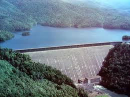 One of the next high points on the trail that you will come across is Fontana Dam. At this point on the AT you have made your way into North Carolina, your second state if you are heading north from Georgia. Fontana Lake is one of those TVA created lakes that took in the small towns of Judson and Proctor (near present day Bryson City) when Fontana Dam was established in the early part of the 20th century. As the trail winds around Fontana Dam, you are going to start to gain some serious altitude. The elevation change will start to reveal a change in the wildlife and the flora around you. Just north of Fontana Lake and Dam, yes you follow the dam as you start up the mountain, you will climb until you are walking the ridge of the Great Smoky Mountains in the GSMNP. You are also walking the Tennessee / North Carolina line at this point on the trail.
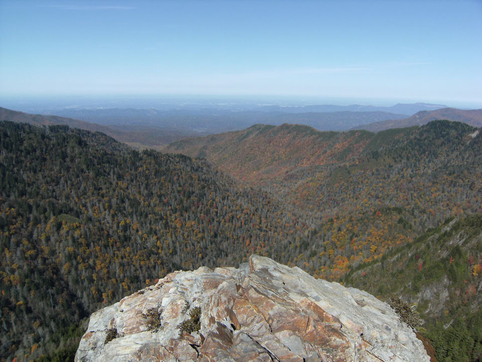
Clingman’s Dome and Newfound Gap Road
The top of the world in the Smokies is Clingman’s Dome. You will go all the way to the top of this part of the mountain as you progress northward on the AT. The climb to Clingman’s Dome will take some time even for the most seasoned of hikers but the breath taking views from these peaks are like no other you will find east of the Mississippi River. As you reach the summit of the Great Smoky Mountains National Park, you will immediately start back down again. Soon you will arrive at the most visited portion of the GSMNP, the piece of the Appalachian Trail that starts at the Newfound Gap parking area and trailhead. From this point you can hike almost 2 miles of the AT, the most hiked portion of the 2,200 mile trail.
Roan Mountain State Park
 If you were to hike from the Newfound Gap trailhead and continue northward the next focal point you are going to come to is Roan Mountain State Park in Tennessee. If you happen to plan your hike through accordingly you can spend some time at the top of the mountain in the rhododendron garden while it is in bloom. Bring a camera and prepare to take a lot of pictures. With the Catawbas in bloom it is a pink and purple wonderland of color. Roan Mountain also has lots of facilities that a Thru-Hiker might need to take advantage of like campgrounds and other amenities.
Hike the various pieces of the Appalachian Trail int he Smoky Mountains. Take in the terrain and the sights and the sounds of nature from the trails that make up the AT. Hike the most hiked portion of the trail and then you too can say that you hiked the AT!